I’m now out alone in a huge expanse of snow, cliffs to my south and east, South Sister towering 1500 meters, about a mile, above me, and only my tracks behind me to tell where I had been. I had turned around about 50 yards ahead, stood there, wondering. “Do I go back? Or do I go on, and see what happens.”
“Obsidian Trail Loop, July 4” was posted on the Obsidians Web Site. That was what I had been looking for, but there was a waiting list, since I was the 16th to sign up, and only 12 could go. Since the hike was scheduled for the fourth, I figured I could go the third. A club member was going with me, but when she called the Ranger’s Office, were told there was “serious snow” 3 miles in and there were so many mosquitoes, they would chase a person back to the car. I was on my own, updates were 1-2 weeks old, which in the high country, are ancient history. Snow accumulates and disappears quickly at 6000 feet in the Cascades.
I decided to do the hike, realizing that if I couldn’t do the 4 mile loop (with an additional 4 miles in and out) gaining 1800 feet, there were other places I could go to hike. As I left Eugene, bound for the high country, a dark wall of clouds and fog were ahead of me, about where I would be. This did not bode well. I kept going, turned on Highway 242, soon was past 2000 feet. There was fog above me, and I figured by 3000 feet I would be in it.

Fog below in the McKenzie Valley.
The road narrowed and climbed, and suddenly I was in sunlight. So much for the fog, which now lay below me in the valley. I got to the road in to the trailhead, which two weeks earlier had a 3 foot high snowdrift blocking it. The snow was not only gone but the road dry. I parked the car, shouldered my pack, and turned on my GPS.
I am new to GPS. I have had one 20 years for marking points, but I never used one with a trail marker before, and I had loaded mine with high definition topographical maps of Oregon and Washington. Those came on a mini-SD disk, a few mm on a side. I can’t believe how much memory we can put on small objects.
I had on gaiters to keep water and snow out of my boots, so long as I was in fewer than 18 inches. I had a light shirt on, because I was climbing and knew I was going to be warm. I had my day pack on with my nine essentials, a whistle still missing, and a few other things added. On a warm day, most people don’t think a jacket is needed; should one get lost and have to spend a night out, having an extra waterproof layer is essential. That has never happened to me, but it can. It is insurance, and the premium is carrying it with me. The first 2 miles were a gentle climb on a dry trail. The third mile had a large series of snowdrifts, upon which I was able to walk on top. No problem, and I reached the lava flow area.

Life grows in some of the most inhospitable places.

First view of South Sister from lava field.
After I got the above view, serious snow was on the trail, and I realized there was no more trail for me to see. The Forest Service had placed orange ribbons on the trees, so from one tree, it was possible to see the next. And this navigation got me uphill to about 6200 feet, 600 feet below where I would top out.

Orange ribbons to navigate by.

Open snow field
One man had come down the trail recently, and I followed his prints back up a steep hill, switchbacking in snow, so that I could work less hard. This was not going to be easy. It already hadn’t been, and if my Achilles Tendon still bothered me, I would have stopped. But I felt fine. I crossed a ridge and saw a gorgeous blue lake that was starting to melt.
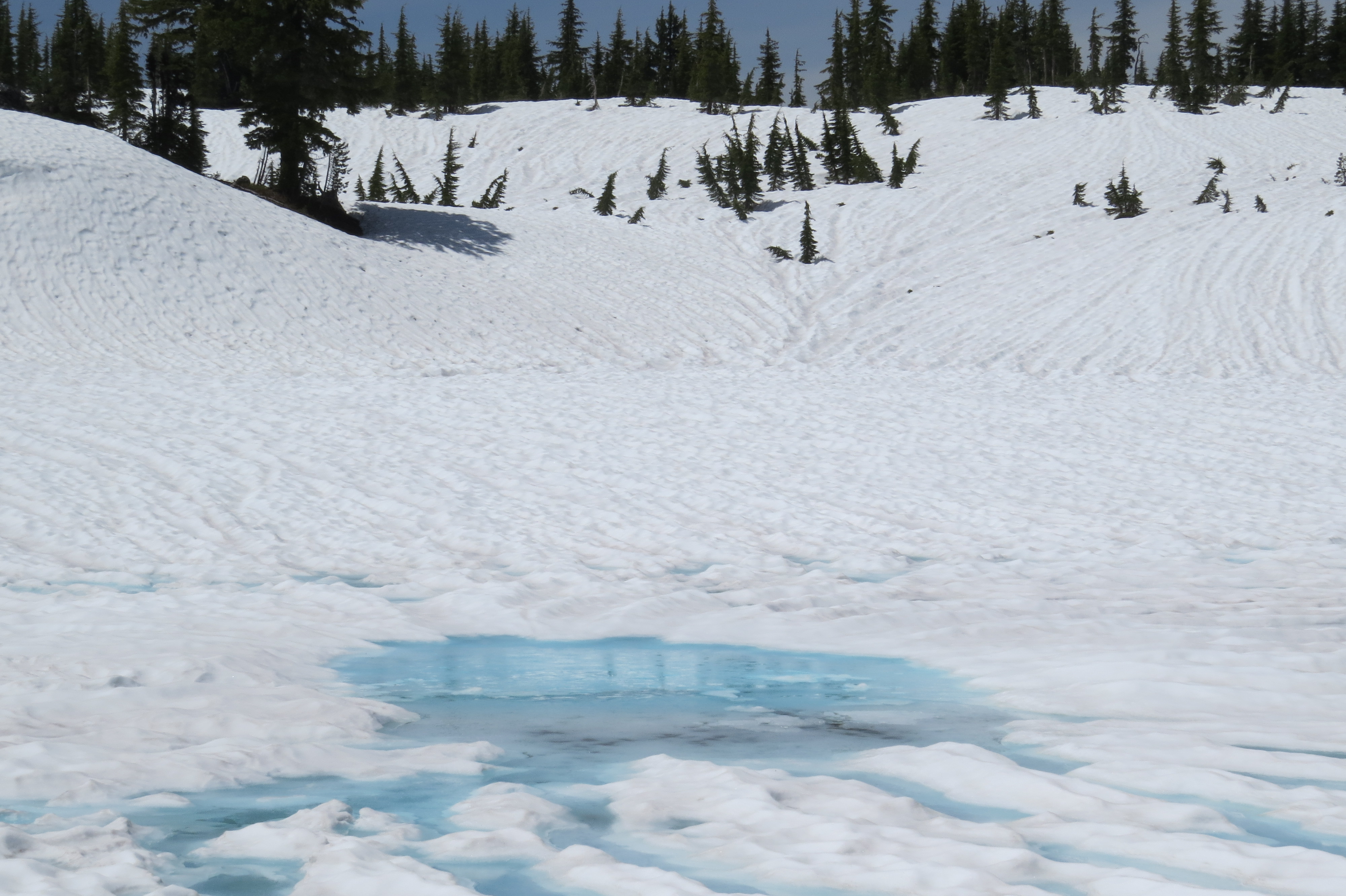
Lake beginning to appear.
I bypassed the lake and realized that my sense of direction was different from the GPS. I was supposed to be on the “open” Pacific Crest Trail, but what looked like a trail was a creek with a lot of snow on it. I started navigating on GPS, because now there were no footprints to follow, except those I had made leading back. I was in a beautiful blinding white bowl of snow, somewhere in the middle of the Obsidian Loop. I stopped by a tree which had no snow under it, heard a waterfall, and looked down at obsidian at my feet, beautiful black volcanic rock, that touched no water as it ascended to the Earth’s surface. I picked up a piece and then dropped it, leaving it where I found it, which is required in the wilderness. The Trail here has a permit system, because there is so much use. If each person takes one stone, in a few years, there will be fewer left. Below me was Obsidian Falls, and I then realized my sense of direction had me on the wrong side.

Obsidian Falls

Obsidian, lava that reaches the surface without touching water.
For the remainder of the loop, I seldom saw a trail, but the route tracker had me going by the trail, or at least near it. Occasionally, I went into the woods, but the direction arrow had me clearly going the wrong way, and I had at one point to climb a rocky area to get back near the trail. When I got near the end of the loop,I saw the trail about 50 feet below me, so I could slide down the now softer snow to reach it. I knew from the stored track that I was close to where I had started the loop, and if necessary, I could walk over to my track. But I continued, reaching the trail junction, not quite where the GPS said it would be, but close enough. GPS accuracy is somewhere between 4 and 10 meters, depending upon satellite reception. I then retraced my now familiar route back to the car.

Back in the lava field.
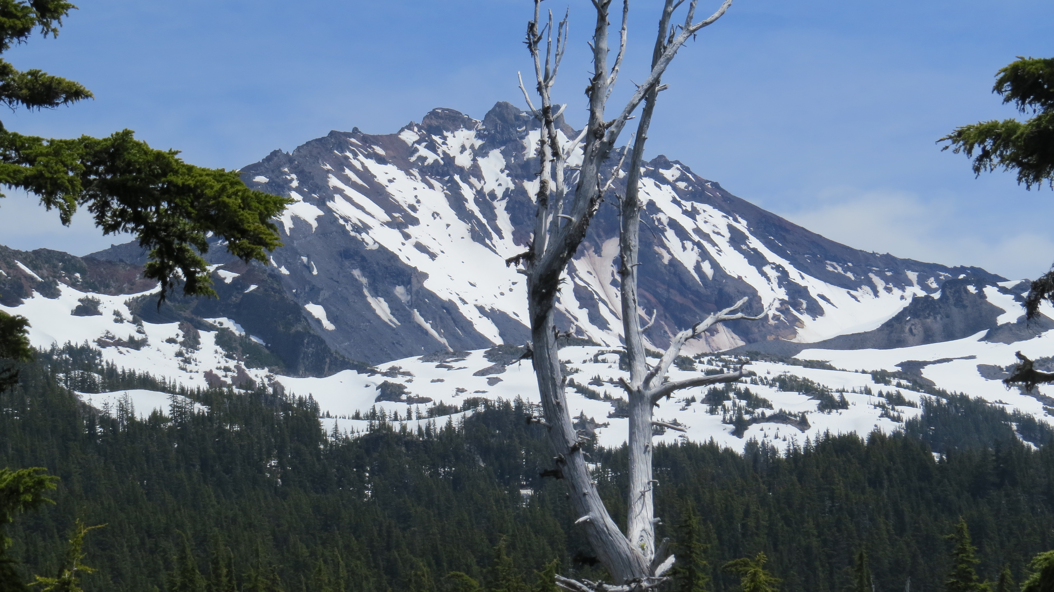
A Sister.
I had wanted to see the loop, but I saw it without the summer wildflowers. On the other hand, I saw the loop in a way few do—in snow, alone, and having to work much harder than expected. I also learned how to trust my GPS, and I learned again other ways to navigate, should they be available. What was perhaps the most important thing I learned was again not to “trust” my sense of direction. It isn’t bad, but it can be very flawed, be it on the Appalachian Trail, the Canoe Country, or in the Oregon Cascades. Using the Sun, when available, is helpful. A compass is better. A map is even better. Knowing when to quit is important, and periodically asking oneself: “Do I know exactly where I am?” is essential.
Tags: Outdoor writing

Leave a comment