I had a lot of other things I probably needed to do last Tuesday. There was a trail over in the Drift Creek Wilderness that needed scouting for downed logs, with GPS coordinates, so the trail group, the Scorpions, which I am part of, could tell those who were going to log it out what to expect. That would still have to wait. I needed to be in the Math Lab at the community college, because it was finals week.
But I had put off my winter trail checking trip way too long. I am one of the winter trail adopters for snowshoe and cross-country skiing. I needed to go up into the mountains, hope the snow wasn’t too deep to bury the markers, but deep enough so I could both find and reposition upward trail markers, blue diamonds nailed to trees. I also needed to replace those diamonds that were broken or missing. I didn’t do it last winter, because the snow wasn’t deep enough. I had done a pre-season look in October, an 11 mile hike from Gold Lake to the Pacific Crest Trail (PCT), south to the Rosary Lakes, out at Willamette Pass. But one person can put up a diamond marker on a tree only so far standing on ground, and I was not about to carry a ladder into the woods and stand on it to mark trails. It is too dangerous, and my wife has regaled me of X-Rays she has seen of people with horrific injuries with the history, “Fell off ladder.” People my age die from minor ladder falls. If any may be considered minor. Standing on several feet of snow is a good ladder and a lot safer.
I shared this trail duty with another, but it now appears it is my duty alone. Such happens. Anyway, I knew what I had to do, so I drove up to Willamette Pass Ski Area on Tuesday, when the place was closed, parked the car on the shoulder of Highway 58, walked past the wet pavement of the parking lot, past a cabin, put on my snowshoes, and headed towards the PCT. The estimated 10 mile snowshoe would be half on the PCT coming in and out, the rest going up the Tie Trail, nearly a mile long, climbing several hundred feet, connecting the PCT to Tait’s Loop. From Tait’s, I would try to find the PCT again near Maiden Saddle and return via Upper Rosary Lake, back past Middle and Lower Rosary Lakes and out the PCT the way I had come in. I hoped some trail would be broken with prior tracks, but I wasn’t so sure about the Tie Trail or Tait’s Loop.

It was warm, with mostly clear skies and light wind, and I started in a shirt, rain jacket in my day pack and a smaller pack around my waist with a hammer, nails, and five dozen blue diamond markers. The trail initially was broken, snow deep on either side, message board at the trailhead almost buried. The trail along the PCT parallels the highway for a while, climbing about 150 m or 500 feet in a little more than two miles or about 3 km. It isn’t difficult, and the last part is almost level. It’s work but not excessive. It took me about an hour and change to get to the Tie Trail, where I noted, with a little sinking feeling, no tracks. Perhaps nobody could find the trail: the Tie Trail turns about 150 degrees left and isn’t obvious, so I added two more diamonds to show people where the trail was, and I raised another that was almost at snow level. The snowpack was slightly above normal, which is reassuring for summer, especially since the valley is in significant drought.

I started breaking trail in the deep snow, sinking in 1-2 feet and also climbing. The plan was to reposition diamonds higher and make sure from one diamond, one could reasonably be expected to see the next. This slowed me down, as I had to come up to trees, pull out the hammer, remove nails, remove the diamond and reposition it. Fortunately, most of the diamonds were in good shape and I just had to deal with climbing in soft snow. The trail went through the woods steeply upward, with a couple of switchbacks, followed by a long gradual uphill to the ridge to Tait’s Loop, adjoining the ski area.

I hadn’t been on Tait’s this winter, but I remembered most of the trail well, and I knew the top part was a lot longer and more difficult than I gave it credit for. Eventually, I reached the junction at about 6300’ and turned south towards the viewpoint to Lower Rosary Lake, far below me. The Diamonds were in good position, and I didn’t have to fix each one, but if on one side of a tree a diamond was too low, the other side would be, too.
I worked my way around to the center of the loop and had to decide whether to complete the rest of the loop by the ski area and go back down the way I came or continue towards Maiden Saddle. The head of Winter Trails wanted that area checked as a favor to a friend who was responsible for it. I decided to commit myself to a longer hike and continued along the ridge, found the sign that normally is 12 feet off the ground in summer but now has the top easily reached by my hand.

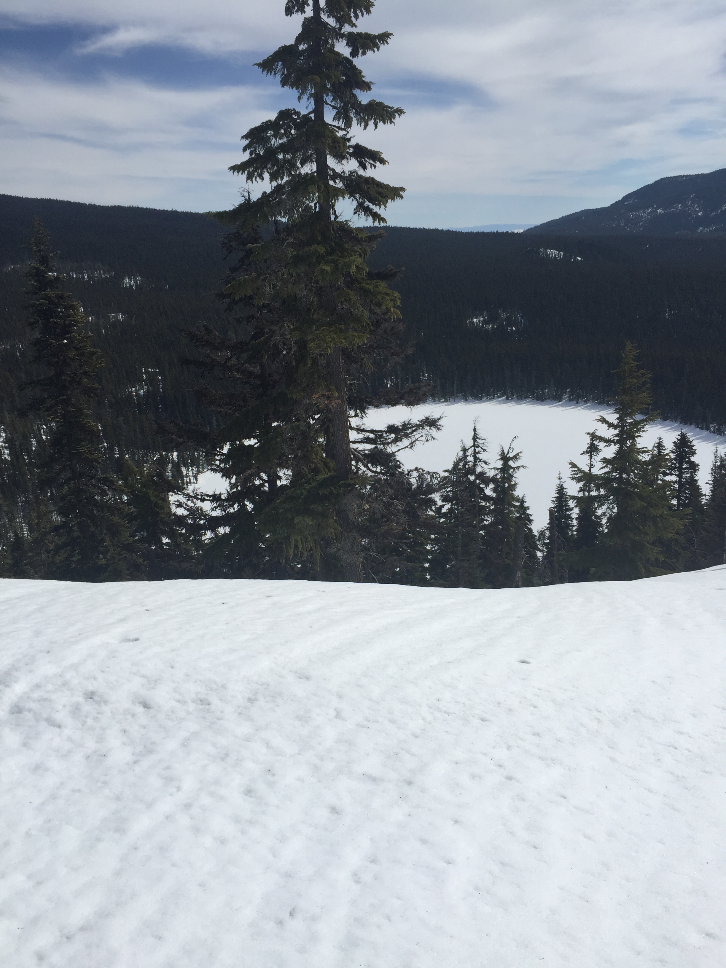

The descent was gradual, soft, with my legs sinking in often. Half way down, I stopped for lunch overlooking the lakes below. I looked on track for getting done in mid-afternoon and getting home in the early evening. The grade continued steadily downhill until I saw no more diamonds to follow. There weren’t any, or maybe there were, but buried. In any case, I lost the trail. This has happened to me before here, and I made a note that it will need to be fixed in summer, when the trail is visible and enough markers can be placed high enough to be seen. I went straight down the hill towards frozen and snow-covered Upper Rosary Lake. I crossed ski tracks and saw diamonds, but they again disappeared after a short distance. I continued down further towards the lake and crossed the well-marked main trail. I was several miles and a few hours into the trip, and I did not have the energy to try climb back up to mark the trail accurately. That would have to wait. I at least knew where the problem was.
Continuing in softer snow, the afternoon sun warm, I passed along the east side of each of the three Rosary lakes, left the south end of Lower Rosary Lake, and reached the Tie Trail a half mile later, where I began the loop three hours earlier. From there, it was back out on a good track, with a gentle descent back to the car.

Leave a comment