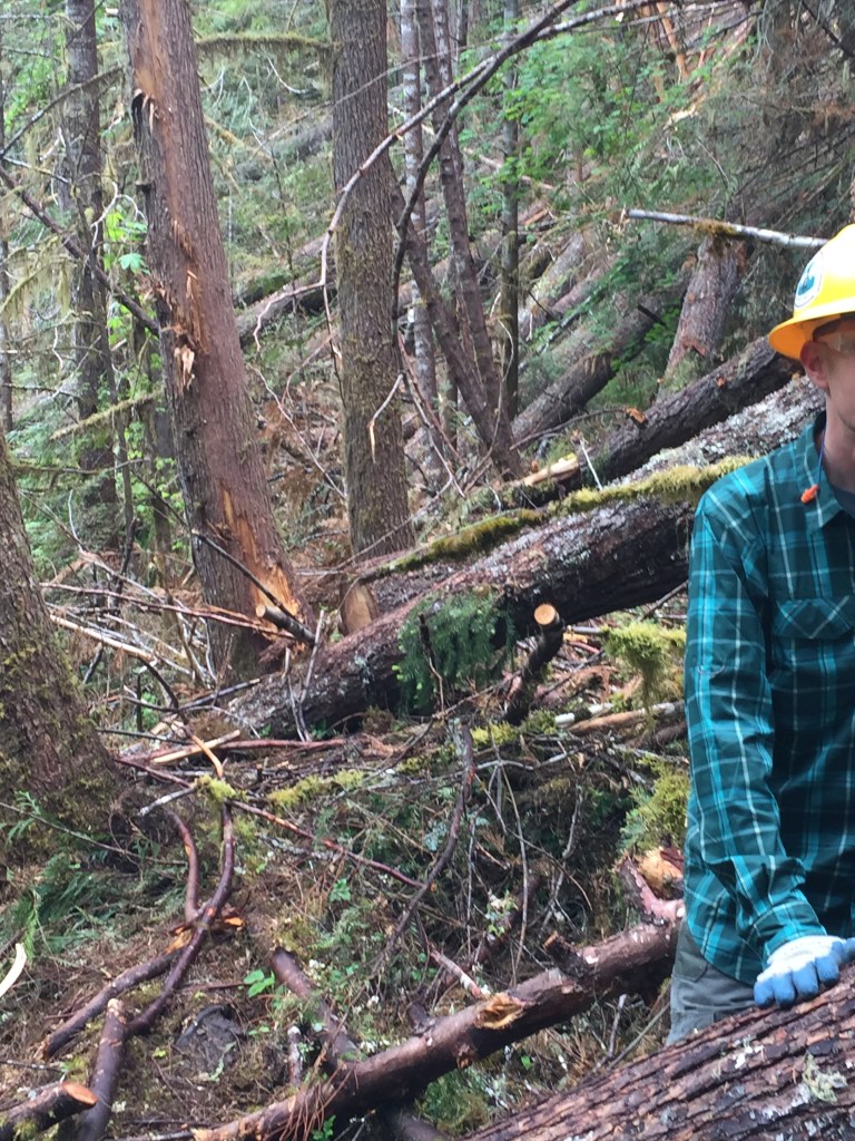
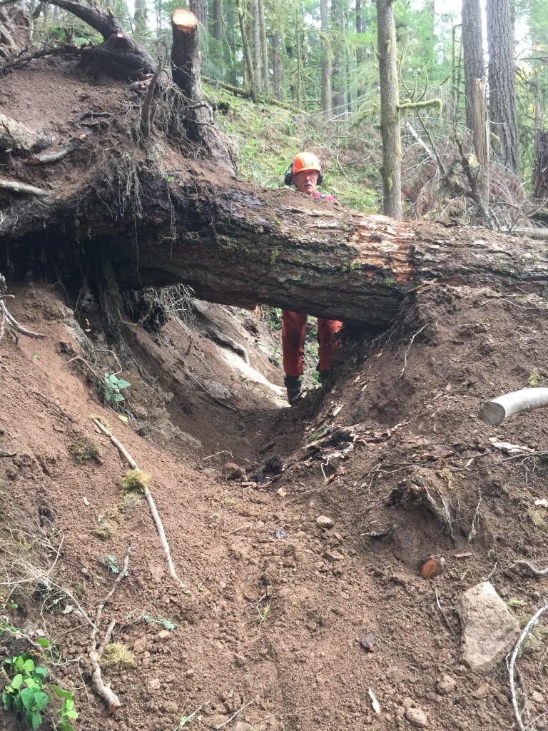
In the first ten yards there were two large trees down over the Brice Creek trail, blocking access and part of the view down the trail, although when I stepped off the trail to look through a gap in the mess, I could see more downed trees ahead. By large, 24-30 inches in diameter. They definitely were not the step over variety, but rather the too high to climb over, too low to go under variety.
One of our group in the Scorpions Trail Crew had actually walked the entire 5.7 mile trail and said the whole trail was like this. It took her 4 hours to do it, and she is a trail runner. Maybe she flies, too, which would explain the 4 hours. I hike at a decent pace, and a couple of months later, with far less to scout, I quit after about a mile, because I felt the blowdowns were too dangerous to negotiate.
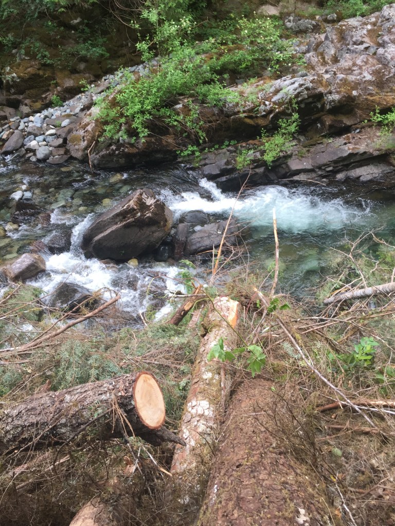
Brice Creek is 25 miles east of Cottage Grove, Oregon, a popular place to go to hike, picnic, camp out, see waterfalls, swim in the creek, and cool off in summer. Further up the road and uphill leads to Bohemia saddle and mines, other places to go, but Brice Creek is a gem of the Umpqua National Forest. Unfortunately, their sawyer was seriously hurt doing work earlier in the winter, and they had nobody to clear trails. That’s how we got called.
The Scorpions themselves began 14 years ago, after a Forest Service employee retired and realized that some of the trails she liked were not getting maintained and would soon be impassable if nothing were done. She and Ron Robinson, a retired executive, started the organization, and Larry Dunlap, a retired ED physician, was part of the original group. There are about 90 members, and I began as a trail scout, hiking the trails, taking pictures of the blowdowns, putting GPS coordinates in them, and getting the information back to Ron.
I had heard from a couple of hikers in the Club who had worked on a trail hauling rocks, saying it was a bad idea to try to work for the Scorpions. But I felt I should go out and see what they did and see if I liked it. I had to sign a waiver, and I didn’t need any training, Ron’s saying that I would get plenty of OJT with them.
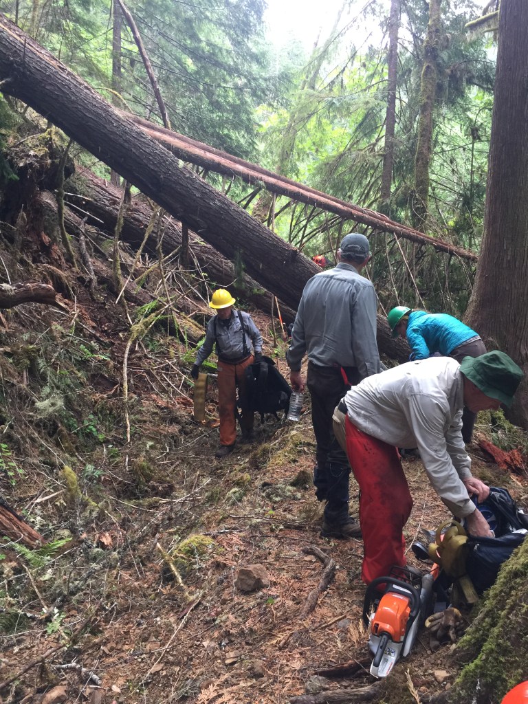
On a dark morning at 7 am, mid-December, 2017, I met up with a group of about a dozen in Springfield, headed out to Rebel Rock Trail in the Three Sisters Wilderness. It’s about an hour and a half from town, and we arrived at the icy trailhead with the temperature somewhere in the twenties, and a bunch of old guys pulling out Pulaskis, 5 foot long crosscut saws, McLeods, Pick Mattocks, a rock bar, and a Peavey. Mind you, I only knew about saws and Pulaskis, and that was because I had done trail work in the Boundary Waters back in 1992. We each matched an arm with a tool and started hiking. I figured we would go in about a quarter mile, but we hiked for more than an hour, uphill, before we reached the blowdowns. Twelve hours later, I was home, really tired, realizing how out of shape my arms were, figuring we had cleared maybe a half mile of trail in addition to a 9 mile hike that gained 2700 feet of elevation.
By the time I started on Brice, it was eighteen months later and 40 more times out with the crew. I had stopped for 5 months, not sure I wanted to do it again, but again signed up for the early morning departures, long drives, hikes in, chain saws (if outside the wilderness), cross-cuts if in the wilderness, trying to stay safe, do my part, stay hydrated and fed.
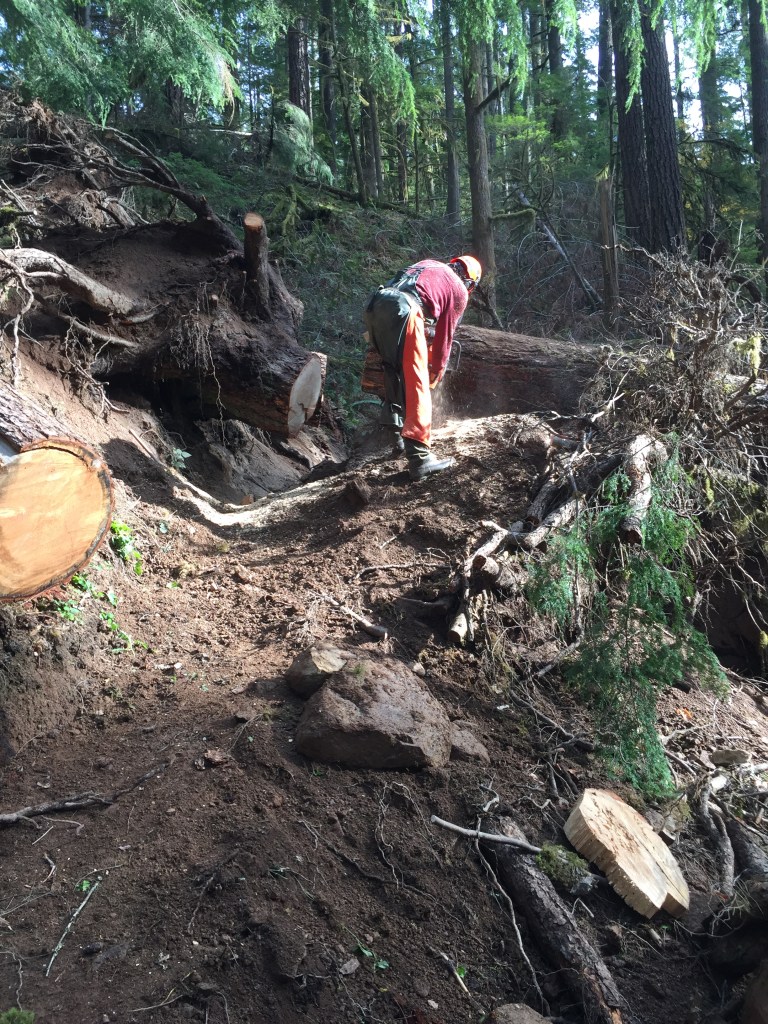
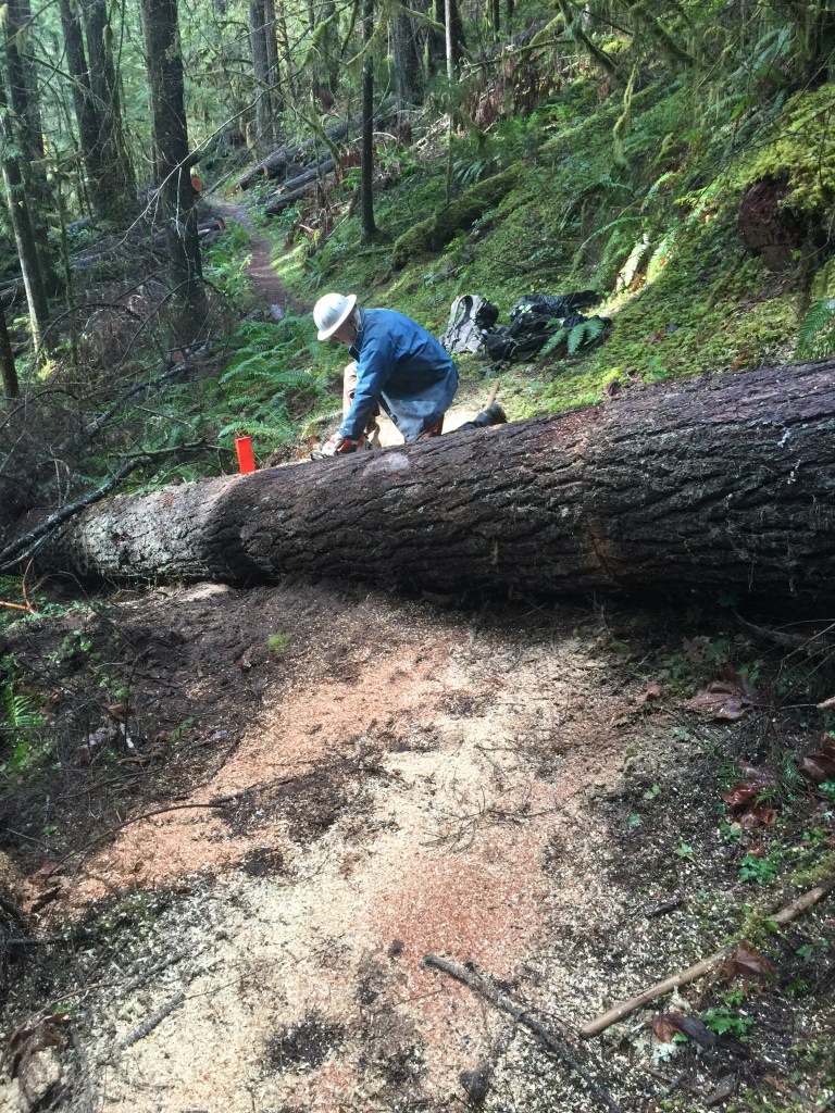
We tackled Brice Creek with multiple saw crews, the way we had other low elevation trails that the winter storm had plastered. There was cutting to plan, pushing cut logs out of the way, trimming branches so the cutter could get to the trunk, clearing 12 or more inches of often frozen, always wet branches on the trail so we could get down to dirt. The days were long, the work hard, wet, and cold, but we gradually cleared the trail of major blowdowns over several weeks. It was gratifying to see the trail again reappear and be usable. Many of us swampers (not chain sawyers) moved to the high elevation trails to clear them in the summer. I left Brice in early July to go up into the Waldo Lake and the Diamond Peak Wilderness, clearing several trails and getting an excellent mental map of the trail system, the geography of the place, water sources and campsites.
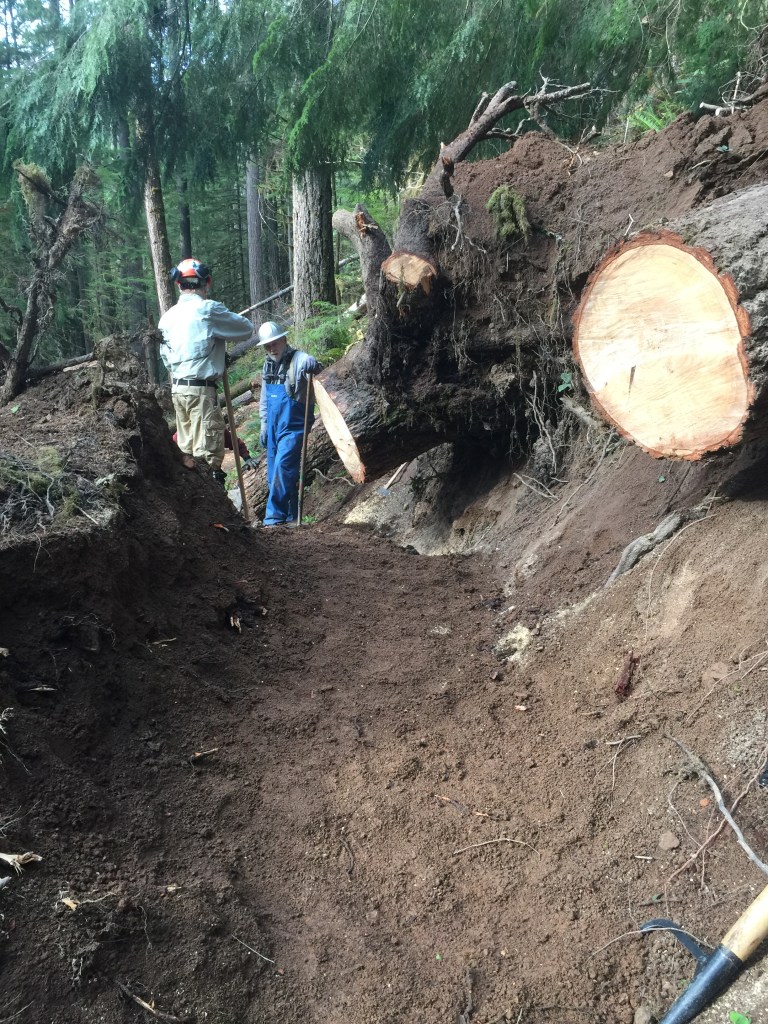
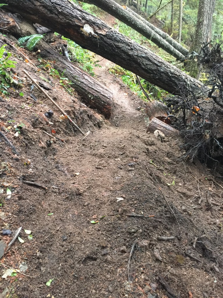
As fall came, there was a need to do trail work on Brice. The trees that had fallen had root balls that came out of the trail, leaving a big hole. We needed to clear the dirt, rocks, branches and route the trail either through the hole, fill the hole, or route the trail around the hole. Fortunately, there were three entrances to the trail, so the hiking in was limited, leaving more time for work.
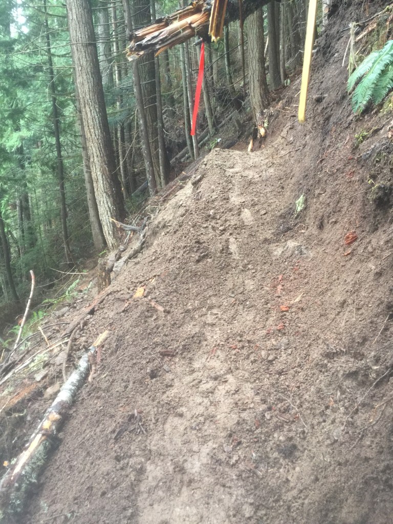
Upper Trestle Falls remained, however. There had once been a small railway where the trail was, and from that area two trails went to a lovely waterfall a mile and a half up and 700 feet climb. This had been logged out, blowdowns removed, over the summer, but now the trail there had to be rebuilt, too.
First job was for me to go in and scout the trail. I did that with the Gaia app giving me the trail, the contours, and a way to photograph the trail defects with location. I mapped about thirty spots in the 3 mile loop and a hiked seven more miles to check out other parts of the trail. Now the weather was different, with a wetter, much muddier trail, and significant work to be done with tools being carried uphill.

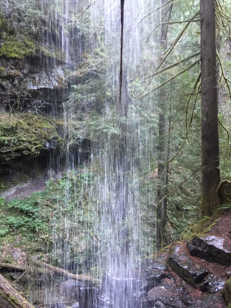
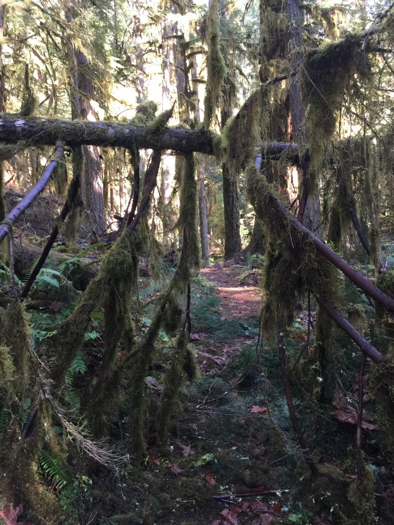
The pictures really do tell the story. So here are some.


Leave a comment