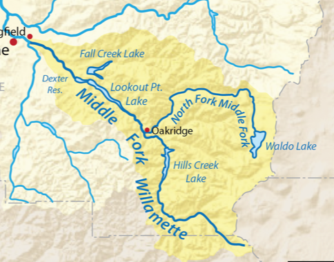
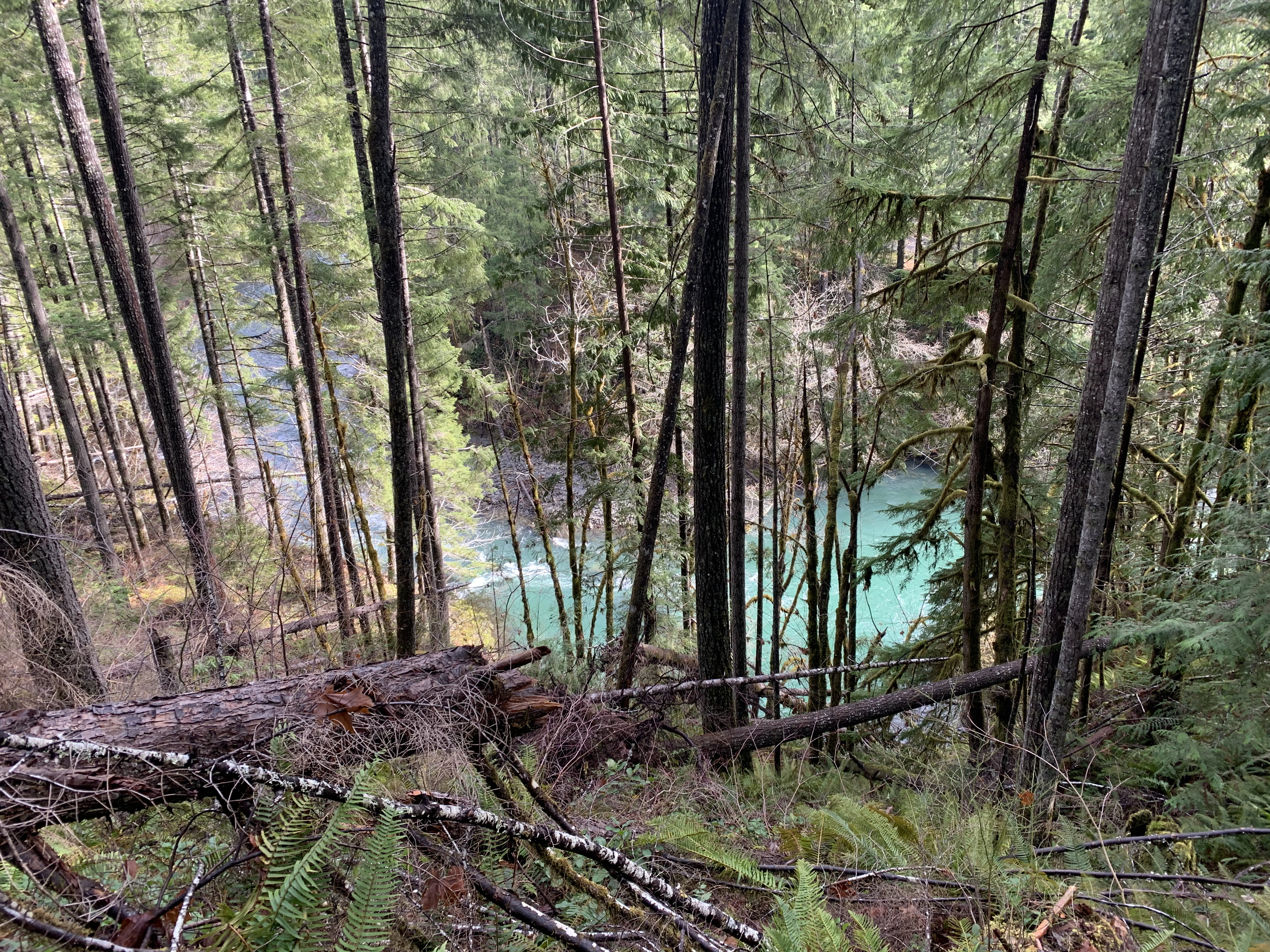
The North Fork Trail parallels the river of the same name (well, the North Fork of the Middle Fork of the Willamette River), an Oregon Wild and Scenic River, for about 11 miles upstream from Westfir/Oakridge and Highway 58. The river itself flows from Waldo Lake to the Middle Fork of the Willamette near Oakridge. The Aufderheide, Highway 19, one of the original 50 of national scenic byways, is across the river on the east side and connects in 60 miles to Highway 126 heading to Santiam and McKenzie Pass. The trail is for hiking and mountain biking at low elevation but hadn’t been fully assessed or addressed after the Snowmageddon event three years ago, and it looked it. The Crew had hiked in the first time from FS Road 1919 at the north end with power brushers to clear encroaching plants and Pulaskis for the root wads—made by falling trees whose roots pulled out of the trail, but soon realized what we needed to do was log the whole thing out–over 400 trees in 5 miles needed removal– in addition to taking apart three failed bridges, or maybe four, I can’t remember. There were other bridges considered passable, but many might not choose to cross them. I can understand their concerns.

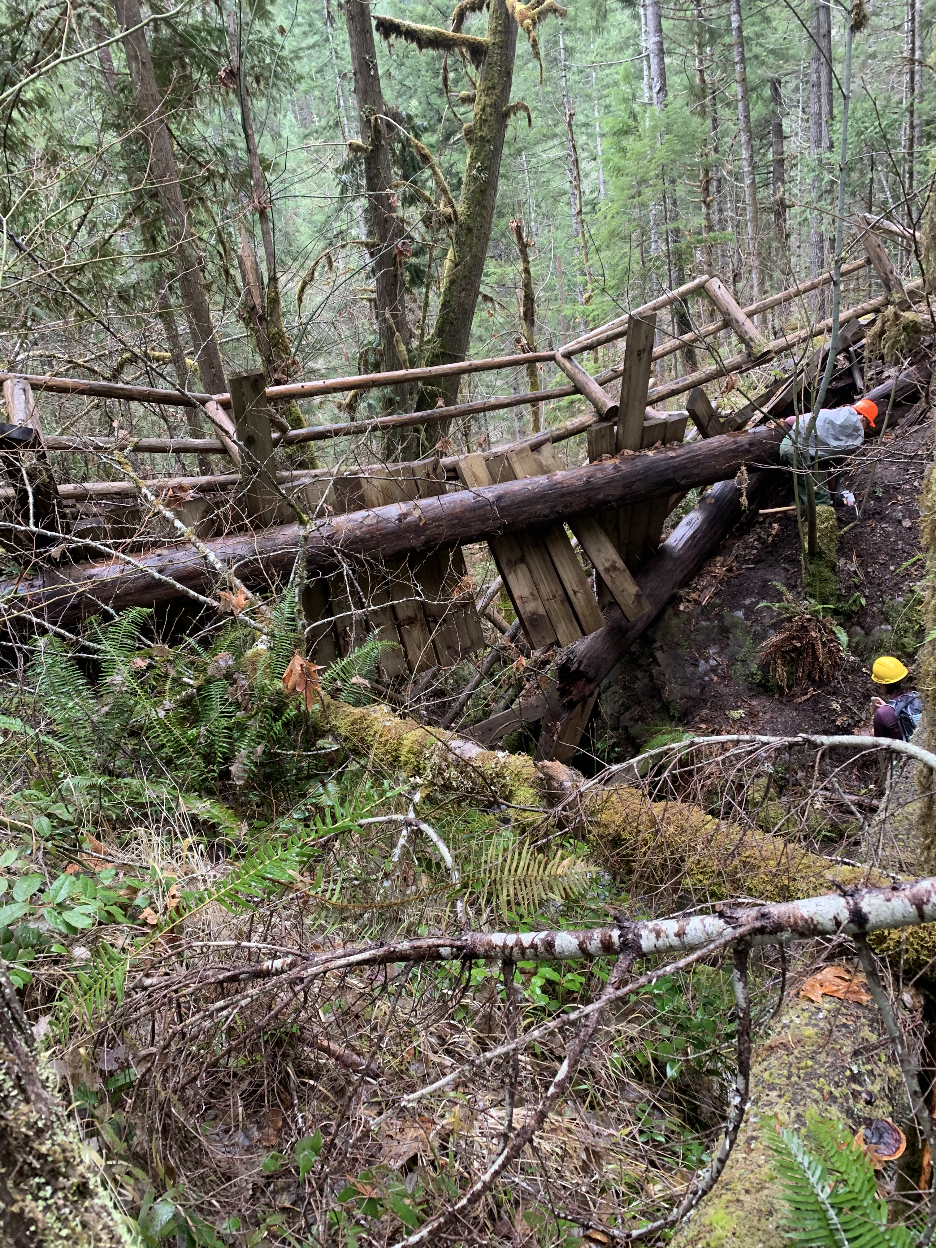
Anyway, after the logging was completed, a brief phrase describing 175 man hours, long days driving in on roads that we sometimes had to log out to drive on, hiking to the trail, then cutting out and moving the rounds (cut logs), we tackled the spectacularly failed bridge north of FS 1912.
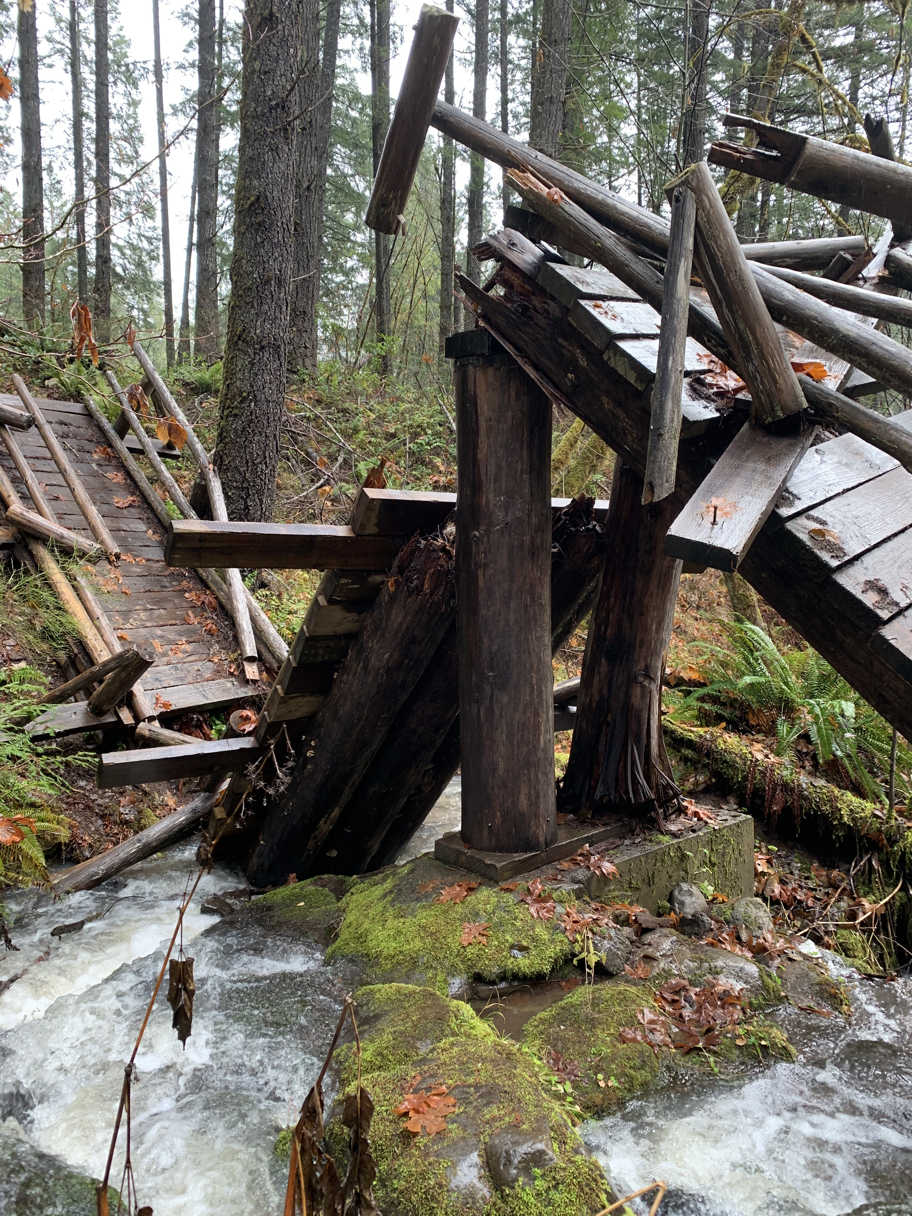
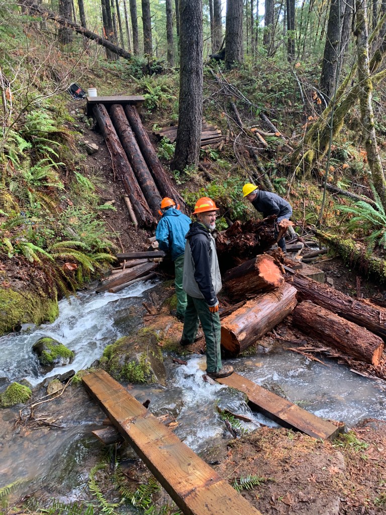
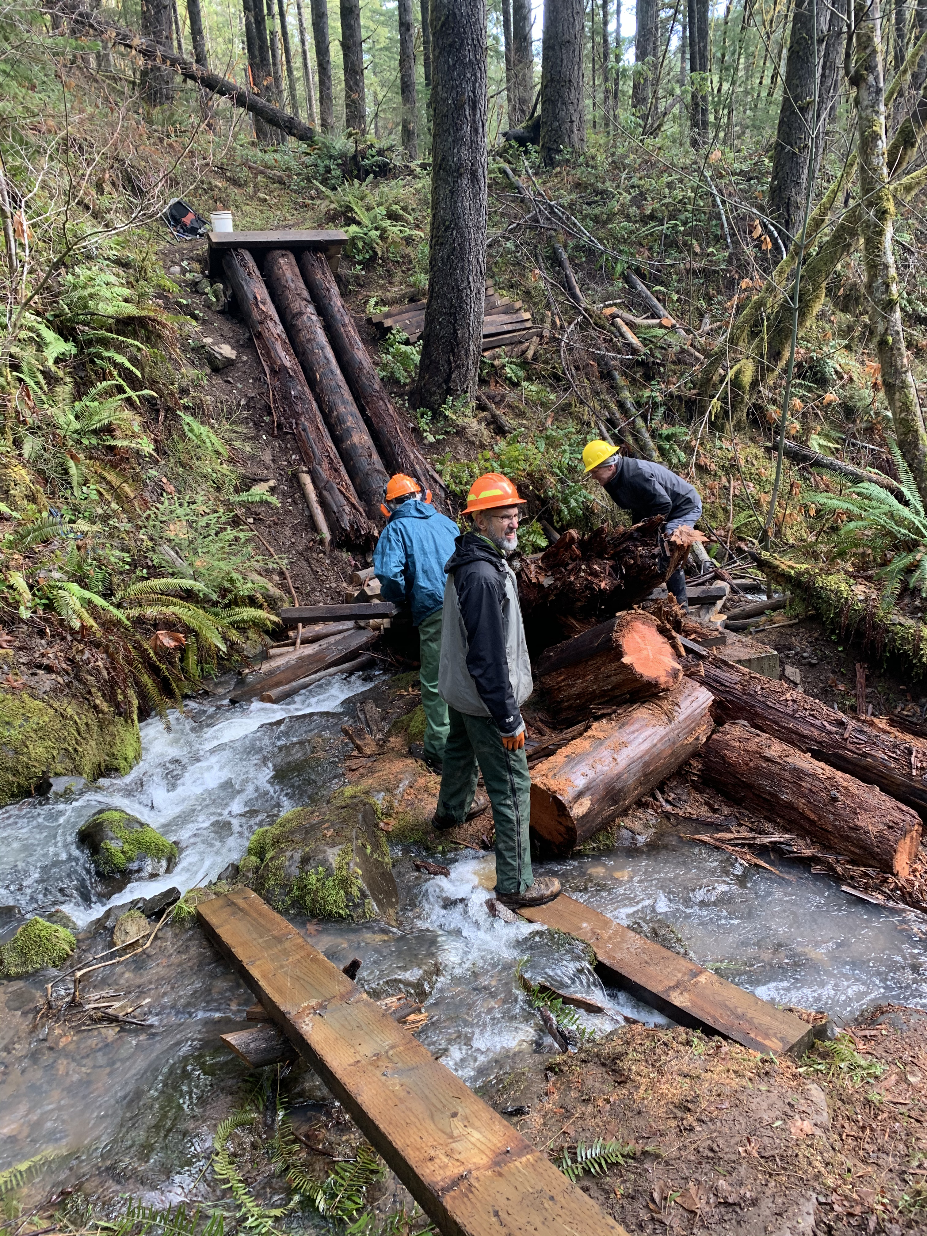
Getting there was interesting. We could hike in a mile from lower elevation, climbing a little then descending to a creek where the bridge was. But since 1912 paralleled the trail, above it, we drove in about 3/4 of a mile, parked, where it was about 200 yards to the trail, 60 of those yards vertically down, on somewhat muddy ground, over a few logs, to reach the trail. Once there, we crossed a serviceable bridge— “passable” although I wouldn’t lead a hike with the Club over—that canted about 5 degrees to the downstream side and was slick on even a dry day. Then it was a quarter mile downhill to the worksite. Downhill sounds nice, but downhill on mud is dicey.
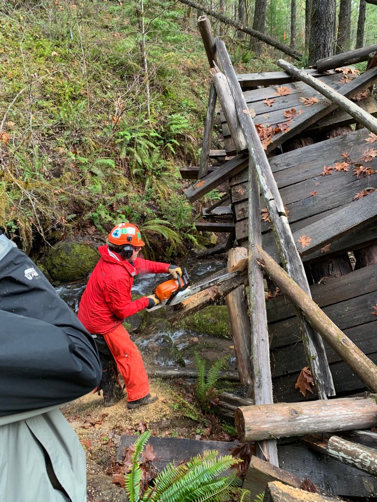
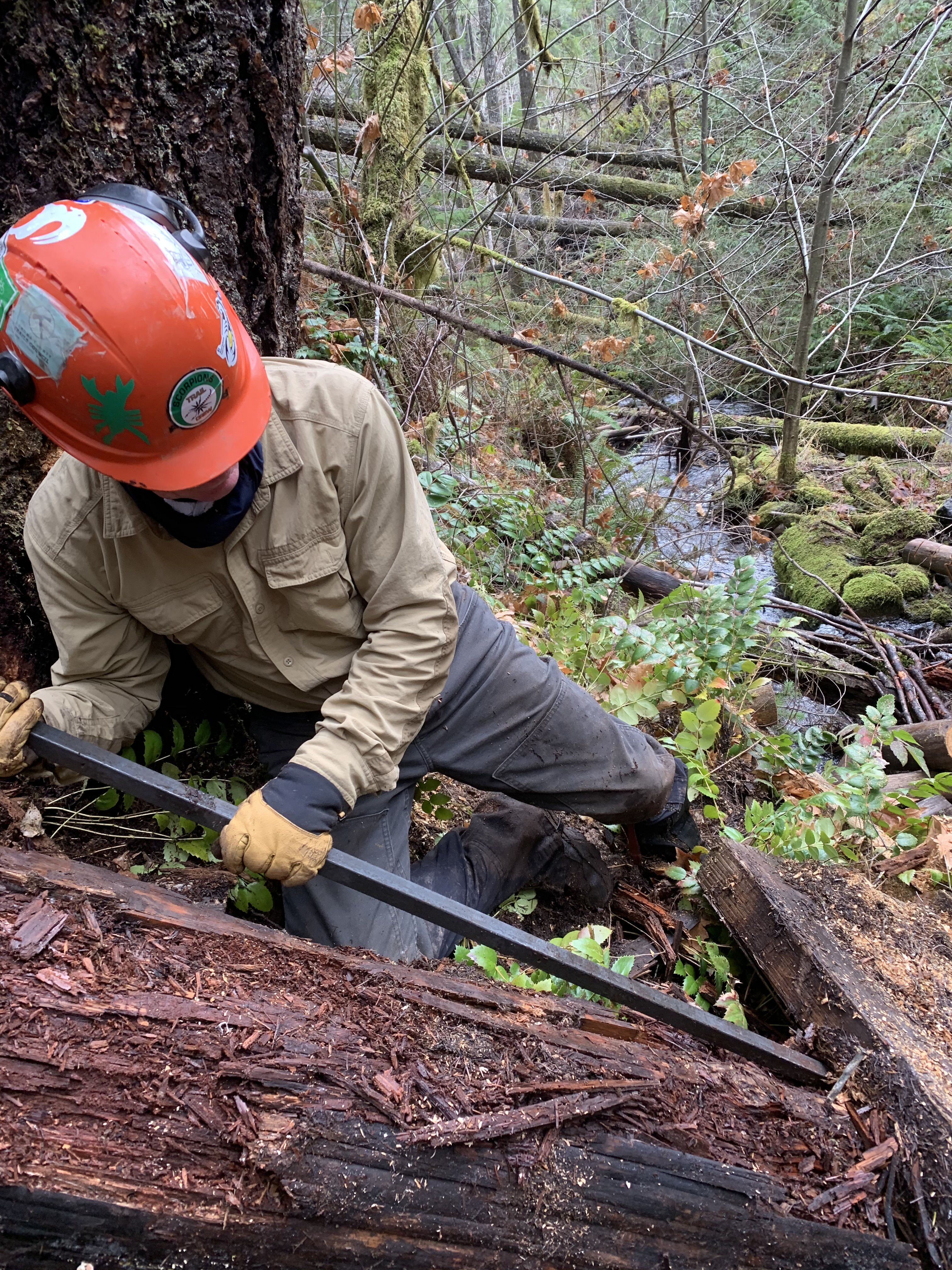
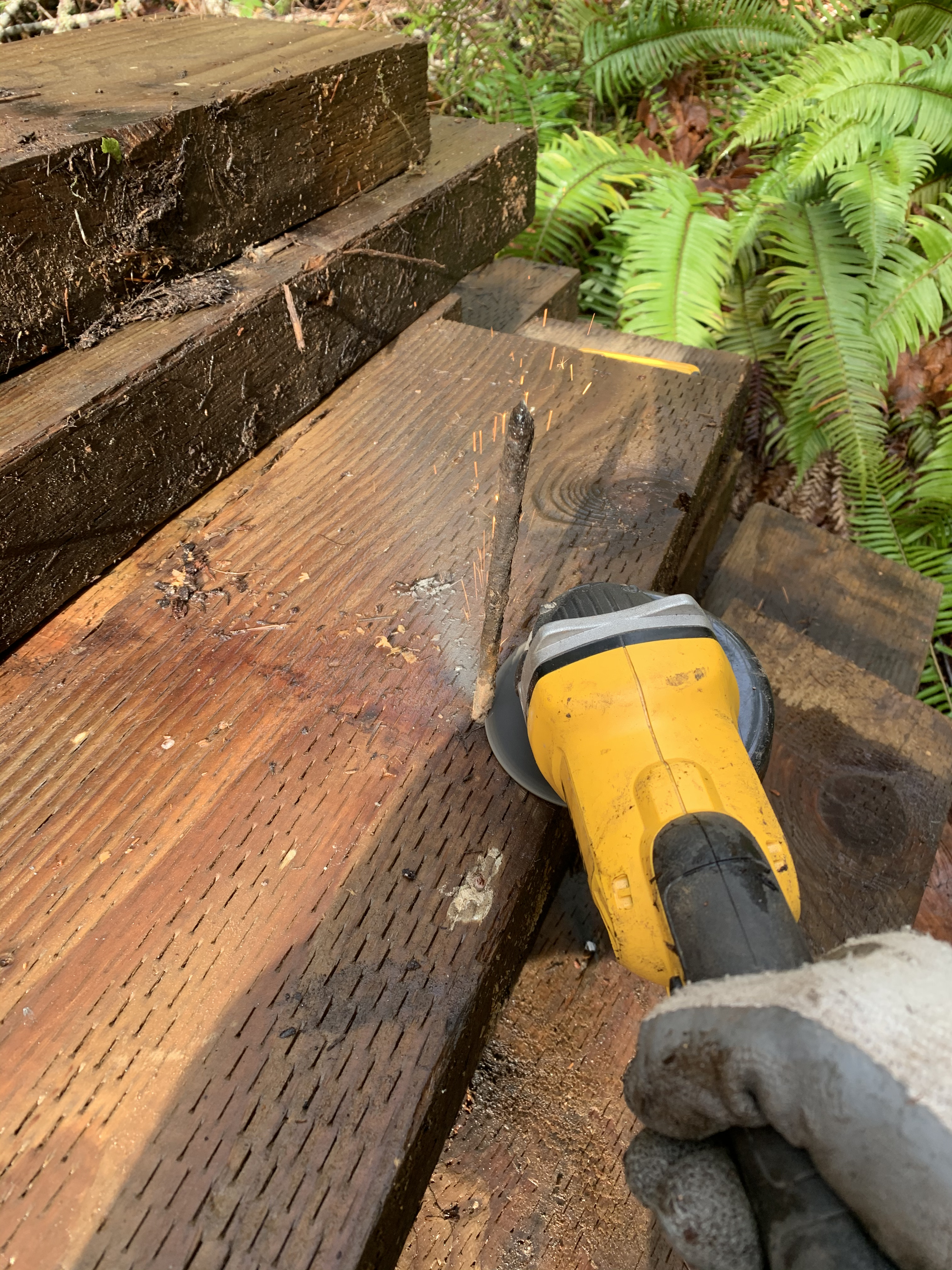
We first had to cut down bridge parts that were hanging in the breeze, then pry up the thick planks that were once tread from the large logs in which they were all pounded into with long spikes. I’m sure there is better terminology, but one gets the gist. We wanted to save the planks for reuse, piling them nearby, but we first needed to get the spikes out. They were about 8-10 inches long, and pounding them out, using the claws on the hammer or chisels was a difficult undertaking, because the claws weren’t deep enough to grab the spikes. It would take us 10-15 minutes to remove a plank and then someone would spend 30 minutes or more on some of the spikes. We then used cawsalls, battery powered metal cutting saws. They would cut, and I learned once the nail started to smoke, and then smelled like boiled metal, although boiled metal isn’t in our smell repertoire, one could then stop and break the nail off. The cawsalls chewed up batteries like a dog a toy.


Remember that we have to carry this stuff in and out as well as use it.

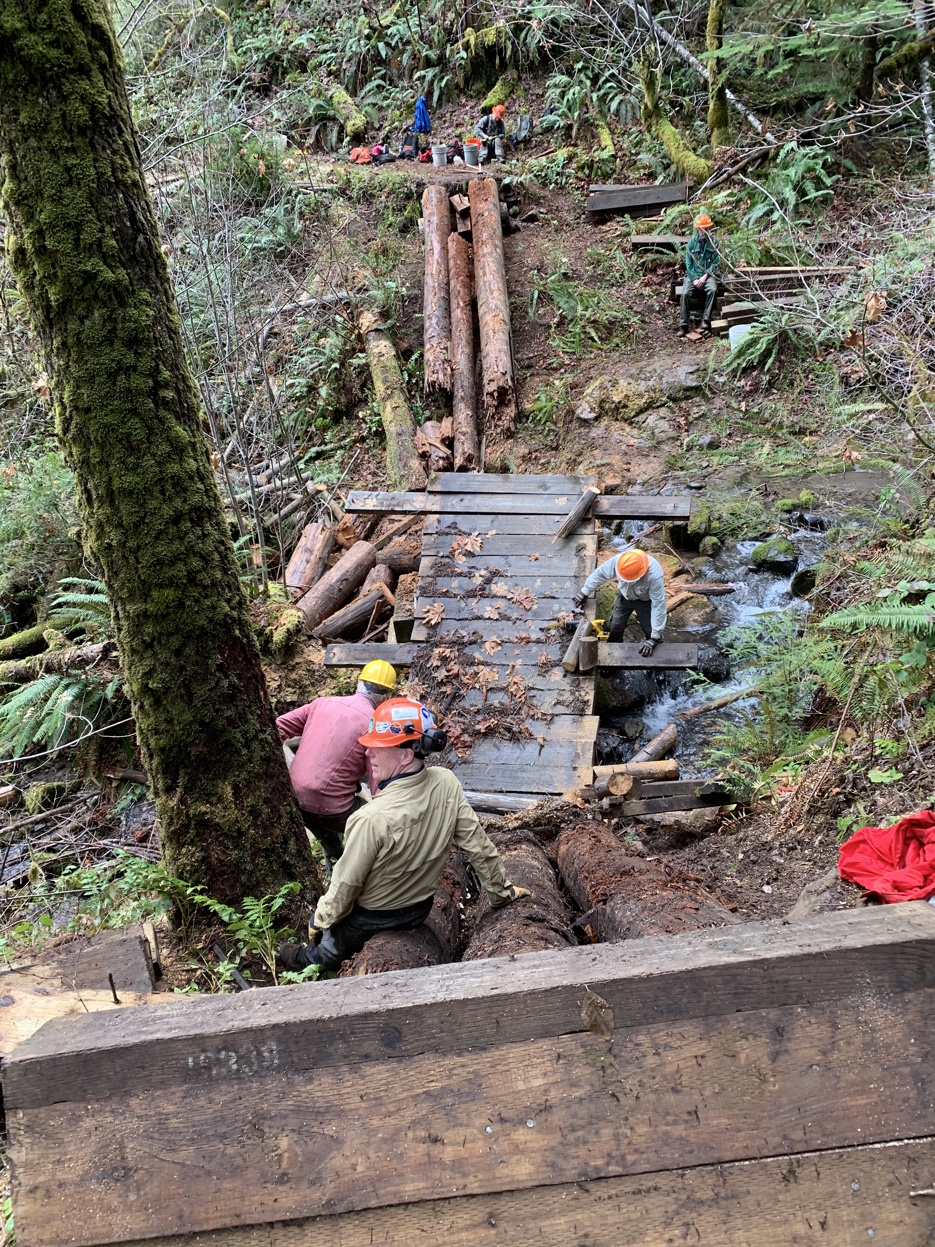
The stream was pretty, about 50-100 feet vertical above the river, but of course the nearby rocks were mossy and slippery, the far side muddy and steep, making any river crossing an undertaking in itself. The first day, we managed to cut out about two-thirds of the planks and stack them, each of the thirty to forty weighing well over 100 pounds, requiring two or more people to move on terrain that was, shall we say, friction impaired. We finally quit, stashing the pry rod, hammers, spikes removed, and a few other tools in a bucket on the other side of the creek. We hiked out, across the 5 degree canted bridge, back up the awful hill to the cars, each puff of breath telling ourselves it was better than hiking a mile back to the bottom of the 1912 road.
We planned one more day on the bridge the following week, this time bringing in more Lithium 18V batteries and a grinder, which I had never seen before. Most of the Crew have their own Home Office for hardware at home. I have a hammer and at least now a voltmeter to check the car battery, not much else. We split up in two groups, one on each side of the creek to remove the remaining planks, cut out some of the logs underneath, continuing to stack everything salvageable on the near side, and leave the cut big stuff by the creek. I watched one of the guys use the grinder to cut a spike out, and then he handed me the grinder. It seemed easy to use, the disk whirred around fast, and I cut the next spike with the usual smoke-stink-bend and break, before the battery died. OK. I picked up another battery, sure didn’t want to have to ask how to put it in, but fortunately figured out how. I pushed the start button, things started to rotate, and went through the smoke-stink-break off spike process again. With the machine stopped, I looked at the disk, which resembles a CD, and while cutting through metal, plays 100+ db screechy music that isn’t much different from some of the stuff my OK Boomer ears listen to today. Heavy metal, indeed.
No teeth. Uh oh, I thought, I ground those things right off. Damn.
“Hey,” I called. “The teeth are gone.”
The crew leader came over. “It doesn’t have teeth. It’s a grinder.”
Oh. I could have sworn I saw teeth when I started. Nope. I guess I have OK Boomer eyes, too.
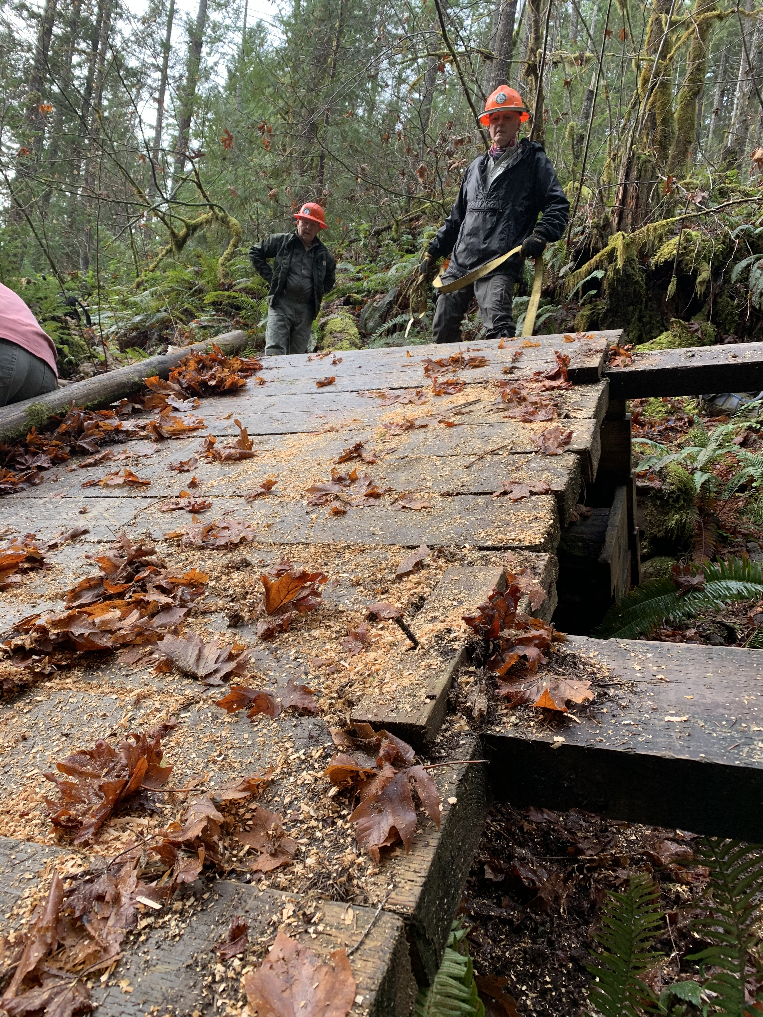
We got the fifty odd heavy planks out and stacked, spikes removed or pounded into the center of the plank, finished cleaning up what we could and the leader called the job complete. Wow, lot of big logs on both sides, many cut ones down in between, and this is done. Well, I don’t want to move those. Better to walk out of there, back uphill where each week the steps were becoming progressively more muddy.
This week, it’s another mile to the next bridge. The planks hang down vertically and it is even more slippery. If it is too wet, we will deal with root wads. That’s safer, but one spends the day walking on boots that have 3 inches of mud caked on them.


Almost ready to start smoking.


Leave a comment