Many years ago, I paddled out one September afternoon from Wolf Creek on Burntside Lake, headed into the Boundary Waters at Crab Lake, back when a mile portage seemed like a good idea. I didn’t have a map for my entry, but I did have the next map north, where I expected to soon be within 2 miles. Error in judgment. After an hour and easily those two miles, none of the landmarks I saw was quite right for the map I thought I was now on. I then “moved landmarks,” or made distant islands fit my map, but a half hour later it was obvious nothing fit, and I admitted defeat. That was better judgment. Far in the distance behind me, I could see where I had started, and that became my goal. I returned to shore, put the canoe back on the car, drove into Ely, stopping at an outfitting store to take a look at a map where I had been. I was miles from where I thought I was. Better prepared, I headed out on the same lake the next day and had a good 4-day solo into the Burntside Unit.
I’ve been significantly off course a few times since, which embarrassed me, because I consider myself as having good directional sense. I do, but one or more minor mistakes can throw me a curve. On the Appalachian Trail, I was so fatigued one day that after I got up from a rest stop, I retraced a mile of my prior route. When I saw a road that shouldn’t have been there—a road I had crossed a few hours earlier— I realized that the proper question was not “What is that road doing here?” but rather “What am I doing here?”
On Isle Royale, first boat out to the island in 2006, I realized I had a Lost Meter: it wasn’t in my pack, it was in my brain. Hiking in the dark with a flashlight I hoped kept on working, I encountered a huge blowdown. I went around it, and around it…, and continued, soon having a disquieting sense I was going back the way I had come. I took out my compass, something I almost never have to do, confirmed that my basic direction was indeed southwest rather than the desired northeast, and turned around. That disquieting sense was my Lost Meter’s kicking in. The flashlight got me through the night until I reached Windigo, ten miles later.
I have seldom ignored my Lost Meter, the last time being on my first hike in Oregon, when I “moved the trail,” because if I had been where I thought I was, I shouldn’t have seen the Sun where it was. I convinced myself the trail would soon turn in the direction I thought it should. It didn’t. The Sun didn’t move, either. I arrived at another trailhead, clearly not where I had started, and started walking to town on an unfamiliar road. The road refused to go north, only south, and the Lost Meter got so loud that I turned around, backtracked to the trailhead, and followed a river downstream back to the car. I was embarrassed and tired, the error costing me at least 2 hours and six miles. On my current hikes, I plan ahead, usually have a paper map, always carry a GPS with spare batteries, and the Gaia app on my phone to use if necessary. If one has to move hills, mountains, islands, or the Sun to match a map, one needs to admit being lost and deal with matters accordingly.
I became a convert to GPS technology on Obsidian Loop, solo in early July with the trail buried under feet of snow. My sense told me to go downhill, the arrow on the GPS pointed elsewhere to a ridge above me. I went up, and life became a lot easier. GPS arrows can’t be moved without physical motion on the holder’s part.
* * *
My healing knee survived the first of three days’ hiking in the Mt. Hood Wilderness, 2100 feet elevation gain on a 12 mile out-and-back to McNeil Point. I was in front and told to stop at some ponds, the leader saying, “We wandered through there last time I was here and weren’t sure where we were.” When I reached the ponds, there were two trails, one going towards a pond, which I assumed was a user trail, not the main trail we wanted to be on. I went a little further on the other and stopped, since on Club hikes we stop at trail junctions, to keep people together. A few minutes later, I saw the leader below me on the user trail. It was not a big deal, really. We could see each other. But the Lost Meter sounded just a little, as I realized I might need to be in charge of navigation this trip. This was an area I felt that one should not have had trouble negotiating.
We got off to a inauspicious start the next day when the leader said the trailhead had changed from the last time she was there. This bothered me, because trailheads usually don’t change, so I started going through my mind what I knew about her navigational skills. She’s experienced, but three weeks prior, on a hike where I shuttled the car, since I couldn’t hike, she failed to find a lake in the Mt. Jefferson Wilderness, looking below her when the contours clearly showed it was above her. Last winter, she took a group into Fawn Lake on a snowshoe. Nobody had a GPS, and they never found the lake. That’s a problem. I am a good navigator, and I wouldn’t go without a GPS. She’s seen a lot, but I ask questions when my Lost Meter goes off. A claim that a trailhead was moved moves the needle on my Lost Meter. Or a trail’s being moved: a leader on a snowshoe hike complained that the trail had been moved, when he was frankly lost and took the whole group on a mile bushwhack in snow. I was glad to have missed that one. I didn’t miss the snowshoe in heavy, deep snow to the top of Willamette Pass Ski Area. After one too many “around the next bend,” I said “one more.” When we went around it, and nothing changed, we turned around. Later, we discovered we had 3/4 mile still to go. In heavy snow.
Trails can change, and part of the Castle Rock Trail actually was moved a year ago by mountain bikers. I knew it had, because my trail memory and the GPS showed me where it used to be. Somewhat a Doubting Thomas, I walked on the unfamiliar trail, watching the GPS carefully, until I was convinced we were going to where we had planned. I wrote Oregon trail guide author Bill Sullivan about the change, got a thanks and a free book of one of the nearly two dozen he has written.
Anyway, we started on the Umbrella Falls trail, a familiar landmark to the leader, but not somewhere where we were supposed to go. I was new here and didn’t know better, so I made myself the sweep, last on the hike. I quickly didn’t like what I was seeing on the GPS. We should have been going east northeast, not north. I called out to her whether we were going in the right direction. She assured me we were, and we arrived at Umbrella Falls a short time later.
This was neither our destination nor part of the hike. It was pretty, but we didn’t want to be there. A comment was made that perhaps this falls was unnamed, “moving landmarks.” No way. Smaller waterfalls in the state are named, and the trail sign said, “Umbrella Falls.” We were at a falls. We were not where we wanted to be, and another look at the map showed we hadn’t driven far enough on Highway 35 to the trailhead.
My Time on Trail meter is also listed below, along with my Danger Meter. Know where you are going, keep an eye on the sky, the trail, the clock, the altitude, and if at any time things don’t make sense, stop until they do, or turn around to the last place where they did. It’s only a hike, and it is not worth risking one’s life to do it.
LOST METER (“Something changed since the last time I was here,” Frequent use of the verb “to hope.”)
One should be able to answer the following questions unequivocally yes:
- Do I have a clear idea of the mileage I am attempting to within 10%?
- Do I know exactly where I am now? Does the altitude match?
- Can I truly say that no landmarks are out of place?
- Assuming one has walked the trail before, are landmarks on the trail familiar?
- Are trail junctions where they should be?
- Do I have a GPS?
- Do the maps and the GPS agree?
DANGER METER (“Come on, you can do it,” Frequent use of “hope”)
- Am I lost? BE HONEST.
- Is part of me saying “I don’t like this” or “This isn’t safe.”? Is somebody saying, “Come on, you can do it?”
- Are there problems with the trail, like blowdowns, unexpected snow, stream crossings? If an out and back, and in glacier country, will a stream be crossable in the afternoon on the return? Glacier meltwater increases in the afternoon.
- If with a group, is anybody uncomfortable with the situation? Have you asked? Really asked by saying, “If you are at all uncomfortable, please speak up.” ? Has somebody mentioned a significant medical condition?
- Is anybody lagging behind or doesn’t look good?
- Is the environment safe for somebody to say NO? Yes, this is repeated, because nobody wants to be a wet blanket or a Killjoy. Except me.
- Does the sky bother you? Have you looked? Storms don’t suddenly occur. There are warnings, even if only an hour or two.
- What are the consequences to a river, snowfield, or scree crossing in front of you if someone falls?
- What is the current windchill?
- What time is sunset, and if applicable, the next high tide?
- Any sign of recent bear or mountain lion scat?
- Are you hearing or saying, “Let’s go a little bit longer,” without “little bit” being defined? “Around the next curve=little bit.” Use “we go 5 more minutes by the clock before turning back.” And stick to it.
TIME ON TRAIL METER “Oh, I didn’t realize how late it was.”
- Did you start late? How late?
- What time do you expect to return (1 p.m., 3, p.m., 5 p.m., 7 p.m., 9 p.m.)?
- Was there unexpected traffic or other problems driving to the trailhead?
- Is everybody getting ready quickly, or does somebody seem to be constantly fixing or adjusting something?
- Does anybody appear to lag, especially early, or is taking long breaks?
- Are you where you want to be at this time? If not, what are your plans?
- When, where, and how long do you plan to have lunch?
- Are there unusual requests, like napping, long meditation, frequent breaks?
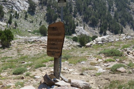
A turnaround point on an out and back exploration. It is worth learning to say STOP, I’m not going further. The trail will be there another day. And so will you. Ruby Mountains, Nevada; August 2016.
Tags: Outdoor writing, Philosophy

Leave a comment