Working nearly a mile up Hardesty Trail, I was amazed that I had fallen in the mud only once, a slow motion deconstruction of my vertical posture arrested by a nearby bank, and which nobody else fortunately saw. The Stihl Brusher was working fine, the trail was cleared of branches by others in front of me, and it was being raked behind me. There were three brushers at work here and a fourth 3 miles up nearby Eagle’s Rest Trail. I had a double layer of ear plugs, and when I couldn’t hear myself or others talk, I figured I was well protected.
Hardesty gets a lot of traffic, especially from mountain bikes. Sword ferns and Salal grow over the trail and need to be trimmed. We were doing a purported 5-year trim, but I suspect in 2 years it will need to be redone.
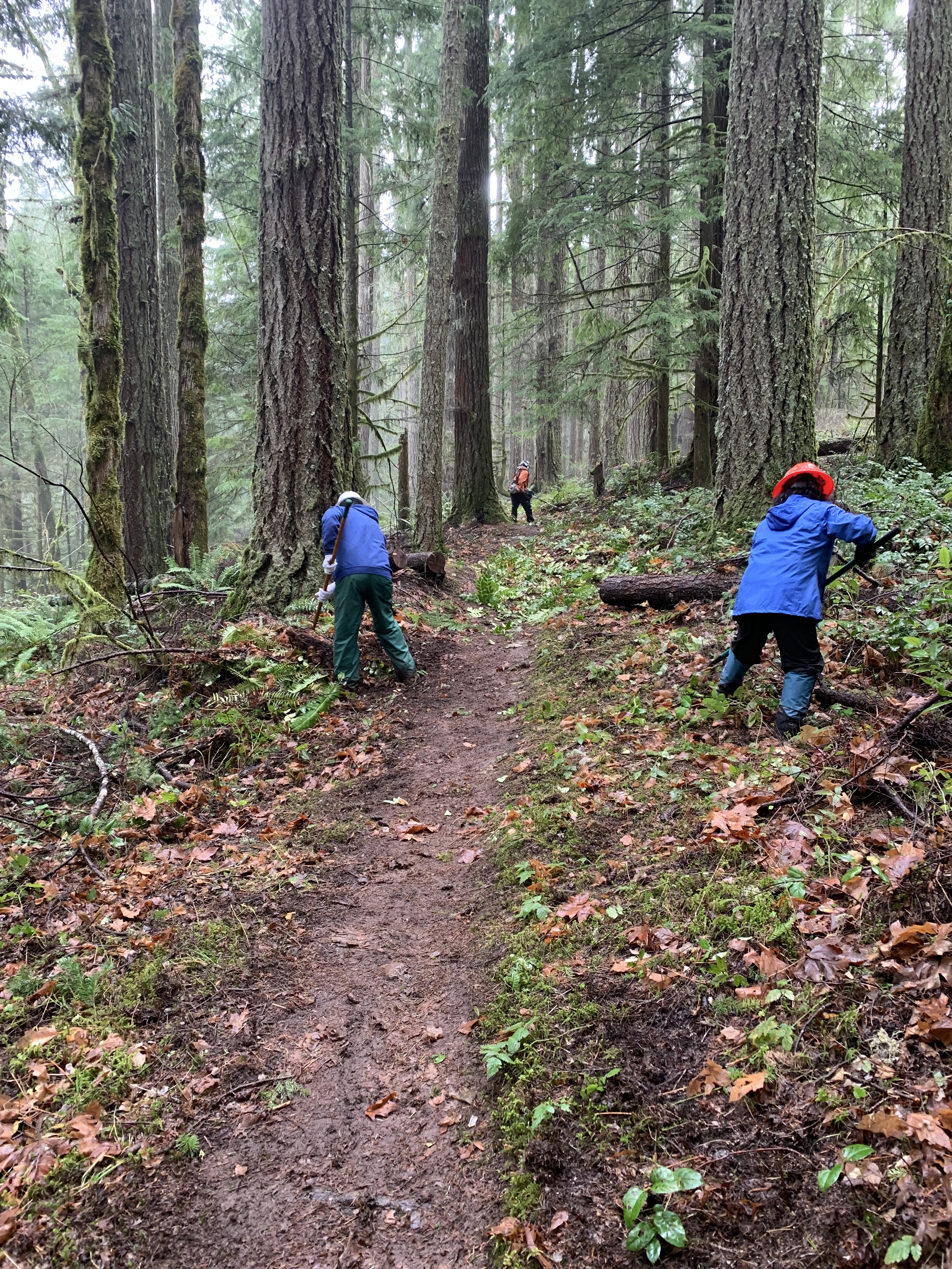
The brusher quickly shut down. Stihl brushers don’t give any warning when they are low on gas. On the other hand, nobody who does much brushing ever complains when they have to stop. The harness helps, but brushing is hard on the upper back. I gassed up and took a break. What a beautiful woods we were in. The darkness of the stratiform rain had lessened, replaced by mist, and the trees stood like tall sentinels. There are huge trees on Hardesty, three century old ones, already big when the country was born, somehow surviving storms, fire, and saws, although a few didn’t survive last summer’s small 20 acre fire just up the trail. Others had blackened bark but would do fine. The first hike I took up here in 2014, my 19th in Oregon, I said that protecting just one of those big trees would be a good legacy. I had hoped we might make the area wilderness, but there is too much recreational mountain biking and it is too close to main roads, although both the Mt. Jefferson, Mt. Washington, and Menagerie wildernesses abut US 20.
The well-known Oregon trail author William Sullivan discusses Hardesty briefly at the end of his book on the Middle Cascades, barely mentioning it in the Mt. June section with the comment, regarding lack of views on Hardesty, “These hikers obviously don’t know about Mt. June.” I found that quotation in my once-got-it-soaking-wet edition (I have two later editions), the day I hiked Obsidian loop in a heavy November rain seven years ago with no pack cover. This is because while Hardesty trailhead is right off Highway 58, easy to access, climbs a full vertical kilometer to the summit, there are no views at the summit. In the few years I have climbed Hardesty, regrowth has taken away what was at best a limited view of South Sister. If you want high mountain or ocean views, yes, go elsewhere. If you want to get into shape in one day for summer hiking, on the other hand, this is your trail—11 miles round trip with a lot of elevation gain. Drop down Eula Ridge trail near the top for 4 miles, and take the flatter South Willamette, still with a thousand feet cumulative vertical to connect back to Hardesty, and it is a nice 14 mile loop. Trail runners race the Hardesty Hardcore loop, which one has do under 4 hours to be considered a finisher. I hiked it once in four and a half, figured I could probably find thirty minutes somewhere to take off, but then asked myself why I would want to do that. I never did the race.
One November, I led a Club hike to Hardesty, over on the Sawtooth Trail to Mt. June and back to Hardesty, an 18 miler with about 5600 feet of elevation gain–“the junk food hike.” I got to the half way point at Mt. June—no views because of fog—was cramping, probably pre-bonk stage, and as hike leader, l was leading from the back, not letting anybody know that there was no other spot in the group I could lead from at that moment. I simply could not go any faster. Fortunately, one guy gave away a pack of Cheet-Os at lunch, nutritionally awful, with the salt and the corn syrup, but oh so good for the bonks, and I somehow got my body back to the car.
Hardesty was only my second time in the Willamette National Forest. I liked the wetness of the first part of the trail, huge trees, constant climbing and the feeling of accomplishment when I reached the concrete ruins at the top. There are some nice views on the way up; one just has to look out and down at Eagles Rest or Lookout Reservoir below. Hardesty Lookout itself was removed in 1968; the trail has existed since 1910. I learned just recently the parking area was once an informal resting spot for truckers and full of trash. Nice the world changes for the good occasionally.

Lunch time for the Crew. As I turned off the brusher, Louise, retired from 32 years in the Forest Service and a newcomer to the group, commented how pretty the trail was. It is. I don’t hear that said much by the Crew, in part while I think we know it, perhaps we forget it in the press of bucking out another log, digging a drain for a trail, or moving rocks. Hardesty is pretty. I hadn’t even reached the section of the huge trees. I like this place. I picked a log to sit on, then as I usually do at lunch, lay down while I ate in order to be flat and to look up for a change. I don’t look up enough in the forest, although both bucking big logs and eating lunches on the trail are rapidly curing me of that oversight, the first for safety and the second for comfort. I savor my food, my reclining, and my view. The dictionary defines savor as to enjoy something completely, but to me, savor speaks to the second level: we are enjoying the fact that we are enjoying, acknowledging at that moment, not later, that we are happy, a higher level of happiness as well, that we sometimes miss. When we savor, we are grateful for this exceptional moment and good fortune that we are alive, know we are alive, glad we are, savoring life itself, recognizing and appreciating our current feelings right now, not taking them for granted.


Leave a comment