The day didn’t start well. Our third day working three years post-Cedar Creek Fire Black Creek trail in the Waldo Lake Wilderness since getting permission, and we had a new detour. Our drive was now 35 miles from Oakridge; 7 miles north through High Prairie plus another 8 on 1931, 4 on 1934, the latter two dirt roads through the burn and dust, just to get to paved FS 24, a few miles east of Oakridge. Then we had to go several miles through the staging area for salvage logging, by stacks of logs and heavy machinery before the final 8 miles on 2421, dirt with potholes to the trailhead. At least the final part was not in a burn.
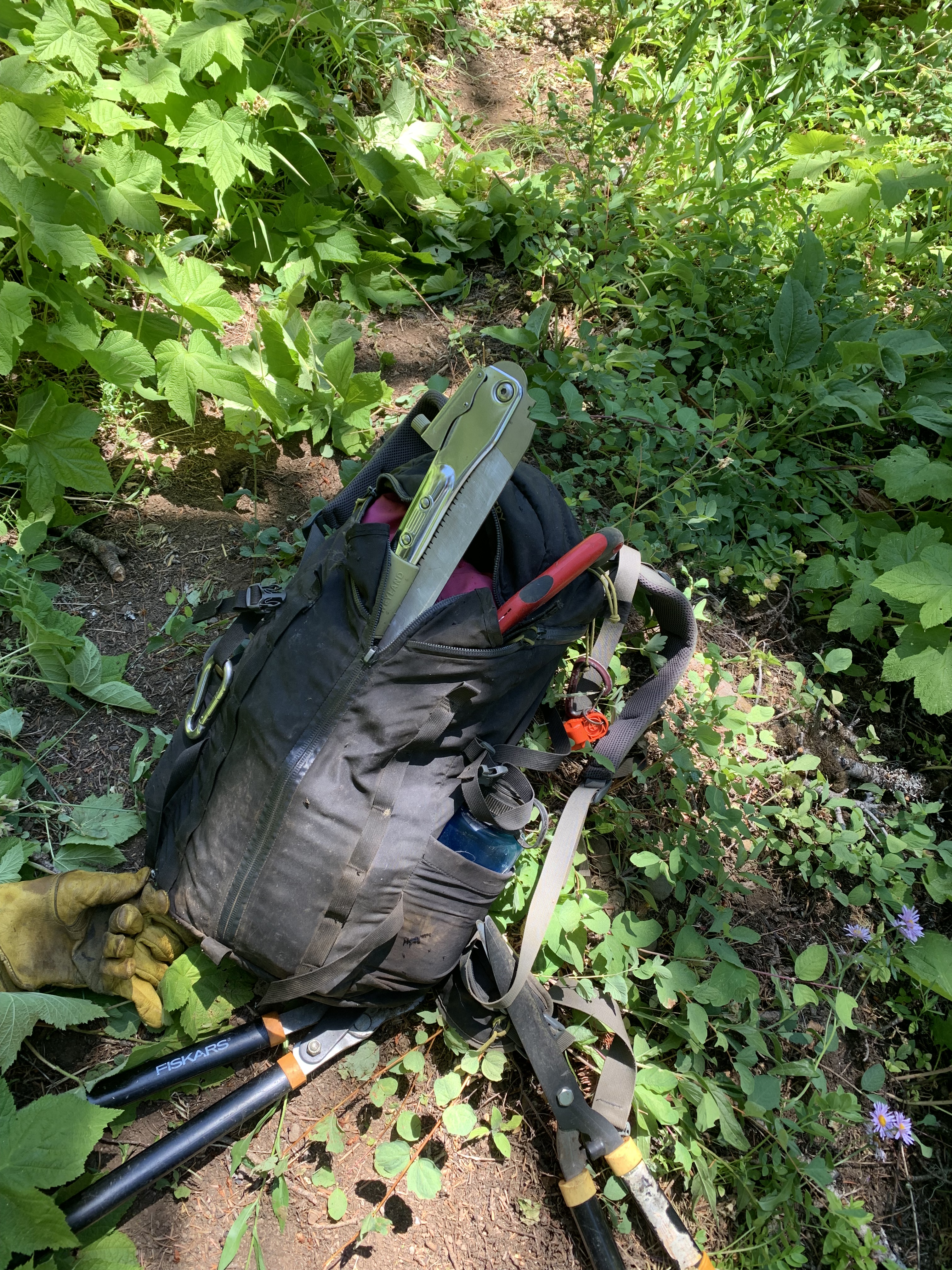
We need permission to work in the forest; we needed special permission to work at Black Creek. Burned areas are dangerous; roads may be busy with heavy equipment, there are falling trees or limbs, maybe silent; treacherous ground with hidden holes; sloughing of the trail; rock slides. During the first two outings we cleared 0.8 miles and 0.4 miles respectively. If the geometric series continued, today we would clear 0.2 miles. Black Creek Trail, 3.7 miles, goes by Lillian Falls before climbing steeply to the west shore of Waldo Lake. We hadn’t even reached the falls. I encountered an all-day-work-on-one-log here several years ago, and logs that gushed sap making saws useless. One of our saw groups had one log that did both, soaking a guy with sap. Delightful.
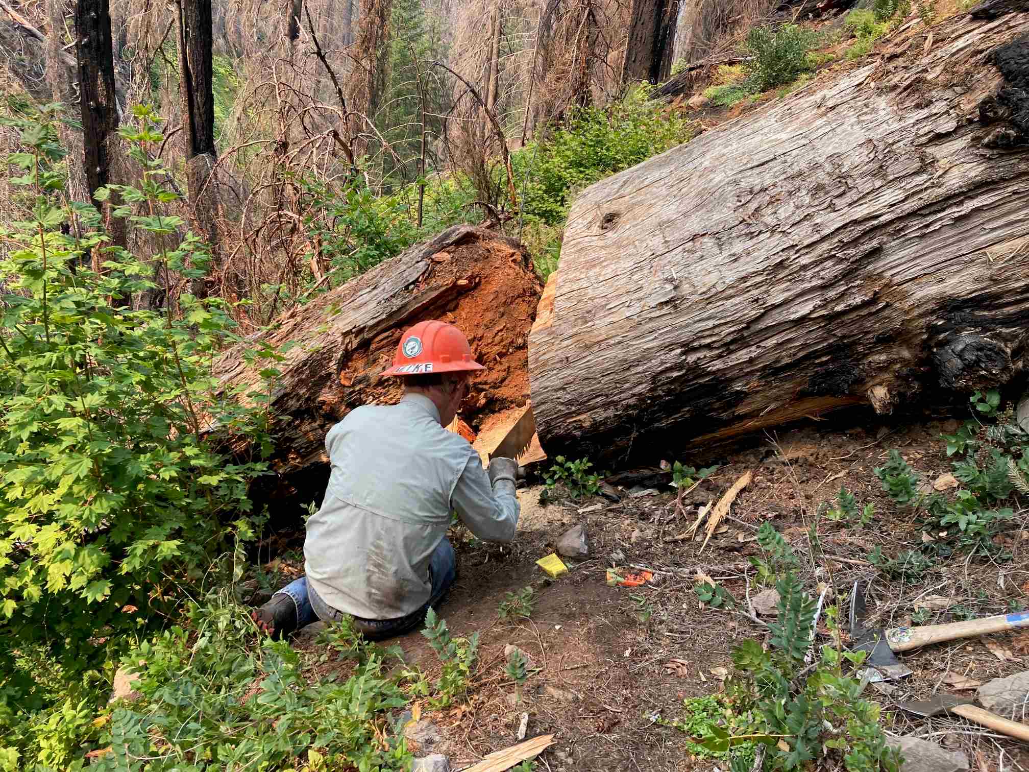
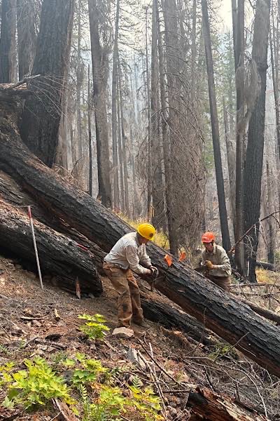
We split into three saw teams and hiked in, gaining 600 feet elevation, passing our previously cut logs, walking where we had repaired the tread. Two of us previously power brushed the quarter mille of trail outside the wilderness. I was in the middle group, where we needed to remove a 30 inch log, which had once been cut, but the remaining log had slid down and jammed two cut areas together. Much of the log lay on a steep uphill, so if we cut anything off below, there was a good chance the rest of the log might slide again. We managed to make a narrow passage through at ground level and started work to cut away the part over the trail. Between the dirt and the blackened bark, we were soon coated. The Emigrant Fire was south of us; by late morning it seemed darker than it should have been. The Sun was dimmer, smoke and white ash started to filter down from the skeletal forest high above us across the creek. We could smell smoke, and by lunch, many of us started coughing and had watery eyes.
The group ahead of us finally got their log removed. The group behind us with sticky log syndrome still had more to do after two days work. Our log would need another day.
By 1:15, I had had enough, enough of the heat, enough of the log, enough of the smoke, and enough of not being able to do enough. Human factors are important part of saw safety: wildfire smoke is dangerous to the lungs, especially given our activity, and coupled with heat and fatigue I felt our continuing to work was unhealthy. The Crew boss agreed and told us to pack up. On the way out, I went by the first group, still working, telling them we were knocking off. One asked me what time it was, and I answered “Time to leave.” We cleared 0.2 miles, mathematically perfect but depressing. I hope that changes, for otherwise next time we will go 0.1 miles and our mathematical limit is 1.6 miles. I really should think of other things.
While waiting for everybody to regroup at the trail head, a California Sister butterfly (Adelpha californica) landed on one of the other crew members. It looked like a white admiral but had a circular orange spot at the tip of each black wing. That was a new butterfly sighting for me.
It was a long drive home, 8 miles back on 2421, past log piles another few miles, then uphill, north, and west 12 miles on dirt to High Prairie. Far south, we saw the pyrocumulus clouds from the Emigrant Fire with a long plume of smoke to the northeast. When we reached a sign that said “Oakridge 2 Westfir 3” I looked at my map and said we could turn on McFarland and drive straight to Westfir, bypassing Oakridge. Nobody disagreed, but a quarter of mile down the road, we had to stop.
Perhaps fifteen elk, at least three young, slowly crossed the road in front of us. It was a tough day out there, dangerous dirty, dusty, hot, humid, and smoky, but seeing the elk helped, and at least for me, so did the butterfly.
Payment in full. See you on the trail.