As soon as I discovered Ken would be riding with us to the work site, I realized I wasn’t going to be—or shouldn’t be— sitting in the front seat of Brad’s truck. Ken was a newbie to the crew. He was big, like 6’2 and 230 at least. But his clothes and gear were appropriate, and he lived in a small town up the McKenzie River, meaning he had probably been in the woods a lot more than I had.
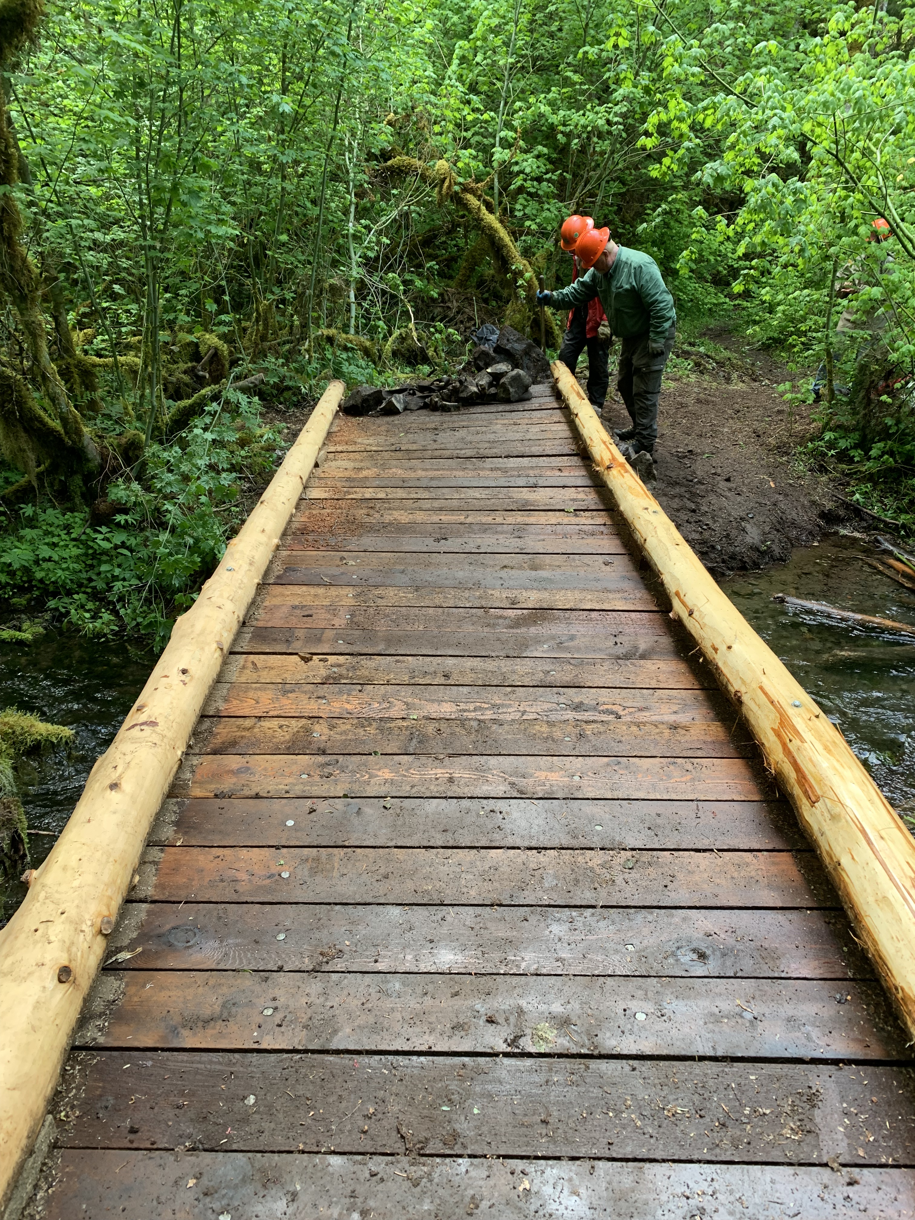
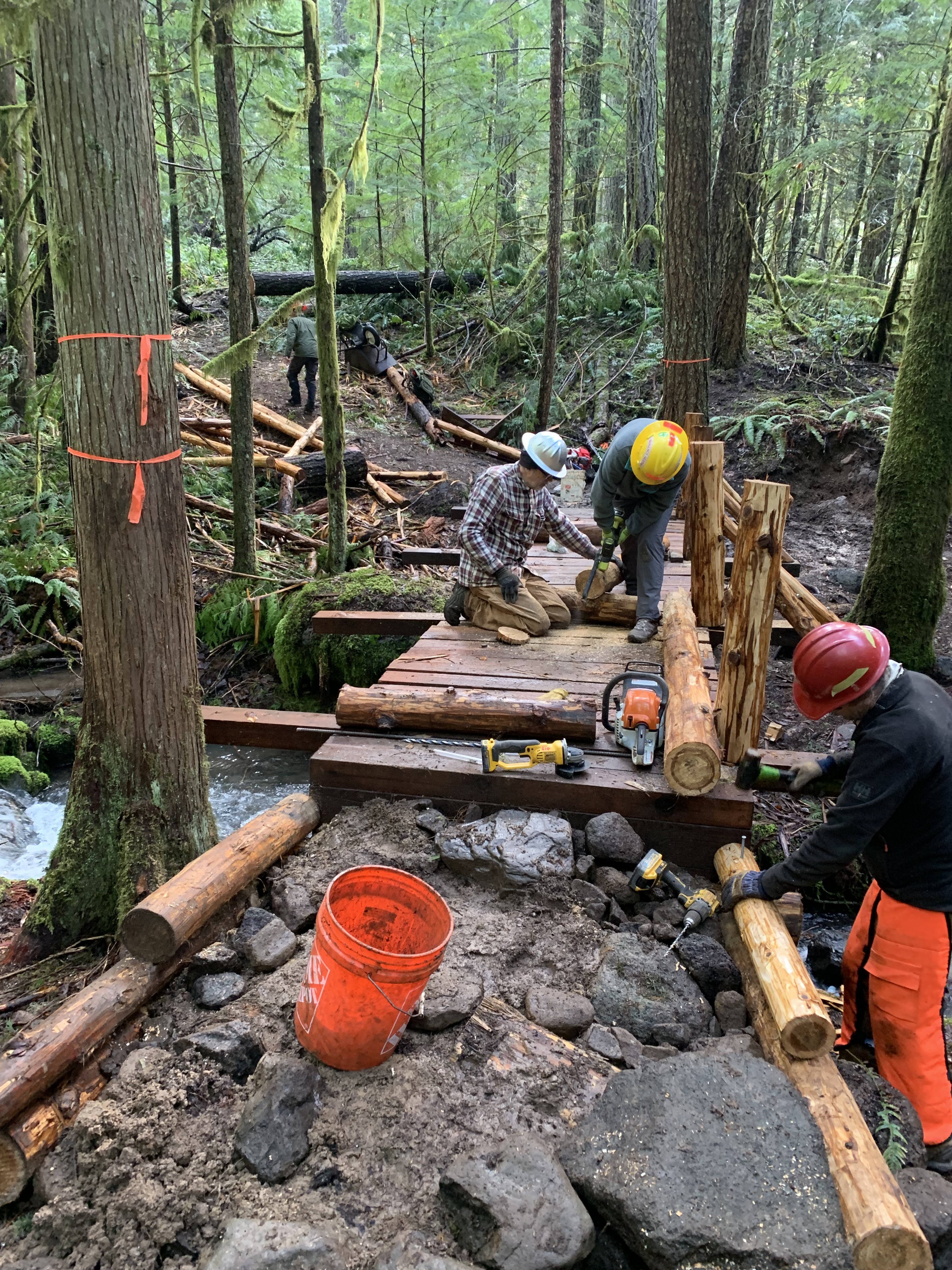
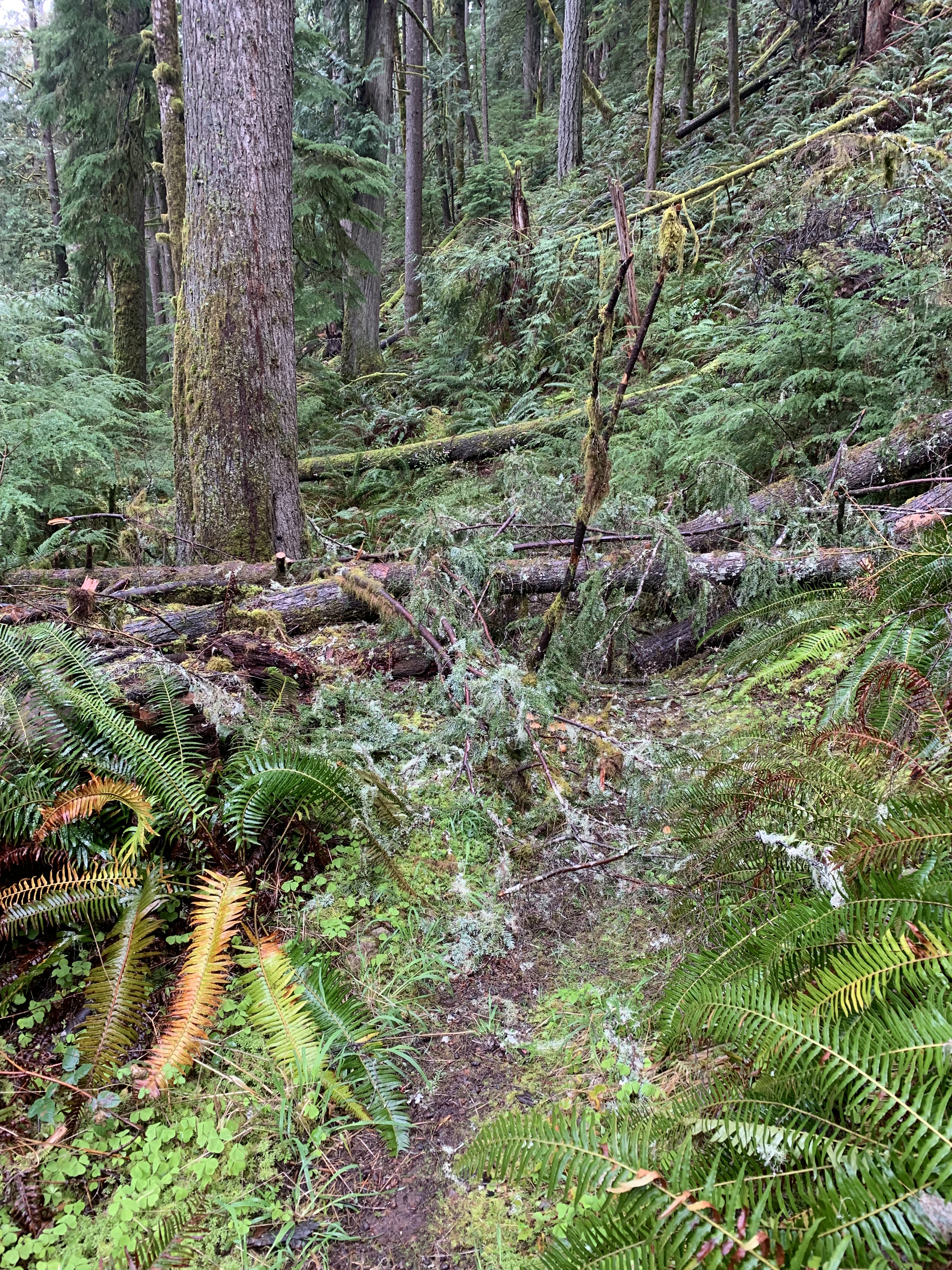
We got to the worksite 60 miles later, parking along FS 21. Lot of interesting places out here upriver on the Willamette: Indigo Springs, Chuckle Springs, often called the source instead of a source of the Willamette’s Middle Fork here (there is a North Fork and a Coast Fork); Pioneer Gulch leading to Diamond Peak, and Lake Timponagos. The Middle Fork Trail runs 32 miles from the last, by our work site, to Hills Creek Reservoir. I had hiked and worked much of the trail. The Crew was making a bridge and two puncheons, which were like an elevated bridge. These involved cutting Western Red Cedar, stripping the bark, moving the 1 ton stringer logs by straps, a rope puller, and people to the bridge site, then placing them on smaller logs or sills, perpendicular to the crossing site, leveling everything, pounding large nails through the stringers into the sills, nailing decking, the planks between them, which we had carried in, and finally making ramps at each end.
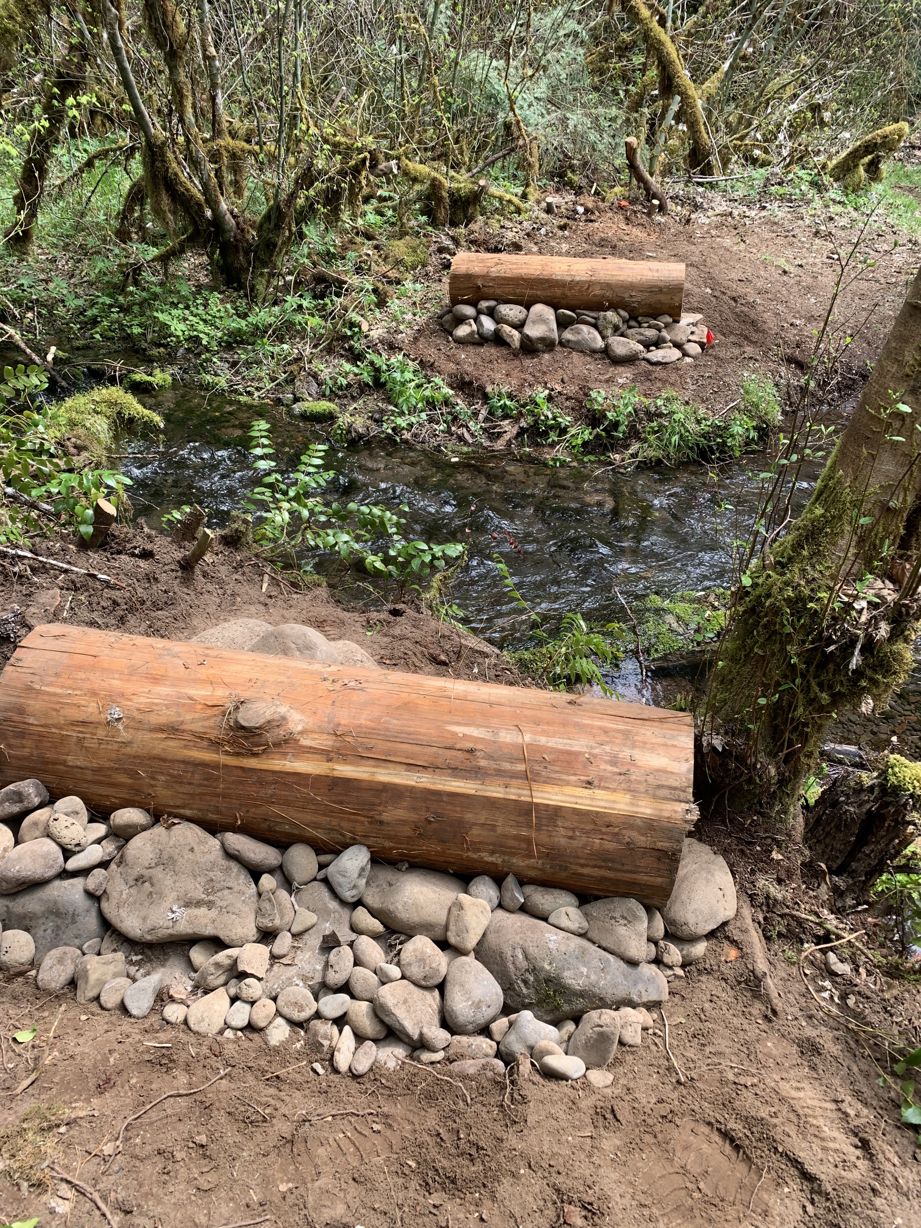
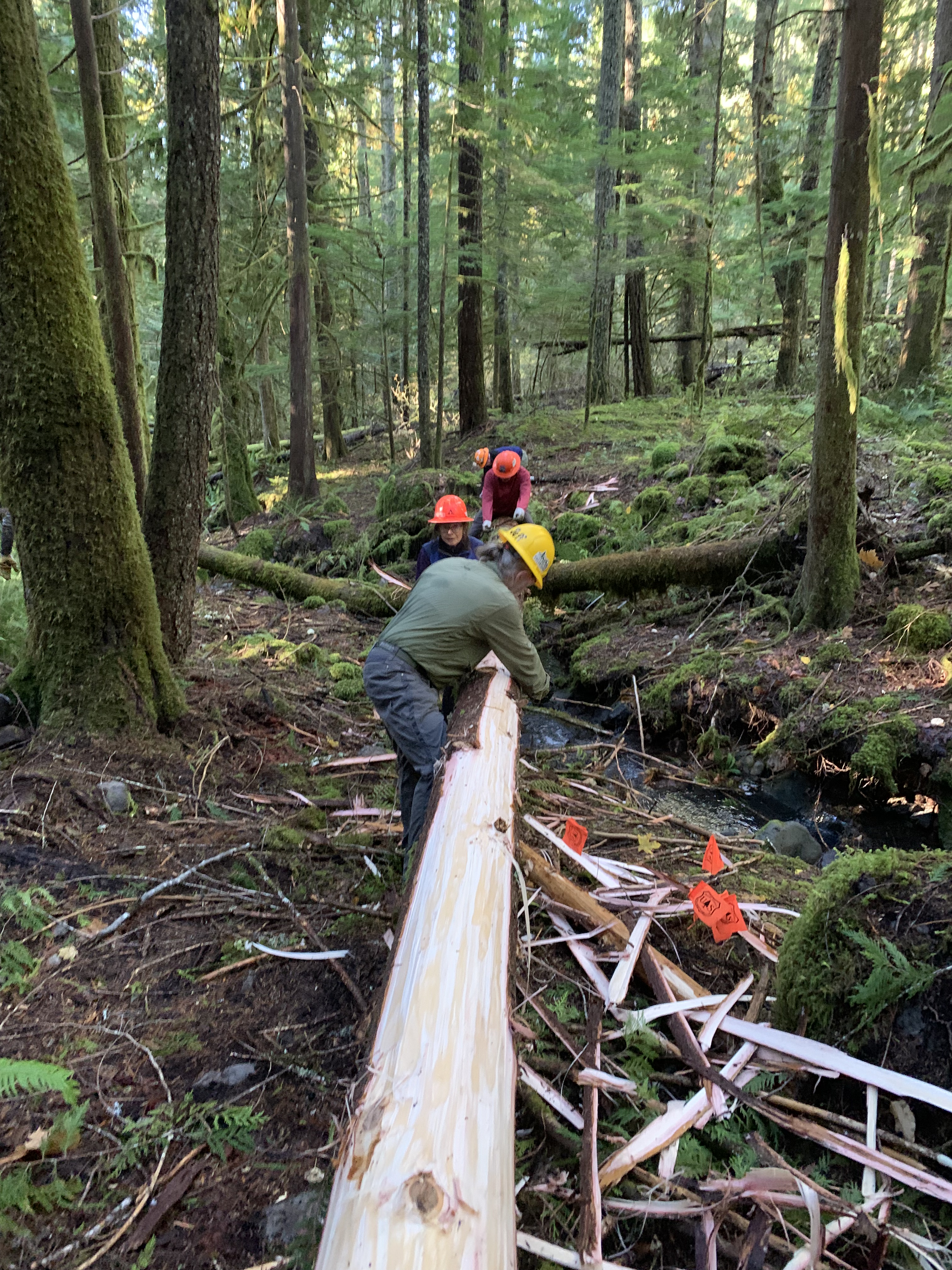
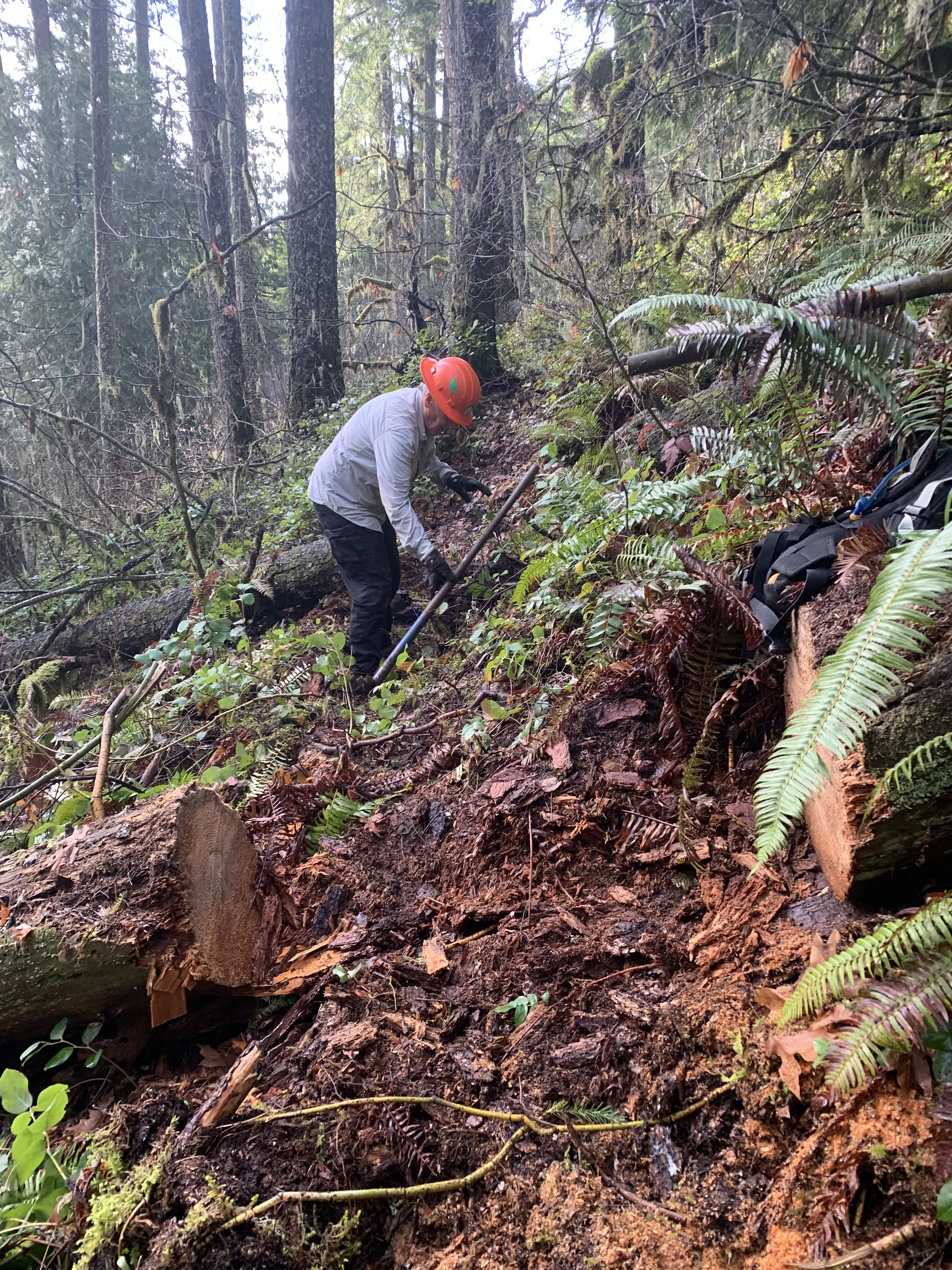
I have done bridge assembly, but others do it better than I, so I self select and am involved in getting rocks and appropriate mineral soil, moving them to the bridge site and helping build the ramps. The more rocks, the less soil needed, and some of the ramps require a cubic yard of fill. It is exceedingly difficult work. I also help make new trail, and we had a few hundred yards of re-routing to do, because rivers move and can erode existing trail.
In one memorable day, I carried planks a quarter mile down a slippery hill to the worksite and then went back up the hill to get the next—8 times. Then I stripped a 30 foot cedar of bark, followed by rock gathering and hauling. Three of us used a rock sling to haul big rocks, which Ken, by himself, would move into place as a support. We called him when we needed a fourth on the sling. After lunch, I shoveled gravel into buckets and carried them to the ramps. We finally finished the project and removed the dicey log crossing we had used for 3 weeks to cross the stream. I pulled out the larger logs and sent small ones down the stream away from the bridge. We were done with this segment.
But not quite. Before I left, I saw Ken down by the water’s edge. He motioned me to come over. There, I saw two plants by the water, each with an odd-shaped flower, which he told me were wild ginger. I had never seen it, and in eight prior days I had worked here, crossing the stream a couple of dozen times, wading in it with boots once, never studied the growth along the bank. I was focused on other matters. Maybe too focused.
All I had to do was look. It was right there, quiet magic, maybe hoping we would finally leave.