Posts Tagged ‘Outdoor writing’

THE BUS TO ABILENE

November 18, 2016

(Taken from management guru Jerry Harvey, who said this about 25 years ago at a Physician Executive conference I attended):

On a hot afternoon visiting in Coleman, Texas, the family is comfortably playing dominoes on a porch, until the father-in-law suggests that they take a trip to Abilene [53 miles north] for dinner. The wife says, “Sounds like a great idea.” The husband, despite having reservations because the drive is long and hot, thinks that his preferences must be out-of-step with the group and says, “Sounds good to me. I just hope your mother wants to go.” The mother-in-law then says, “Of course I want to go. I haven’t been to Abilene in a long time.”

The drive is hot, dusty, and long. When they arrive at the cafeteria, the food is as bad as the drive. They arrive back home four hours later, exhausted.

One of them dishonestly says, “It was a great trip, wasn’t it?” The mother-in-law says that, actually, she would rather have stayed home, but went along since the other three were so enthusiastic. The husband says, “I wasn’t delighted to be doing what we were doing. I only went to satisfy the rest of you.” The wife says, “I just went along to keep you happy. I would have had to be crazy to want to go out in the heat like that.” The father-in-law then says that he only suggested it because he thought the others might be bored.

The group sits back, perplexed that they together decided to take a trip which none of them wanted. They each would have preferred to sit comfortably, but did not admit to it when they still had time to enjoy the afternoon.

Back when I was in management, we had a consultant come to help us at the hospital.  After she left, the executive team discussed how the meeting went.  Everybody was positive and effusive about what the woman had done. I didn’t board the bus and spoke up.  “I wasn’t impressed,” I said.  “Every time I brought up numbers and measurement, she pooh-poohed me. You’ve got to count certain things in life, if they are important, countable, and the counts matter.”

It was as if I had breached a dam.  Virtually everybody then started to say something negative about the meeting.  They had gone from Coleman to Abilene and back, saying all was great when in fact nobody thought it was.

My wife had a similar experience when radiology residents were discussed.  Everybody said one individual was fine, until my wife said that she had reservations about the person.  Suddenly, when the room was polled again, everybody had reservations.  How does a group, who has reservations about an individual, decide that the individual is just fine?  Nobody wants to rock the boat. Nobody wants to raise an unpleasant possibility that maybe the truth lies elsewhere.

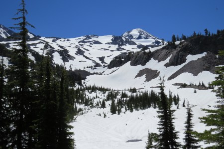
Last week, nine of us were hiking that along the Middle Fork of the Willamette River, near 3000 feet elevation south of Oakridge, Oregon.  It was an easy hike, short and would get me back to town in time for me to lead the monthly hike up Mt. Pisgah I lead every full Moon.

Right away, I was concerned about the time.  I had called the leader to ask when we would get back and whether I should even be doing the hike.  She assured me there should be no problem, that we would be back at 2:30, plenty of time to get ready for a late afternoon hike.  Even with that reassurance, I should not have gone.  I need to be completely focused on the hike I am on, not thinking about other things.

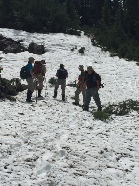
The trip was to see three separate springs that formed the headwaters of the river. The first was easy, and we then returned to a road, walked south along it, then headed towards the river.  The trail went upstream for about a mile before forking.  Here, we waited about 20 minutes as two of the group were picking mushrooms.  The leader told me she was a little annoyed at this; I could sympathize, having led 76 hikes.  The leader expects people along to follow the hiking plan.  I once had a woman taking a video of the entire Scott Trail, which put her a half hour behind the group after only three miles. I almost had to abort the hike. It’s rude and unfair to others.

We regrouped at the junction and went further upstream.  This soon became a problem, for the trail ended in a mass of blowdowns.  Two of us looked for other routes, but there weren’t any.  In the meantime, the easy hike, where I could give my sore elbow a rest, suddenly wasn’t.  I was climbing  up on 24 inch diameter blowdowns, wet and slippery, trying to navigate well above the ground, where sharp branches were plentiful.  A slip would have made more than my elbow painful.

A few minutes later, others found a way—no trail, only a way— to the base of a steep muddy grade, leading to the other trail, well above us.

I muttered sotto voce that this was dangerous.  I didn’t want to do it, and I was one of the strongest hikers in the group.  Others just kept going.  So, I went along, too, but reluctantly.  I figured I could get up the muddy slope, although if anybody above me fell, I would be going down as well.  It was a nasty climb up about 75 meters, and more than once, I found myself in an area where I had to think for some time what I was going to do next.  Finally, I took a chance of sorts, where there was a decent probability I would make it, and I did.  Everybody else did, too, but just because we all made it safely didn’t make it a safe route.  It wasn’t.  If we had done this 10 times, somebody would have fallen, and a fall here would have been bad.

I was upset with myself.  I should have suggested we turn around and take the other route.  I wasn’t the leader, but the leader probably would have agreed.  I should have told her later, in private, that we should not have done what we did.  Additionally, I should have added that she scout trips before leading them, to know where the trail is and isn’t. That doesn’t rule out a blowdown that occurs before the hike, but the blowdowns we encountered had been there for years.  Every trip I lead I have hiked at one time or another, learning in advance about route finding difficulties, significant snow, or a change the map didn’t show.

We never did see the headwaters.  Afterwards, everybody in the group, sans me, thought it was a great hike. Nobody, and there were some people on the hike I respect, said anything about the danger.  Had we done what I suggested, we would have been safe, we would have had time to get to the spring, and we would not have been pushed to get back to town as quickly as we later did.  We made a bad decision, and nobody, including me, spoke up about it.  Had we had a hiker who signed up for this “Easy” hike, they would have been far over their ability.

I was annoyed with myself. While the Obsidians do have bus trips, Abilene has never been a planned destination.

IMG_4813.JPG

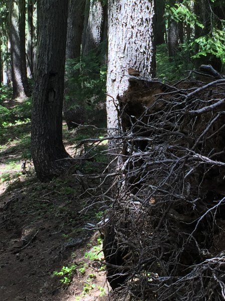
The top of the hill.  Note the angles of the trees, looking down through dense brush to the bottom.


IMG_4814.jpg

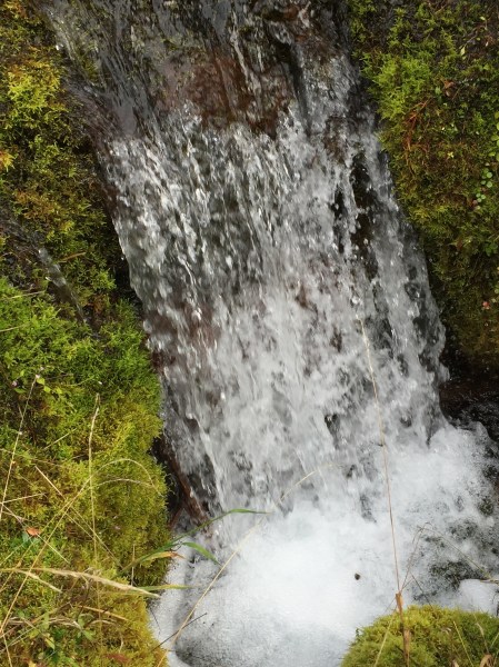
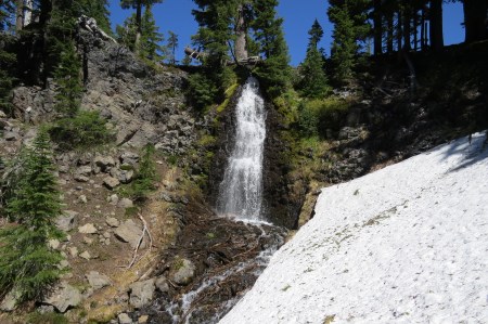
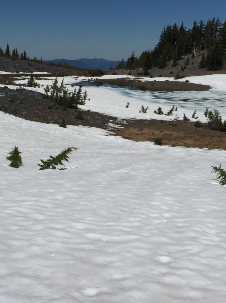
What passed for the spring that began the Middle Fork.

IMG_4812.jpg

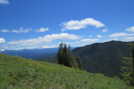
The road referred to was behind us.


IMG_4811.jpg

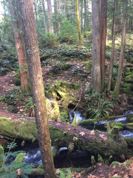
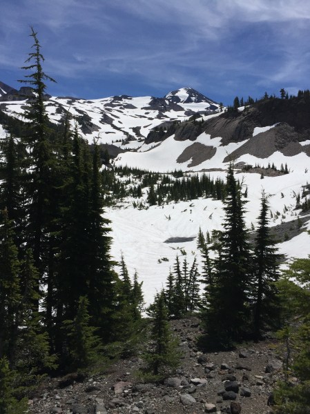
One of the branches of the upper Middle Fork

SECOND CHOICE

September 26, 2016

“Is the site open?” I asked.

“I can’t tell from here,” said my wife in the bow of the canoe, as we entered a small bay with a low isthmus separating it from another part of Basswood Lake, forty-five square miles that  straddles the border between the US and Canada.  I looked with binoculars and couldn’t be sure whether I was seeing a rock or some part of a person’s camp.

We paddled a little further until we found to our dismay that the object was a tarp.  Site taken.  Damn.  We had walked on that site in 2012, and I had camped there solo a year later.  Not this year.  We turned back to another site that we had passed, second choice, at the mouth of the bay and still out of the motorized zone, for while we were in wilderness, concessions were made in 1964, one of them allowing parts of Basswood Lake, a national treasure, to allow small motors.

We landed on Second Choice, walking up from the narrow beach landing on ledge rock to the fire grate, part of every Boundary Waters (BW) campsite.  When we turned around, we had a splendid northeast view down a channel to Canada, two miles distant.  A little elevation makes a significant difference in what one can see in the BW.

IMG_7857.JPG

View from the top of the ledge rock.  Canada in the distance.

That first year on the site, we stayed five nights, with a nightly parade of three beavers, two adults and a young, swim by getting food, branches from trees they fell in the adjacent swampy area.  We heard and saw one tree fall. We saw the northern lights twice, heard wolves, and had a moose visit.  Second Choice?  This place was a gem, and with two small tent sites, it probably didn’t get much use.

IMG_4635.JPG

Beaver with stick, 2014

IMG_4667.JPG

Moose, 2014

We returned in 2015, but while the beavers were gone, we saw three otters playing. Every sunset, we marveled at the lovely way the light appeared on the isthmus site and the rock face across the bay.  We returned again this year, where we didn’t day trip much because of wind, so I sat and read, looking at Canada in the distance, realizing that Tru- as a leader really meant Trudeau, and seeing things I had never noticed before, because I had more time to look.

IMG_6093.JPG

Otters at play, 2015

IMG_6066.JPG

Sunset on the isthmus site

I saw a chipmunk, an occasional pest, climb up on a wild rose bush and eat rose hips.  I didn’t know they ate them.  A flock of eight common mergansers swam by, not uncommon for the BW, and we saw them again nearby on a day trip.  This was clearly their territory.  An otter walked on the shore one afternoon, swam across the swamp, and disappeared among the rocks.  Many times, a raven announced itself by the WHAP, WHAP of its wings over us.  I watched an altercation between a Broad-winged hawk and a raven.  Twice, looking high in the sky, we saw an eagle soar, easily 1000 meters up, a dark spot against a white cumulus cloud.  These things you don’t see on high mileage trips.  They matter to me now.

IMG_7869.JPG

Chipmunk eating rose hips

IMG_7932.JPG

Mergansers

There was more.  For the first time in my wonderful outdoor career, heavy dew and morning fog did NOT presage a wholly sunny day.  It rained that morning, only later becoming sunny.  I had never seen that before.  I had thought the channel led north, until one night, I saw the North Star 45 degrees to the west of the channel.  It led northeast. The North Star doesn’t lie.

I found myself studying little things: the waning gibbous Moon each day, a long curvilinear cloud one evening, and its stunning reflection, which appeared like disturbed water in a calm lake.  We twice found a rock where turtles hang out, and noted the one’s shedding part of its carapace.  We know all the campsites up the lake towards Canada.  They are nice, but they aren’t Second Choice.  We may be the last on the site this year, for all we know.

One morning, we heard Basswood Falls, a mile or two distant across forest in a straight line, considerably further by canoe.  We had never heard the falls before on our prior two visits, but on a quiet, calm morning, they were unmistakeable.  I saw orange hawkweed, one of my favorite flowers from my boyhood, right next to our tent. It has the most wonderful smell.

IMG_7908.JPG

Orange Hawkweed

Second Choice has become for us one of our most special places we can go.  My wife has reluctantly said good-by to the area.  If she doesn’t return, I may go by there, but I don’t know if I will go on the site.  Not alone.  It’s hard to say why.  Only that I don’t think it is a place for me alone.  Once, when severe illness visited us, I paddled into the bay alone and stayed on the isthmus site.  I can stay there again, if it is open.  If not, there are other sites.

Every year, it gets more difficult to canoe.  I threw my back out the day we left, and my dominant elbow was inflamed.  Somehow, I was able to paddle and carry, and we paddled to the site in just over 4 hours, due to a tail wind that we had not planned on.  We don’t assume good weather for our trips.  That’s a recipe for trouble.  Because of a falling barometer, we decided we would spend four nights there, not five, and come out most of the way to a busier lake near the entry, avoiding heavy rain, thunderstorms, and strength sapping headwinds.

On clear nights, the Milky Way is bright, brighter than nearly any American can see on a given night.  We told time by the moonrise, for this trip coincided with the latter part of the Harvest Moon.  As I type this, I just heard the crash of a tree fall across the bay. Yes, if a tree falls in a forest it makes a sound.

Second Choice taught us that sometimes less visited sites have value.  In such places, I can learn a little about the neighborhood, see things that I have seen before, learn something new, so long as I sit quietly for a few days, foregoing the high miles that once appealed to me, back when I once wanted to know what was out there in the Quetico-Superior.

Second choice sites do that.  I may not physically return, but I will often go there in my mind.

IMG_4610.JPG

Sunrise

IMG_6106.JPG

Sunrise

IMG_7911.JPG

Evening sky

MITCH

September 14, 2016

Six months ago, Mitch joined our Wednesday hikes up Spencer Butte here in Eugene.  We meet early, pay a dollar that goes to the Club, have one of us lead the hike, and take the 3.1 mile route 1500 vertical feet to the top.  It’s a “conditioning hike,” meaning people can go at their own speed, whatever suits them.  I like to go fast, as if I were hiking alone.  I’m told I’m fast, but I can think of at least 4 people in the group who are faster.  I do OK.  I’m not young, but the four who are faster aren’t young, either.

Mitch was in the back of the group the first day. He was overweight, and just making it to the top was an event for him.  He was pleased and so were we.  Several in the group use the hiking time to socialize on the way up, and nobody is racing.  I’ve done it in 53 minutes, alone, just to see what I could do.  The top part now has steps in places, which make it safer, but it’s an average 20% grade, and it is a real cardiac workout to do it.  My pulse tops out at 160, and I can take it just fine by listening to the pounding in my chest.

With time, Mitch began to hike better, both in appearance and on the trail.  He was 50, diabetic, and his doctor told him he needed to exercise.  Mitch took him up on it. He wanted to do some out of town hikes, which the Club offers every weekend and almost every day in the summer.  Somebody has to organize one and lead it.  We meet at a place arranged by the leader, everybody pays a dollar, five for non-members, we carpool to the trailhead and hike at whatever pace the leader has decided.

I’ve led about 70 hikes now, both in town and all over the west Cascades.  My longest hike led is 17 miles; I’ve been over 20 miles twice. I did a 22 miler in 7 hours.  I hike a trail before I will lead a hike on it.  That requires I “scout” hikes, sometimes even hikes I’ve done, because there may be snow on the trail, or blowdowns of trees, and I need to know if the hike is even feasible.  The Club gives credit for being on a hike, leading a hike, but not scouting one.  On early season hikes, I am also a volunteer, reporting and photographing blowdowns to the Forest Service and High Cascade Volunteers, the Scorpion Crew, so they can later prioritize resources to clear the trail.  I may join one of their work crews some day.

Anyway, Mitch asked me in June if he thought he could be able to do my Obsidian Loop hike on July first, a classic, requiring a permit, that goes through the Obsidian Limited Entry Area up near McKenzie Pass.  It’s a great hike with closeup views to North and Middle Sister, has a beautiful waterfall, and a couple of miles on the Pacific Crest Trail.  By then, I thought he could.  The hike is difficult, with 12 miles and 2000 feet vertical climb, but half the climb is spread out over the first 3 miles.  I had scouted the hike 5 days prior, concerned about snow, finding a lot of it, off trail a lot depending entirely upon GPS and trail memory, making it difficult to complete the loop, so I was fairly certain we would have to do an out and back hike, not completing the loop.

IMG_7271.JPG

Obsidian Falls on the scouting hike.  The trail is under about 5 feet of snow to the right.

IMG_7279.JPG

Middle Sister from Obsidian Loop Trail.

Mitch thanked me profusely the day of the trip for scouting the Obsidian Loop Hike.  That was a pleasant surprise.  Usually nobody does that, nor do I expect it. I appreciated that somebody acknowledged that on my own, I had driven a total of 4 hours and hiked another 4 in snow, alone, rather difficult conditions, to see if a trail was passable.

On the day we all went, there was less snow on the path through the woods to the loop.  That was a good sign.  Other areas had less snow as well. I made the decision to go around Obsidian Falls, because of significantly less snow than had been present just five days earlier.  On the way down, however, I had to again use the GPS to try to find the track I had taken earlier, and we ended up glissading on hills where there was no clear way to get to the trail, which was buried under snow anyway.  One of the guys told me at the end, “Now, that was a HIKE.”  Another said it was one of the most beautiful hikes he had ever taken.  Mitch thanked me yet again for the work I did.  He had no problems with the difficulty.

IMG_3789.jpg

Hill we glissaded down, not far from the trail.

IMG_3787.JPG

High Country Lake.


Mitch started adding more on the Spencer Butte hike. There is a back way up to the top, longer, steeper, that he wanted to do.  He did it.  I led a 17 miler that involved climbing two cones, Collier, which is a long climb, and Four in One, shorter, where four vents came out of one cone. In addition to the 17 miles, the hike involved net 2700 feet of vertical climbing.  It’s the most difficult hike I’ve led.  Mitch did just fine.  I knew he would.

IMG_7814.JPG

View from atop Collier Cone, with Belknap, Washington, Three-fingered Jack and Mt. Jefferson (the largest) in the distance.

IMG_7834.JPG

View of Collier Cone from Four in One Cone

IMG_7828.JPG

Four in One Cone from the base

I had led three hikes in five days when I led a fourth two days later, up Spencer Butte.  The prior three hikes had all been difficult, but I felt I was rested.  In other words, I had no excuses.  Mitch and another man were with me on the first mile up to Fox Hollow.  There, we cross the road and continue on the trail upward.  I led to Fox Hollow; Mitch passed me on the road, and I said, “Go ahead and I’ll see you at the top.”

Mitch replied that I’d probably catch up to him.  When I hear that, I know I won’t.  And I didn’t.  He got up to the top, mostly still in sight, but at least a minute ahead of me.  He’s faster and stronger, no doubt about it.  Yes, I’ve got 17 more years of age on him, but he’s lost 40 pounds and is only going to get stronger.

Three days later, I led a hike that did the whole Ridgeline Trail in Eugene, out and back.  Mitch hiked it and asked if he could detour and climb Spencer Butte as well.  That added 3 miles and another 1000 feet to an already difficult hike.  I told him to go ahead. I didn’t find myself jealous at all.  The last time I did the hike, he started off fast, and I couldn’t have caught him if I had wanted to.  Mitch earned it.  He’s strong, and he’s good.  I am glad I had a part in it, encouraging him to do difficult hikes that I led in the Cascades.  I had faith in him, but more importantly he had faith in himself.

It’s great to see.  Even from well in the back.

KATMAI

July 28, 2016

Last year, we spent a day in Kotzebue and several days in Anchorage and the Kenai, visiting Lake Clark NP and taking one flight seeing tour. We liked Kotzebue and wished we had stayed longer.  We were less enthralled with Anchorage and wished we had stayed less.  Part of the problem was that we did not realize how crowded south Alaska is in summer.  We saw two rivers packed with fishermen side by side.  I guess people love doing that, but I don’t.

We went to the Kenai because we had heard so much about Homer.  People loved it.  We thought it pretty but not special. The spit was fine if one likes a sea of humanity, and many do.  We don’t. We went over to Lake Clark to see bears, but unfortunately for our poor guide, we saw one brown bear and a black bear with two cubs.  That happens.  I view wildlife sightings as a gift, not as a right.  I wasn’t surprised by the bear paucity with the number of powerboats on the lake, especially at one end of the lake, where bears had been previously sighted.

IMG_5919.JPG

Black Bear and cub at Lake Clark, NP.  This was the only time I saw both a black and a brown bear the same day.

This year, we changed our visit, spending most of the trip in Kotzebue and the final full day in Anchorage.  Kotzebue is a native village north of the Arctic Circle, accessible twice daily by plane.  There is one hotel there and two rustic B and Bs.  The food isn’t great, and there are a lot of junked cars in yards, because there is no place to dispose of them, and ATVs are more useful than a car there.  But we liked Kotz.


We took three flights, one to see the caribou migration in the Brooks Range from the air, one to see Kobuk Valley National Park, and a third to see Serpentine Hot Springs, all special places in the public lands system. The number of people we encountered in the last two?  Zero.

IMG_7307.JPG

Caribou migration from the air.

IMG_7358.JPG

Kobuk Valley NP

IMG_7405.JPG

Tor (granite) at Serpentine Hot Springs

We then returned to Anchorage and flew to Katmai for the bear viewing, hoping my wife could see what I saw in 2013.  Then, I saw 18 bears, two sets of 3 cubs and 7 boars at one time feeding at Brooks Falls.  There was a slight wait to get to the Falls platform, but it was minor, and I had three separate hour visits, because an hour is all that is allowed at once.  Since then, I have often said, “I’d go back to Katmai in a heartbeat.” (Not, “You should see Katmai.” I seldom use “should,” because it sounds like I am imposing my values on others.)

We flew down and went to the orientation, better than I had remembered.  The rangers have a good video and one mentioned she told someone to leave the Falls platform, because he had a Diet Coke with him.  The rangers are serious about no food being allowed.  If food is not regulated, too many will try to throw bread or candy, because they believe feeing animals is cute.  It is not.  It is a death sentence.  Here, I will use a stronger word than “should.”  One MUST NEVER feed animals in the wild.

The only thing I didn’t like about the orientation was when she said, “Yesterday, there was a 3 hour waiting period for the Falls platform.”  I was stunned. At Katmai, the Falls platform, where the boars congregate, catching and eating salmon that are trying to make their way upstream, is the best viewing spot.  People give their names to a ranger who controls access, one is allowed an hour there, then must leave and get in line again to return, although last year a group of Germans apparently refused. I know all Europeans aren’t like that, but they must abide by our rules, just like I try to be polite and abide by European rules when I am abroad—including the expectation I will be pushed, shoved, subjected to a lot of second hand smoke, deal with rowdy football fans, and have some pretend they don’t understand my German or French.  We are all different.

While waiting, the “riffles,” the lower platform, 100 yards downstream, is accessible.  There may or may not be bears there.

We walked the mile plus distance to the check-in, not being told the waiting time, although it would be easy to do.  The ranger can count the number on each page who are waiting ahead, and divide by 40. That’s the waiting time in hours.  The ranger made it clear she didn’t like being asked.  We wondered why the ranger didn’t give people the page number and have a small board with the current page (which had a total of 20-25 parties containing) being served.  It would have allowed some flexibility. Not knowing makes it difficult to decide if one wants to take a chance to use the pit toilet, a 30 minute round trip.  Since I knew my page number, I asked for only that, so as not to annoy her.  We had time to go back down the trail—during which we and maybe five others saw a large boar go by right under the raised boardwalk— to the pit toilets and return.

IMG_7512.JPG

We got lucky.  He passed 10 feet under us.

Many waiting were bored, standing, although there were 3 cubs asleep below the raised area, and occasionally the sow had them go to the river.  A ranger told me that the sow had helped him deal with a lot of grumpy people, suggesting that the bear viewing was not optimal this year, often because there were so many salmon they were feeding in early morning and resting the rest of the day.  I wondered if that and the extensive waits were causing problems.

After 2 hours, we had an hour on the Falls platform, which has an upper and lower part, good for 30, but 40 were crammed in, most of whom were on the lower part, not moving, including a French couple in the corner with a tripod, which takes up an extensive amount of space.  I guide at Rowe Sanctuary during the Crane migration. We don’t allow photographers to do that. There were two bears, and watching the salmon attempt to jump the falls was more interesting.

IMG_7546.JPG

I estimated about 5% of the jumps were successful.


IMG_7504.JPG

IMG_7505.JPG

Sow with 3 spring cubs.

Viewing the bears at Brooks Falls in Katmai has to change.  We need to sharply curtail the number of daily visitors.  It’s better for the viewing experience and for the bears, and the latter matter more.  It is expensive to get there, crowded, the waits are long, unpredictable, leaving one to stand around, for possible sub-optimal bear viewing.  For the time, effort and money, it isn’t worth it.  There are custom trips that can be taken, but they book rapidly and are more expensive.

In the meantime, I’ll do my Alaska visiting further north. I’ll go to Kotzebue, perhaps.  Or not.  I haven’t decided.  The Sheenjek River drainage in the Arctic Refuge beckons.  Serpentine Hot Springs would be nice for 2 days, and I’d love to try to catch the caribou migration from the ground.  I’m not saying that you should see it.  Indeed, the good places I want to go, I want as few people as possible to be there.

Selfish?  Yep.  But look at the bright side.  I won’t be clogging up Brooks Falls.


THE POSTS I DELETED THIS WEEK

July 19, 2016

When we were staying up in Kotzebue, the Internet was slow, so I did a lot of reading, especially the day it was rainy and windy.  I like those days.  After years in the desert, I equal “beautiful sunny days” with drought. I read “Wheelmen,” how Lance Armstrong was able to cheat in the Tour de France and hoodwink millions, including me. I also helped students on algebra.com, a math help site.  I find it relaxing; the students are mostly grateful.

When we got to Anchorage, with faster Internet, I posted some of pictures from my America the Beautiful Series on Facebook—the Western Caribou Herd migration seen from the air, Kobuk Vally NP, Serpentine Hot Springs, red raspberries picked from a vacant lot next to the hotel, and pictures of the brown bears salmon fishing at Katmai.  I commented on several posts…and quickly deleted my comments.

IMG_7313.JPG

Western Caribou Migration north of the Arctic Circle. This line went on for 7-8 miles.

IMG_7360.JPG

Kabuki Valley NP, Alaska.  This is reachable only by plane or boat.

IMG_7405.JPG

Serpentine Hot Springs, Bering Land Bridge Preserve, Seward Peninsula, Alaska

I don’t often give advice to people, because few either want or follow it.  You will seldom hear me use  “should,” like “You should do xxxx,” because I think it arrogant and presupposes my values should be somebody else’s.  I am not advising anybody to do what I did here, only stating that I have found deleting a comment on Facebook—before or shortly after posting— is a good way not to have to eat my words later or get into an argument with somebody I don’t know….or do know.

The first comment I deleted was on a post that said “Take this test to see if you are racist.”  I think we are all racist.  Humans evolved that way.  We are tribal. Listen to the Kingston Trio’s Merry Minuet sometime, and you will understand that racism is not new.  I don’t have conversations about race, and I try not to treat people differently based upon race, dress or sexual orientation.  If they are trying to convert me to something, I’m generally not interested, although in the face of compelling evidence I may change my mind.  I might be more willing to listen if they gave me the same courtesy to offer my opinions.  They won’t, for they alone know the Truth.  I can’t remember what I deleted, but it was along the lines that given my 17 years of expected longevity I wasn’t going to change much, so please don’t tell me how racist I am. Delete.

The second came from a relative who posted  that the Earth was going to be destroyed at midday tomorrow, a time that has come and gone.  It was on some “truth” site, and if I were going to comment on every bit of bad science that found its way to Facebook, I wouldn’t have time to tell some kid how to solve a mixture problem or complete the square of a quadratic equation.  I started….then I just went to a new page.  FB is nice enough to give me a “Do you really want to leave this page?” to which I reply quietly “You betcha, delete that mother that I wrote.”  Problem solved.  No trolls to come after me, nobody to say I used the wrong word, and nobody telling me I was going to hell (I did but they kicked me out for bootlegging ice water becomes too trite after a while).

I have a few rules I use on FB.  I don’t de-friend people, only stop seeing their posts.  It’s easier that way, because they don’t know that I am not following them but I show up on their friend list.

I don’t share things that people ask me to share.  That’s their banner to carry, not mine.  I don’t read things for the most part that people tell me I must read. The “watch how xxx just slammed xxx in Congress” in general is not much of a slam; indeed, there are very few perfect squelches.  I can think of exactly four times where I have said exactly the right words at the right time, and it was devastatingly powerful.  Most “classic putdowns” are not worth reading.

Some have political or religious beliefs I don’t share.  It’s easier to delete all posts coming from Right Wing News or Oliver North.  It helps my heart stay out of dysrhythmias if I don’t read stuff I want to challenge and squash.  Few will read my post, and I will only annoy someone.

The third one I deleted was easy.  It was about how much money was being spent to build a replica of Noah’s Ark in Kentucky to spread the gospel that humans walked with dinosaurs (appalling in 2016 that some believe that.)  I commented the ark could be used for low-income housing, especially since the toilet and septic system were likely good, given all the bs.  It felt good for a few seconds.  Then I deleted it.  I had other more constructive things to do, like help kids with their math homework.  Interesting sidelight: I tend to answer questions where kids beg for aid, like “I am totally lost,” or “Please, I haven’t a clue how to do this,” and I can, easily and clearly.  That is doing the Lord’s work, although I don’t follow the Lord’s posts, because…well, I don’t.  I just try to be a decent guy.

The last post was how the Western world was at WAR (capitalized) with radical Islam, and that we didn’t have Facebook memes and blabs when we dealt with Natsis (Nazis—her spelling and grammar leave a lot to be desired, but I’d never dream of telling her that) weren’t going to be the solution. She’s right on one count—changing one’s profile, calling ourselves French…or Turkish…or whatever—doesn’t change anything.  I’m pessimistic. History is on my side. And I wish in the meantime we would stop using the word “solidarity,” for it lasts as long as it takes for the next tragedy to strike.

I posted that before we go to war, I’d like to know the endpoint when we will stop warring.  We didn’t have one for Afghanistan, and we may be there forever.  We screwed up. I had hoped after Vietnam in 1975 we had learned our lesson, but we didn’t.  I continued: if we go to war, I want a War Tax (50% marginal rates) and a draft of men and women.  Next war, everybody serves, and we pay as we go. That sort of personal and financial commitment gets people thinking whether it is worthwhile. I said in 2003 we would create a lot of terrorists by invading Iraq, so I am not surprised by what I am seeing now.

Why did I delete this post?  I like the person.  Her son will be draft age in 6 years. He’s going to fight the next war, not me.  She is going to worry, and she will learn in spades what going to fight the bad guys means.  She won’t remember my words.  She will likely blame My Side for it.

After I left Alaska, posts deleted, I have found myself spending less time on Facebook.  It’s too damned depressing.  And there is far too much life to be lived, far too much good to do, like math homework.  Or math help in person.  Or reading a book.  Or hiking.  Or showing a kid the night sky.  Or an adult for that matter.  Or seeing places in the world while I still am able to.

Don’t bother sharing. It’s just my way of living. Your results may vary.

SAME BEAUTY, DIFFERENT BEHOLDER

July 12, 2016

As the Cessna 206 flew northward over the western Brooks Range, dark clouds ahead, I was thinking that we weren’t going to see the caribou migration from the air.  We might have to soon turn around, but at least we had already seen spectacular scenery that few are fortunate enough to view.

We had flown to Kotzebue, Alaska, for the express purpose of seeing the caribou migration from the air.  The Western Arctic Herd fluctuates in size, now about 275,000.  I have seen pictures of the herd bunched together from the air; I have heard stories of having the caribou go through one’s campsite.  The chances of being in the right place on the ground, however, are small.  The animals may come early, late, or take a different migratory route.

Jared, our pilot, had told us a year ago on a prior visit that it might be possible to see the migration from the air, suggesting we come about the second week in July.  We decided to spend six days in Kotzebue.  If weather were an issue, or Jared busy, which all pilots are in summer, we would have flexibility.  We arrived on the evening of the sixth and walked one block from the airport to their office.  Jared had just finished a trip and told us the caribou had migrated 2 weeks earlier this year.  Much of the herd was far to the northeast, he said, but a significant number were still due north of us in one of the valleys.  He thought we might be able to fly out the next afternoon, proposing a triangular leg that would put us near the first group and then move westward to see the others.

The next day Jared was still busy at 3, and my wife and I were beginning to think we’d wouldn’t go until the following day.  Maybe. I have dealt with Alaskan bush pilots for a decade, and things are predictably unpredictable.  One needs to expect anything, be ready immediately, and ascribe any untoward event as “It’s Alaska.”  We took a short walk down the beach, waiting. At 4:30, we were asked if we were ready; at 5, we were in the air heading north. We were going to try to find the tail end of the migration.

We overflew the valley where the caribou had been the day before, now empty, except for a stunning rainbow, which suggested we might have some sunshine in between showers.  I wasn’t expecting much, my long standing philosophy being that seeing wildlife is a gift and not an expectation.  We turned east, passing by mountains of the western Brooks Range. I think we saw six rainbows.

IMG_7302.JPG

Rainbow over the Brooks Range

IMG_7300.JPG

Not uncommon view in the Brooks

IMG_7334.JPG

Canyons of the Noatak River.

Suddenly, Jared said, “There are 10.”  I didn’t see anything.  “There are a few more. Wow, they sure have put on their hiking boots.”  My wife then saw them.  I hadn’t configured my eyes yet for what I should be seeing from the air.  I’ve seen thousands of caribou, but mostly from the ground.  I looked and looked.

Then I saw them, a couple of small dots, moving.  Then I saw several brown lines on the tundra, animal trails, with a line of brown moving on them. Caribou.


IMG_7313.JPG

There are about 400 caribou in this picture.  The dark lines are animal tracks.

The valley narrowed into a canyon, and the river, its banks, and the narrow sides of the canyon appeared alive.  It was.  The ground itself was moving, lines and lines of caribou moving east.  We weren’t standing still watching them move.  We were traveling 80 knots, 1.5 miles a minute, and for at least five minutes we saw lines of caribou.

Everywhere.

Jared banked at a fork in the canyon, and we turned back to a valley where a hill marked the entrance.  Flying much lower now, we could see the hill covered with caribou, a sea of brown, some lying on the ground in the 24 hour a day sunlight.  It was stunning.  I like to take pictures, but from a moving plane through a window, I looked, videoing while looking more carefully with my eyes.  If the pictures came out, fine.  If they didn’t, well…it’s Alaska, and the scene was now embedded in my brain.

All too soon, we banked away from the caribou, leaving them to their migration, heading south.  Nearby, the prior night, Jared had dropped off a guide with 3 Australian clients, telling them to camp by a small, shallow river and hike over to a nearby hill and wait for the caribou.  “I hope I was right,” he said.

We approached the camp and overflew it, then banking and landing on a gravel bar near the group.  The guide, a young woman, appeared with the three others in tow, young men.  She was ecstatic, slapping hands with Jared, saying they had spent much of the night, sun up of course, watching the migration from a quarter mile.  The clients seemed more muted. Wow, I thought.  What an experience, hours of caribou viewing from the ground.

IMG_7317.JPG

Ground view about 10 miles from Caribou viewing.


We took off and flew back to Kotzebue, thrilled that on our first full day we saw what we came—and hoped— to see.  No, we didn’t see 200,000 caribou in a valley milling around.  I’ve seen those pictures, and they are amazing.  We saw instead something more subtle, nothing I expected to see, but to me every bit as memorable.  We saw miles and miles of caribou on the move, covering the hills, the streams, moving through a valley and a canyon.  One doesn’t see that when they are bunched up.  We saw a migration.  Would I like to see it from the ground?  Yeah, I would. But I saw something special.

The next day, we happened to run into one of the Australians in the hotel, not surprising, since there is only one major one in Kotzebue.  He said nothing about the caribou, not one word, but spoke about the Wildebeest migration in Tanzania, telling us at least 3 times that we really ought to see it. I’m 3 1/2 times his age, but I get excited about nature like a kid.  At 19, he saw something rare and beautiful, but as Steve Prefontaine said, “sacrificed the gift.”  His father paid for his trips; the flight alone (not including guides, food, or the trip from Australia) were $6600.

We subsequently took two more flights with Jared, one to Kobuk Valley National Park, where we were dropped off while he flew elsewhere to shuttle a group from one area to another.  We had free “ground time,” because he had to be out there anyway, and spent three hours hiking in perhaps the most remote park in the country, quiet, beautiful and alone.  Two days later, we flew down to the Seward Peninsula to see Serpentine Hot Springs, part of Bering Land Bridge National Preserve. Jared, very familiar with the area, had never been in the water. Come to think of it, he had never seen such good weather there, either. While we were hiking, looking at the many tors, granite that appeared as the ground above it eroded, he soaked.

IMG_7370.JPG

Bush growing on sand dune in drainage where there were a remarkable number of wildflowers and a 15 year-old spruce tree.

IMG_3850.jpg

Western edge of Great Kobuk Sand Dunes

IMG_3837.JPG

The wind causes changes in the sand, changes in the clouds.

IMG_3836.jpg

Crop circle effect of wind’s blowing grass. Foot tip for perspective.

IMG_7396.JPG

Changes in the color and texture of sand occur just like in snow.


We came to see the caribou migration, seeing it in a way I had not expected.  Additionally, I got to see Kobuk Valley a second time, with adequate time to explore.  And I flew down to Serpentine Hot Springs, a place I hoped some day I might see but figured I never would.

I won’t ever see the Wildebeest migration, although I’m certain it’s remarkable, as are both North American migrations, caribou and crane.  Some of the best experiences come not from managing a trip to Tanzania or Alaska, but from managing one’s expectations.


WHY I LEAD HIKES

July 5, 2016

After I joined the Obsidians, an outdoor club in Eugene with 500 members, I thought it might be interesting to eventually lead a hike or two.  One of the women in the club, a dynamo now 75, has led perhaps 500, and strongly encouraged me to lead.  I told her I couldn’t lead anything that I hadn’t hiked myself, so I spent my first summer in Oregon soloing many trails in the Willamette and Siuslaw National Forests.

In August, two months after I joined, I led my first hike on the Obsidian Limited Use Trail, requiring a permit, for no more than 30 are allowed in any given day, post the hike online, meet everybody at a given time and place, assign cars and drivers to get to the trailhead, then hike.  Somehow, everything worked out fine.  The first reason I lead hikes is that the club needs hike leaders.

During the next two years and the 51 hikes I led, some were easy, like in-town ones that required little driving and were on a trail or path that was familiar to everybody.  Most, however, were out of town.  I had hikes where people were spread out on 2 miles of trail, others where some people were fast and had eaten lunch before the stragglers got to the turn around point.  I had hikers who wanted to video the whole trail, some who wanted to photograph, others who used the hike as training, slowing down the group, and one, who was late to the meeting point, joining us at the trailhead and didn’t say one word to me the whole hike.  I treated falls, heat exhaustion, and often hiked a mile extra each hike.

We leaders are volunteers, but to hear some talk, one might think that only certain people lead.  I got behind two discussing various merits of leaders on an in-town Thanksgiving Day walk.  Why, I thought, don’t they lead, if they don’t like a leader’s style?  That is what I did.  So the second reason why I lead hikes is because I like having control.

Leading, however, is work.  It’s easier to show up at a hike and just do it, without having to organize it, write a description of what is expected, field phone calls from members or non-members who often would have such questions answered if they logged on to the site and read the description, ensure that the people going can do the hike and have adequate equipment, worry about drivers, know where everybody is, make sure the hike moves along, take care of any problems, and get everybody back to the trailhead safely.

I want those on my hikes to know what to expect. We leave promptly, I give the approximate speed on the trail, regrouping points, the lunch stop, and when we can expect to get back home.  If you want to hang loose and walk around in the woods, I’m not your hike leader.  If you want to see some good backcountry where not many people go, cover some ground, and get home at a specific quoted time, I am.

I put Obsidian Loop on the schedule for 1 July this year, figuring the hot June would take care of the snow.  The Forest Service told me the snow level was at 5200 feet.  I had done a hike in early June to 5600 feet, encountering only one small patch of snow.  I suspected there might not be much snow left, but to be sure, I scouted the hike 5 days prior.  Scouting is a full days’ work.  I’m doing the whole hike, including the drive. I had to buy a permit, then a few days later drove to the trailhead, the last 20 miles on a winding, curving, narrow road.  Finally, I hiked the loop, 12 miles—solo.  There was a lot of snow, although not as much as two years before.  I got off trail several times and navigated by GPS.  It was a difficult day. The Obsidian Trail is beautiful, but it takes a lot out of people— some is on volcanic rock, a lot of snow was present in this instance, there were six stream crossings, some of which were deep. Still, I was glad I did it, because I knew exactly what we could and could not do. I returned home fine, but I put on the trip description that we might be doing an out and back to Obsidian Falls, and to be prepared for snow. Two people cancelled.  One other, who had been on the waiting list, joined, and I was glad to see him, for I knew he was a good hiker.

IMG_1045.JPG

This is the Obsidian Trail after a snowy winter, 3 July 2014.  No trail visible, and one either knows the route or uses GPS.

Friday, eleven of us met, driving up in three cars.  We always carpool.  I had a good group, and we got an earlier start on the trail than I had hoped.  We stop at trail junctions, and as leader, I usually am not in front but somewhere in the middle, trying to have a sense where the front and back are, who is fast, who isn’t, and anything else I observe.  When we reached the first regrouping point, I discovered that one of our hikers had continued on, which was clearly not something we do. I hoped he would go directly up the proper trail to the Falls, because there were side trails that could be taken.

IMG_7274.JPG

Obsidian Falls from above.  The passage here was the area I was most concerned about, for it was on a 45 degree snow field where sliding was dangerous.  

From here on, I led from the front, because I knew the trail and wanted to keep the group together.  When we reached the Falls, I saw the missing person and went down to talk to him.  I first quietly asked him how he was, and when he told me he was fine, told him firmly that we waited at trail junctions.  He hadn’t heard me say that, but I had, and others on the hike could verify that, and in any case it’s a Club rule.  I had been worried about his well-being and a bit angry, but I kept my anger in check and he apologized.

IMG_3789.jpg

100 meters off trail, we came down this area, some choosing to glissade.

After lunch, I thought with less snow, we could complete the loop, and we did, slowly coming back down off trail through snow, my navigating by GPS and memory I had of the trail, which I knew ran near a creek.  More than once, I was concerned about not knowing exactly where I was, despite having been in the area five days earlier, but yet I knew we were going the right direction.  The map on the GPS was off by 400 meters.  Eventually, we finished the loop and hiked almost 4 miles to the cars.  For the second time in 5 days, I had to drive back down the winding road, tired, back to town.

People loved the hike.  One called it his favorite, another said he wanted to do anything I led, and a third said “That is what I call a hike.”  That’s a good day.  They aren’t all that way.  Why do I lead hikes? My third reason: Had I not decided to do this hike, no Obsidian–indeed, no person–would have seen the vast stretches of snow in the Three Sisters Wilderness that we saw on 1 July 2016.  Nobody would have glissaded, nobody would have seen a lake emerge from its winter ice, nobody would have seen the Winter Wren calling, and nobody would have known what they had missed.

IMG_3750.jpg

Lake emerging from ice at 6800′ elevation.

IMG_3788.jpg

Nobody saw this area that day but us.  Middle Sister in the right center.

IMG_3794.jpg

Winter Wren.  Interestingly, five days earlier there was one on this root ball, so a nest is probably nearby.

TRAIL MEMORY

May 28, 2016

We were descending Marys Peak in the Coast Range to the cars, the last part of the hike’s being on a service road used to oversee the Corvallis watershed.  No vehicles were present, and from the blowdowns on the road, none had been there for some time. After about a mile, there was a trail heading off into the roadside brush, with a sign: “Trail Closed due to Operations in Area”.

The person hiking with me said, “Was that the way we went up?”

“No,” I replied.  “We entered about a half mile further.”

IMG_0530.JPG

Three Sisters from Marys Peak (April 2014)

I am no longer surprised by these comments.  I was the trip leader, and there is no way I would take a group past a sign saying “Trail Closed.”  The trail we had taken 3 hours earlier ascended immediately in forest and this one stayed low and in brush.  But, as I have learned, what is sometimes obvious to me isn’t obvious to others.

“Where was that hike where I got so exhausted with the pack I was carrying that I fell?”

“Browder Ridge.”  I know where on the trail it occurred, too.

IMG_4761.JPG

Browder Ridge Summit with Mt. Jefferson in distance (2014)

“What mountain were we trying to climb last fall when we turned around because of weather?”

“Crescent Mountain.”  I know exactly where we turned around, and I will see it in a week when we go there.

IMG_1953.jpg

Crescent Mountain, on a day people did not belong at the top.  We turned around (2015).

IMG_1013.JPG

Crescent Mountain in June 2014, with lake of same name below.  It is about 5 miles and 2100′ vertical to the summit, where there was once an lookout.

IMG_1019.JPG

Mt. Washington (far left) and The Sisters from upper meadows of Crescent Mountain

Granted, many of these hikes I have done before, but after one time doing them, I have a sense in my mind of the trail.  I’ve only hiked Middle Pyramid once, but I can visualize the bottom of the trail, the open area with the cliffs high overhead, and the gradual climb up through the cliffs to the top.  My memory is good enough to help me as trip leader.  I am not a Jon Krakauer, who saved his life on Mt. Everest during the 1996 disaster, because when the storm hit, he had a sense of where the trail was and how to get back to shelter on the South Col.

IMG_2819.jpg

View down from summit of Middle Pyramid, 2014

IMG_2810.jpg

Author, summit of Middle Pyramid.  It’s a little more than 2 miles but climbs steeply.

I think trail memory is both natural and observational.  I remember trails without usually thinking about it.  I am not as good at remembering steep ascents or descents, perhaps because I tend to hold my speed constant on them, so they don’t stand out so much.

This isn’t to say I haven’t gotten turned around a few times in my life.  In 1998, on the Appalachian Trail, I rested sitting on a rock, and when I got up, retraced my steps about a mile before I realized the traffic I was hearing was a road I had previously crossed.  There was no road the way I was supposed to be going, and bells were going off in my head that something wasn’t right.  That was deeply embarrassing and likely due to fatigue.

In 2006, on Isle Royale, I was hiking at night back to Windigo after a wolf had visited my campsite.  It was late, but I wasn’t going to stay there with a wolf in the vicinity.  I knew that wolves didn’t attack healthy humans, but knowing that intellectually and being alone ten trail miles from the nearest person were two very different things.  It was time to sleep, not hike, but I was going, sunset or not.

Or what passed for sunset under thick clouds that promised snow.

In any case, with a small light, that I hoped would keep working, I went around a blowdown and continued.  But something didn’t seem right.  I had walked around a lot of the blowdown, maybe too much, and I couldn’t say for sure that the trail I was seeing was similar to where I had just been.  Jon Krakuer might have known.  But I had a sense—an uneasiness—that I was going the wrong way.  I stopped, found my compass, and took a bearing roughly the direction I was headed.  It should have been northeast; it was southwest.  I turned around and walked back to the blowdown, confirming my error, and found the trail sooner on the other side, eventually making it to Windigo.

ISLE ROYALE 154.jpg

Young moose, Isle Royale, taken from the campsite where 2 hours later I would see the wolf.  10 May 2006.

I’ve been cultivating these senses lately.  I’ve been slow to do this, because I am mostly a linear, analytical person who hasn’t much believed in them.  As I have spent more time in the woods as I got older, I started realizing if I weren’t sure where I was, it was wise to admit—out loud—that I was lost and do whatever was necessary to get myself on track again, usually meaning backtracking, sometimes back to the beginning and quitting the trip.  Trail memory is fine, unless I am on a trail that I have not trod.  I did that on Burntside Lake in 1992, when my map didn’t quite show where I entered the lake, but I reasoned the distance was short so that I would soon be navigating by my other maps.  That didn’t work, I was lost, and I backtracked the whole way.  I felt stupid, but at least I didn’t compound my mistake by continuing.

The last time I really messed up was on Mt. Pisgah, practically in Eugene’s city limits.  I hadn’t lived in Eugene at the time, and Pisgah is famous for two things: a large network of trails and even more poison oak.  The first time I climbed it, I thought I found a different route back to the parking lot.  I soon realized that the trail was not going there, or the Sun had moved its position in the sky.  Finally, I realized I was descending to a different parking lot.  Once there, I walked to a road I thought would take me where I wanted to go.  After a mile, I admitted I had no idea where I was, retraced my steps, and took a chance that a trail along the base of the mountain would get me back.  Had it not, I would have backtracked to the summit and down the trail I originally ascended.

Getting lost still embarrasses me, but I learn from it.  With GPS, I am able to know where I am and can try a different route.  Still, GPS is sometimes not enough to counter a sense that one’s direction is wrong.  GPS is also dependent upon not only battery power, but having a good connection with satellites.  Such connections may disappear In deep woods, and especially canyons.

Trail memory is also useful on those winter nights or difficult times in life, when one wants to escape civilization and find solitude in those hundreds—no, thousands—of trails across the continent.  I can go there in my mind: climb, breathe the air, hear the birds, see the flowers, and be alone.  I get great pleasure at looking at maps and saying to myself, “I’ve been out there.  I know what it looks like.”

IMG_6841.JPG

High Desert from the top of the canyon overlooking the Owyhee River, 2016.


TRANSIT (OF MERCURY)

May 10, 2016

I have shown many the night and daytime sky. Twenty years ago, I went to a conference in Palm Desert, during which time Saturn’s rings happened to be edge-on, an occurrence every fourteen and a half years.  I was driving, so I took my telescope, set it up in the parking lot the first night and had maybe 5 takers.  The second night, I had 30.  The fourth and final night, I had a continuous line.  People were thrilled.  One woman almost cried when she realized she was looking at Saturn.  Another guy told me about his childhood, when he once knew the planets and stars.  He finished looking and got back in line.  Loved that trip.  It had been nearly 4 years since I last did a telescope-aided “star party,” when I showed maybe 50 people the 2012 transit of Venus across the Sun, an exceedingly rare event that won’t be seen again until 2117.

IMG_1129.JPG

TRANSIT OF VENUS, 5 JUNE 2012

Mercury transits the Sun as well as Venus, about 13-14 times a century, but I had never seen one. I looked during the November 1999 transit, when I was a grad student in Las Cruces, New Mexico, but I had no telescope, and binoculars were insufficient.  This time, I was prepared with my telescope, Mylar solar filter designed for it, and camera, with which I would shoot the transit, using a solar filter designed for binoculars that could be held over a camera lens.  I put the event on the Obsidian hike schedule, where it appeared as a “class”.  Where asked, “number of people allowed to join,” I wrote “100.”  Exactly 6 eventually signed up, including me, and one of them cancelled.  I decided to set up just south of Autzen Stadium at 7:30, during which time the transit would be well underway.  From Eugene, the transit started before sunrise.

I knew of two other local sites where people had telescopes, one downtown, the other on Skinner Butte, a wooded hill 300 feet above the city, near the Willamette River.  I hoped I might have several visitors, since my site was near a dog park and a lot of walkers were out, but it was quiet.  I arrived with my wife at 7:30, and one of the Obsidians joined us about 20 minutes later.  It was quiet, except in the celestial arena, where interesting things were happening.

Once I had the telescope focused on the Sun, I saw Mercury immediately.  It was small, but compared to the sunspot near it, the planet was a sharply defined black sphere. I shot pictures of it using high power, letting the camera gradually get the Sun into focus.

IMG_6724.JPG

Mercury is below the sunspot in the lower middle of the picture.


A few came by, but they were either wearing earphones and couldn’t hear me or not interested.  Four other Obsidians came and kept us company.  I don’t push people to view something in the sky.  I will tell them what I am doing, and if they seem interested, I suggest they take a look.  Some are very interested, some not; a woman with two dogs was more interested in showing her dogs than she was in Mercury.  She never made one move to come over and look.  People have their reasons.

Perhaps it was just as well.  I hadn’t read up on transits.  That’s inexcusable for me, and I’m a bit ashamed that I didn’t prepare my lesson plan.  Kepler predicted the first known transits of Mercury and Venus, incredibly occurring within a month of each other in 1631, but ironically and sadly, he died the year before.  His predictions were not only verified (he said to check a day on either side of the prediction, because he didn’t trust his calculations), but were within 5 hours of the correct time.

Why did it all matter? In the 17th century, we knew the relative distances the planets were from each other but not the Sun-Earth distance. Knowing that distance, known as an astronomical unit (AU), would allow us to know all the distances. The path of a planet’s crossing the Sun is different depending upon one’s location.  In other words, the path will be a different chord on the circle of the Sun for observers in different locations.  By knowing the location and the chords, one can determine the distance from the Earth to the Sun, an astronomical unit (AU).

At 11:30, four hours after arrival, we saw Mercury near the edge of the Sun.  It then became internally tangent to the Sun (third contact).  Finally, there was a slight irregularity, a little hole, on the edge of the Sun.  Mercury was continuing on its orbit, in several days becoming visible in morning twilight.

IMG_6743.JPG

Mercury approaching the edge of the Sun.

After I posted my pictures on Facebook, some of which were actually decent, I saw in “trending news” something about the transit, referring to it as an “astrological event.”  Worse, it was accompanied by a NASA picture.  I posted a scathing comment about the inability of so many people to know the difference between astrology and astronomy, and the distressingly large number of Americans who believe in astrology.  I later deleted the comment.

I became disheartened when I heard from a friend that not one classroom he knew of, and he was recently a teacher, had kids go outside and see REAL (caps his) science in the REAL sky.  He continued: “The kids who looked through my scopes today were awestruck at seeing a live event right before their eyes and experiencing the size of the solar system via this transit. Heard lots of ‘wows’ and ‘cools.’ Funny, I never heard that when they were watching a video on a Smartboard.”

I would have loved to have shown the transit at a school.  Had I tried, however, the first thing I would likely have heard would have been, “Who are you?”  (now, one has to be somebody, not just an experienced amateur astronomer).  Then I would have heard how busy teachers are, require fingerprinting and have a background check.  Yet, in 60 minutes of having 100 kids look at Mercury’s crossing the Sun, I bet more of them would remember this day than the day they would have at school.  It would stay with many, just like when I talk about eclipses, people remember days in school where they made pinhole cameras to view a partial eclipse.  I could have made trig, geometry and space exploration come alive.  Instead, I showed this to 10 other people.  Ten.  And I told passersby what I was doing.

Still, the fact that only 10 others saw it with me was immaterial. I made my choice; they made theirs.  We will have to wait until November 2019 for another chance here.  Climatologically, that is a cloudy time in Oregon.  Whether I would go elsewhere to see it is not clear.  I enjoyed this transit more than I thought I would, and if eastern Oregon were clear, it might be worth a trip.

Nah.  Definitely will be worth it.

IMG_6754.JPG

Mercury almost at the edge of the Sun.

Screenshot 2016-05-10 08.47.17.png

Talking to Evelyn N. of the Obsidians about the Transit. Photo courtesy of David Lodeesen.

BAD DECISION

May 3, 2016

I put fourteen people, counting myself, at unnecessary risk the other night.  And I think I am the only one who knows that.

The Obsidian Hiking Club has a monthly full Moon hike to the top of nearby Mt. Pisgah.  Taking the most direct route, one climbs 1000 feet in 1.3 miles.  It is a popular hike near Eugene, the trail good, if a bit too wide, and the views of a moonrise or a sunset are stunning.

The woman who had led the hike for some time still wants to lead the solstice hikes, but she asked me if I would be willing to lead the other ones.  It’s no big deal, really.  The hike is easy to organize, people show up, we collect $1 from members and $2 for non-members, and I decide the route.  We go to the top, look at the sights, and come down.  Anybody who wants to leave early can, and the leader just makes sure everybody gets down without difficulty.

What can go wrong?  There is a saying in bridge when a contract is a sure thing, look for what could possibly go wrong.

People can get hurt by tripping, having heart attacks, heat stroke, hypothermia, and anything that can happen in the outdoors.

Like getting struck by lightning.

Two days before the hike, we had had very warm weather for April, and I suspect most thought the hike would be perfect for viewing an April moonrise.  I had noted the GFS weather model showed a low pressure system moving up from the south.  This was a little unusual, but the model was consistent, and with hot, moderately moist air over us, a low pressure system could trigger thunderstorms.  Thunderstorms are unlikely in Oregon, but they do occur.

Sure enough, the day of the hike, there was a chance of thunderstorms that evening, and I started wondering how this might affect the hike.  At 3 pm, four hours prior to meeting at the trailhead, it was sunny.  Two hours later, it had clouded over; although the clouds didn’t look threatening, the weather was changing.  I drove to the trailhead at 6 and looked at the radar, which showed a narrow line of precipitation 250 miles long, from Redding north to Roseburg, heading our way.  I knew from the NWS discussion that the storms were moving at 35-40 mph.  The wind had picked up, too, but the sky, while cloudy, was not showing any overt signs of thunderstorms.

People began to arrive, and we had all 14 just before 7.  I was concerned about the weather and voiced my concerns.  Nobody seemed concerned, but I didn’t ask, either.  I said I would be looking at the radar and the sky, and at the first clap of thunder, we would turn around.  That’s stupid. We are about to do an unimportant out and back hike, and if there is a significant possibility of thunder, we should not begin.

As we climbed the mountain, I figured an hour for the whole hike, since we wouldn’t see either a moonrise or a sunset, I hoped we would miss the storms coming up from the south, one of which was significant on radar.  I saw rain to our west, the storms appearing to be at least 10 miles away, moving north.  That was good news, and we stayed several minutes on the summit, along with maybe a dozen other people.  The sky to the south did not appear threatening, but on the radar the next storm was closer, still 60 miles away.

As we started down, all was fine until we heard thunder to our northwest.  The clouds to the west had become thunderstorms, and we felt a little rain.  I told people to spread out, which at this stage was perhaps helpful, but we were on an open trail, and there wasn’t a lot we could do other than to keep moving.  We descended to the trailhead in 20 minutes, much to my relief, but nobody else seemed concerned.  Everybody got off the mountain, and I heard no complaints.

Except from my own conscience.  What was I thinking?

I could rationalize.  The storms fired to our northwest, we were not in the path of the main body, and the radar showed that consistently.  But we easily could have been.  And had we been, we would have been rained on for the hike up, before thunder occurred right over the top of us.  The storm in the south could have arrived sooner.  Thirty minutes later, when I got home, it started to rain heavily, and there was some thunder.  We missed the main thunderstorms by about a half hour. That’s too close.

In short, it wasn’t smart hiking Pisgah that night just to do the hike.  I felt an internal pressure to do it, and that was wrong. Had I cancelled the hike, some might have been annoyed or disappointed, having made the effort to get out there, but there would have been zero risk of being struck by lightning.  Telling people that I would have us to turn around were there thunder was not good strategy.  We were on an open trail, and it would take us at least 15 minutes to get back down.  As it turned out, when we did hear thunder, we were on our way down, and not in a good position.

Had anything bad occurred, I had no defense.  I was the leader.  I know weather better than most, both reading the sky and understanding the models, soundings, and forecast discussions.  I knew the situation wasn’t good; I discussed it with the group.  And yet I still went.  It is this concatenation of small events that leads to major disasters.  The fact that we got away with it and people had a good hike was irrelevant.  I took a chance that I didn’t need to take.  We weren’t trying to rescue ourselves from some situation and had to continue, thunder or no.  We were doing a hike to see a full Moon, which we weren’t going to see.  Worse, we were going to one of the higher places around.  It was a bad decision.

I have cancelled trips before because of weather, both on the trail and beforehand.  On the trail, I looked at the distance we had to cover, noted the weather and called the trip.  Nobody complained.  It was a good decision.  Before another trip, I cancelled, because I didn’t like going into the mountains to do a difficult 12 miler with possible snow when it was raining hard in the valley and 45 degrees–hypothermia weather.  That was also a good decision.  This one on Pisgah was not.

Nobody has commented adversely to me, even when I stated my concerns.  Maybe they are being polite.  Politeness is a virtue, but there are times when one needs to stand up and say, “No, I am not doing this hike.  I do not like the weather, and I will not take the risk.”  And leave.