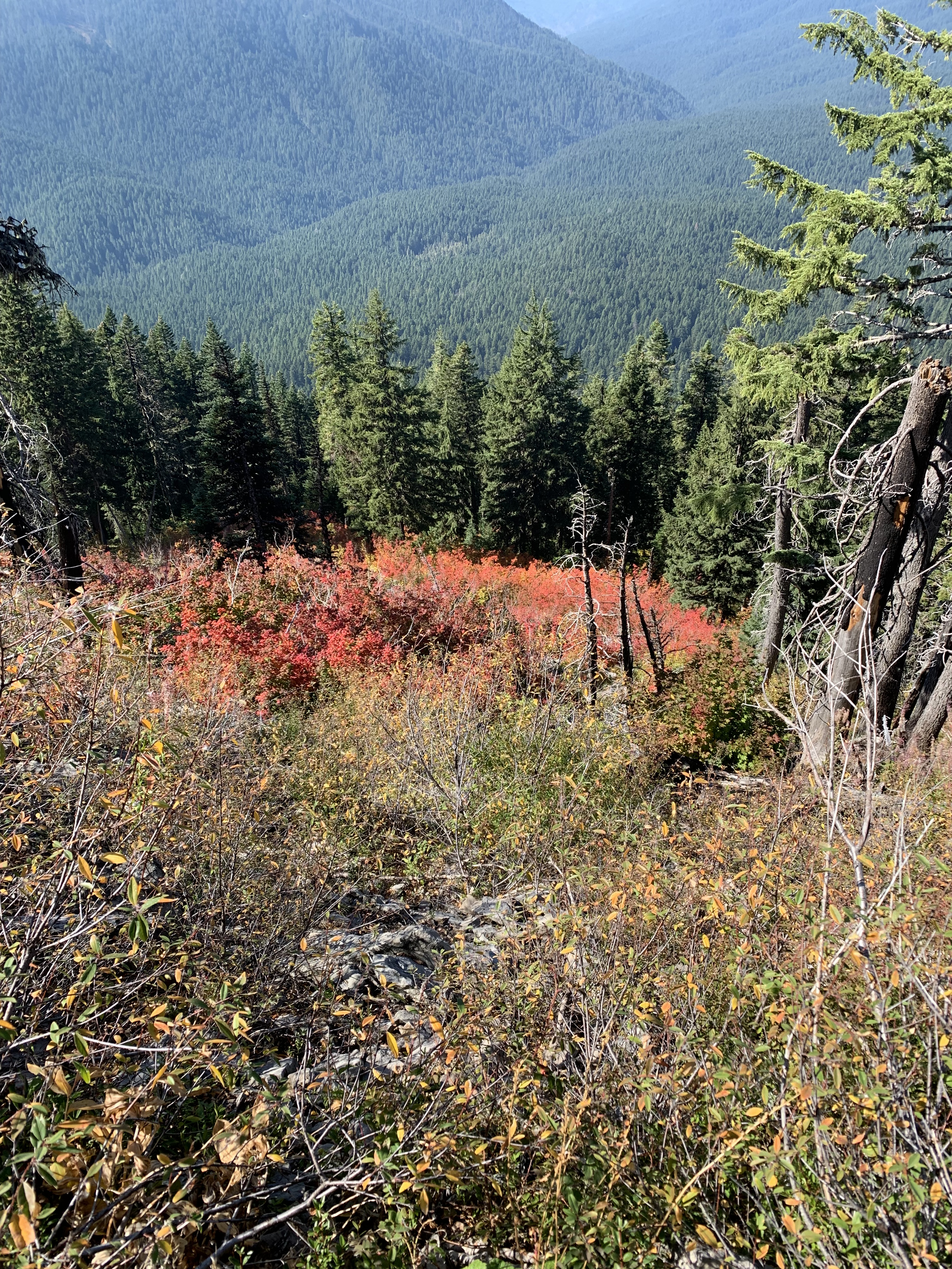
On the last push to the summit of Olallie Mountain, Jeff asked me what I thought the reds were on a distant mountain to our northwest, across the Three Sisters Wilderness. I wasn’t sure if they were maples and even mentioned the possibility of a local die off of conifers where the orange needles can look red from a distance.
A hundred yards later, carrying packs, saws, and other trail working tools, hiking on a narrow trail where I definitely did not want to trip, I discovered a third possibility. Below us were large patches of huckleberry plants, vivid red. I quickly averted my gaze, however, not wanting to tempt my body to go where my vision was. Huckleberries are often part of trail work, because they are a common plant we cut out in order to work on a log we want to remove. The berry season had been over for a good month, but I had fond memories of being first to the bottom of Lowder Mountain a month ago, after our log out there, not because I was the fastest hiker—I am closer to the back these days—but because I left the top before anybody else. I knew there were huge berries at the trailhead and wanted at them. They were delicious. My job is to support the crew, but huckleberries are another matter. The crew’s founder, the late Ron Robinson, told me he loved his huckleberries.
Earlier that day, fireweed, few pink blooms remaining, now with either seed pods ready to open or already spilling seeds into the air, had red leaves as well. It reminded me to take a few so I could try making fireweed tea, which I had once done in ‘85 but as it turned out not the proper way.
After summiting earlier than expected, due to another trail crew’s prior log out of some of the top trail, we hiked back out. I stopped to take pictures of the huckleberry plants I had just seen. Well down past the junction, re-entering the forest, where I planned to take a short rest before the final mile, I was on a stretch of trail that drops off steeply to the east. Out of the corner of my eye, something red caught my attention. I looked and saw a small maple far below, completely red.
Before the outing, I thought my recollection of the day would be the work I did on the mountain, pushing logs off trails, cutting out small stuff, using the big saws on the larger logs, and a tough hike.
The large German Shepherd in front of me on the trail informed me someone was nearby.
“You fire or trail?” I stopped cold, never having been asked that dichotomous question.
“Trail.” With my orange hard hat and carrying tools, I could almost be working fire, but I was not wearing Nomex and the last fire here was seven years ago.
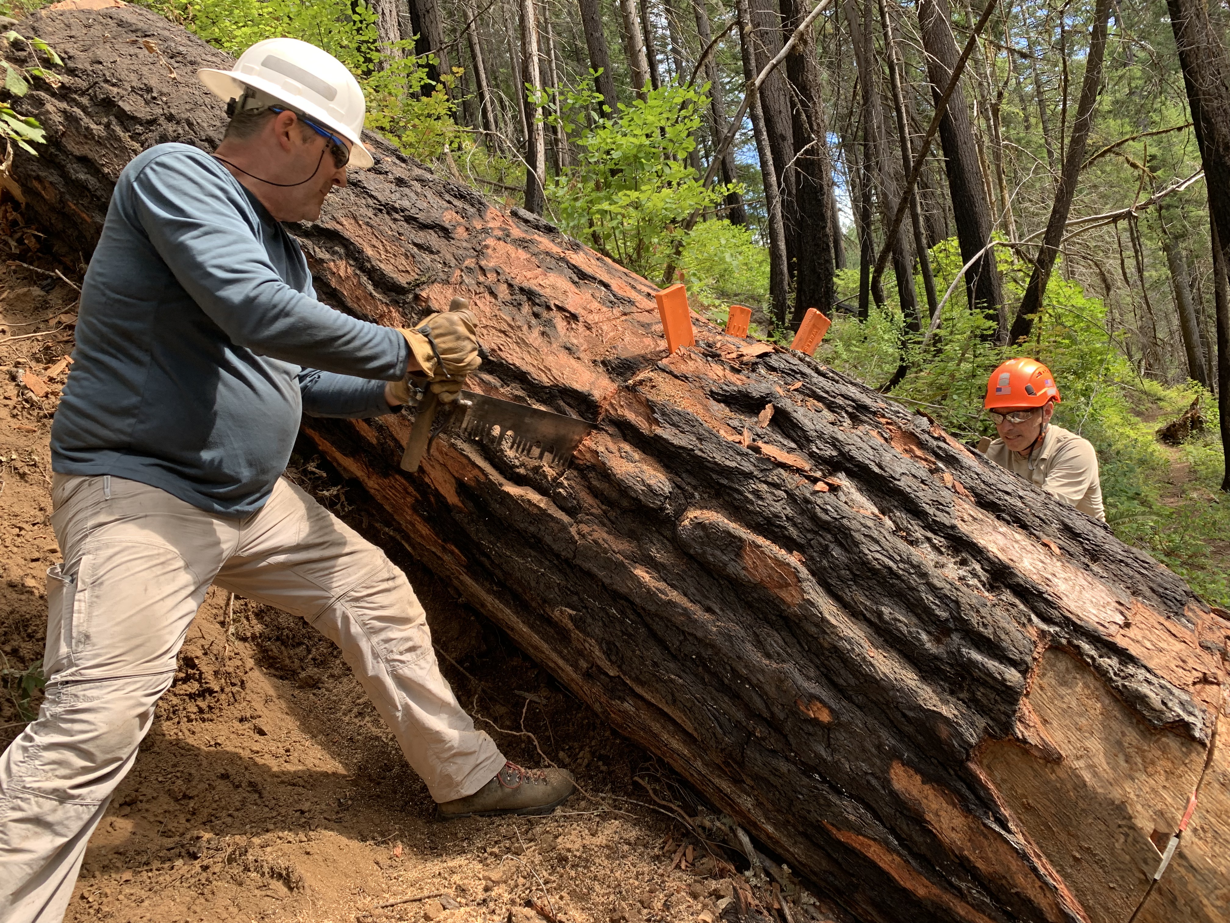
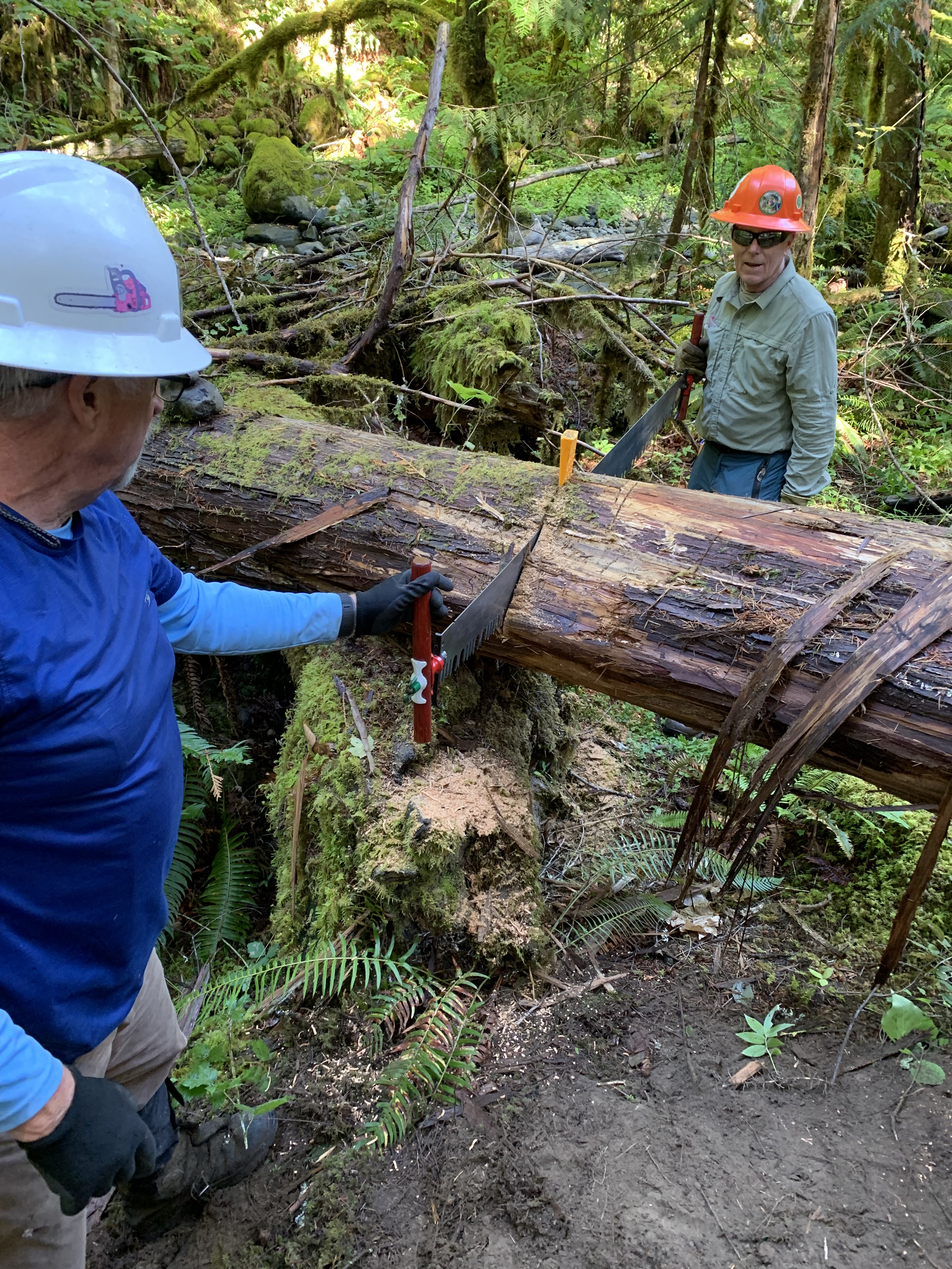
I was part of a crew hiking out the French Pete Trail in the Three Sisters Wilderness. Six of us had hiked in nearly 2 miles, forded a stream, and then worked another mile clearing encroaching brush, repairing and widening the tread, cutting out large logs over the trail using two person 6 foot crosscut saws. It was our third week here, the first two visits spent removing a 34 inch diameter log on a slick slope. No power saws are allowed in the wilderness.
I carried a moderately heavy pack with my first aid kit, the remains of the 3 liters of water, a 500 mm folding KatanaBoy saw, a 14-inch Corona, a radio, the remains of my lunch, a rain jacket, axe in one arm, Pulaski in the other, other items in my pockets, plastic wedges to keep saw cuts or kerfs open preventing saws from binding while we cut a log, my GPS, a strap to pull logs off the trail, a small hand saw, so I didn’t have to remove my pack to cut something under 3 inches diameter. I also had my phone; I tried to remember taking pictures of the crew at work. Occasionally, I’d get a video of cut logs rolling downhill into a stream. I had several of those on Fall Creek during our clearing of the Fall Creek Trail, which promptly burned over a year later, thanks to an unattended campfire in July.
“Can I ask you something?” A woman with piercing blue eyes and short hair, maybe in her early sixties, looked at me. My judgment on how to cut a log could use improvement, but it is far better than guessing a woman’s age.
“Sure,” as I put down the ten pounds of hardware my arms had carried the last mile.
“Is Lowder Mountain open?” The dog came up to her side.
“Yes,” I replied. “We cleared it a month ago or so. Took us two days, Nice hike.” One of those days was spent cutting out another 34 inch diameter monster with end bind, which meant it was on an angle across the trail, and wherever we cut, compression from above would pinch the saw. The following week we finished the rest of the trail, but it was foggy on top, so there were no views of the central Cascades.
“I hope you aren’t trying to get there from here.” She wasn’t. It was theoretically possible but the middle four miles of this trail needed to be marked and cleared. We talked for a few minutes about the route, which followed the creek until there was a crossing about 2 miles in. Some changed to light shoes for the crossing. I’m a lifelong canoeist and many time Alaska hiker. Wet feet don’t bother me. I wore gaiters and took 8 water steps each way across. My feet were damp, but the boots weren’t squishing. I was fine, other than being tired, and at 75, I would need a full day to recover from this outing.
I told the woman there was a spur trail about 1500 meters ahead. “Oh, she will love getting down to the water,” pointing to the dog.
We parted, I walked under two large logs higher over the trail, which were no problem as is, up a hill, and continued back to the vehicles.
I limped in to a bare spot on the North Tonto Platform of the Grand Canyon shortly before sunset. That afternoon my wife and I left Clear Creek, a well-named delightful, quiet spot, where we had camped two nights. Neither of us was eager to hike 7 miles back to Phantom the next day, but if we could get the climb out of the creek done and a couple more miles, the last stretch would be simple. Canyon hiking is full of long descents into drainages and long climbs out of them. We loaded up with as much water as we could carry, because we were going to dry camp. I would miss soaking my feet in the stream, which I love to do below the Rim.
An hour later, we stopped on a pile of cinders, dropped our packs, pitched the tent, unpacking and getting dinner going before it became too dark. Some spots in the Canyon are “At Large” camping, the North Tonto among them, meaning one may camp anywhere. We have spent many nights below the rim; on the south side I always marveled how I could be several miles from another person by trail but only three thousand feet away from those on the rim, high above me. But that distance was as the raven flew, like the one that called while flying into The Abyss, its call echoing off the curving arc of the Redwall Limestone. By foot, it would have taken most of a day to reach the top.
We were careful with water, even left some in the filter that we carried out and could use, used no more than necessary for dinner and cleaned everything the best we could. In twilight, it was quiet, the Canyon Wrens were silent, and we couldn’t hear the river. It was clear and would be a great night for sky viewing. It was different camping with no designated campsite. We just stopped, dropped and made camp. Who knew who last had camped here? The flat area had probably seen many stop for a drink, food, rest, and periodically perhaps an overnighter like we were doing. Go back a thousand years, and many likely came through here.
I don’t know if it was a mouse, a dream, a jet’s passing high overhead, bound for southern Arizona or Salt Lake, that woke me, but I unzipped my sleeping bag, unzipped the tent door, but definitely did not zip outside in my sneakers, standing rather stiffly on the North Tonto Platform. I looked around and then up: Wow. The sky was clear, and I got lost among all the stars. Normally I find my way through the sky by starting from a bright star or two I know which are guides to dimmer ones, and so on, like finding my way in a city from main roads to secondary ones. But there were so many bright stars above. From home, I saw bright zero and first magnitude stars, dimmer second and a few third magnitude. Down here, I could clearly see fainter fourth magnitude stars in the Little Dipper’s handle. At the end of the handle was second magnitude Polaris a bit more than a third of the way from the horizon to the zenith, an indication of my latitude. I saw fifth magnitude stars, 6% as bright as Polaris, and even fainter ones. The constellations we see in books really are visible, but one must look from a dark site to appreciate them, and today there are fewer such places.
I checked the time. Since I had gone to bed, the pointers to Polaris, Dubhe and Merak, in the asterism we know as the Big Dipper, had moved counterclockwise from the “8” on a clock dial to “6” or directly below Polaris, the center of the clock. This is one-sixth of a daily rotation, because the clock disk is almost 24 hours as the Earth turns (just 4 minutes shy, to be more exact.) Four hours had passed. Cowboys used the movement of the Big Dipper to determine when a two hour watch was finished. Escaped slaves could find the North Star and headed towards it. Islam uses a lunar calendar; Ramadan is 11 days earlier every year. Jews use a lunar-solar calendar with 7 leap months every 19 years; Hanukkah occurs 11 days earlier each year for two years then jumps back forward, always on the 25th day of the ninth month Kislev. The Persian year begins based on observation of the vernal equinox (Nowruz). Looking at the night sky connects us to all before us who have looked up at the same stars, which are all moving, but because of their immense distance generations a millennium from now would see them not much different. Each of us has had a reason for looking up, often asking who am I, where am I, what is that, why is it there?
And tonight, I had asked and had answered, what time is it?
I was lucky and saw a sporadic meteor, not part of a known meteor shower. I remembered the first one I ever saw from the Finger Lakes region of New York, when I woke up one night, head just outside the tent, and saw a flash west to east right over my head. It was brighter than Venus. I recalled 18 November 2001 when I lay outside at 2 am for an hour and counted 300 meteors, four times seeing 5 simultaneously, and while that was a great Leonid show, the Leonid storm of 1966 had rates of forty per second, a celestial waterfall of meteors.
It was quiet, and I kept silent. A slight southeasterly stirring of air allowed me to just hear the Colorado River, 1500 feet below. It had been good to look up, but time to return to bed. Morning, I would be looking down a lot on the hike to Phantom. And not zipping along.
See you on the trail. Enjoy the night and the dark skies.
I dropped my pack by the sign at the bottom of Horsepasture Trail next to FS 1993, a narrow single track road that led one way 20-odd miles on occasional pavement and two other dirt roads back to main highway 126. The other way the road continued about two miles to where a landslide blocked it. The rest of the crew would join me in a few minutes, but we were ahead of schedule and nobody was in a hurry to get down. It felt good to have the pack off, the breeze cool my wet back after a day’s work clearing the logs off the trail to the summit.
I walked over to a patch of Cascade Asters by the side of the road. They were filled with bees. That was good. While I am concerned about the yellow jackets later in the summer, I like seeing bees. We have wiped out many insects, and while few care for mosquitoes, we need Insecta in our lives. As I watched the bees, I put myself in let my thoughts wander mode.
These insects were living, not in designated wilderness, but where there were few visitors and the insects could live their lives—even if shortened by predators—without almost no human contact. Horsepasture trail joined Olallie Trail 100 yards in, to the right about 10 miles to Olallie Mountain, where I had worked the prior week; the other way about 6 miles to FS1993, near Horse Creek. Ironically, horses can’t come in here by trailer. I didn’t see Indian Paintbrush, Cascade or Mariposa Lilies down here like I did up top, but the asters were just fine.
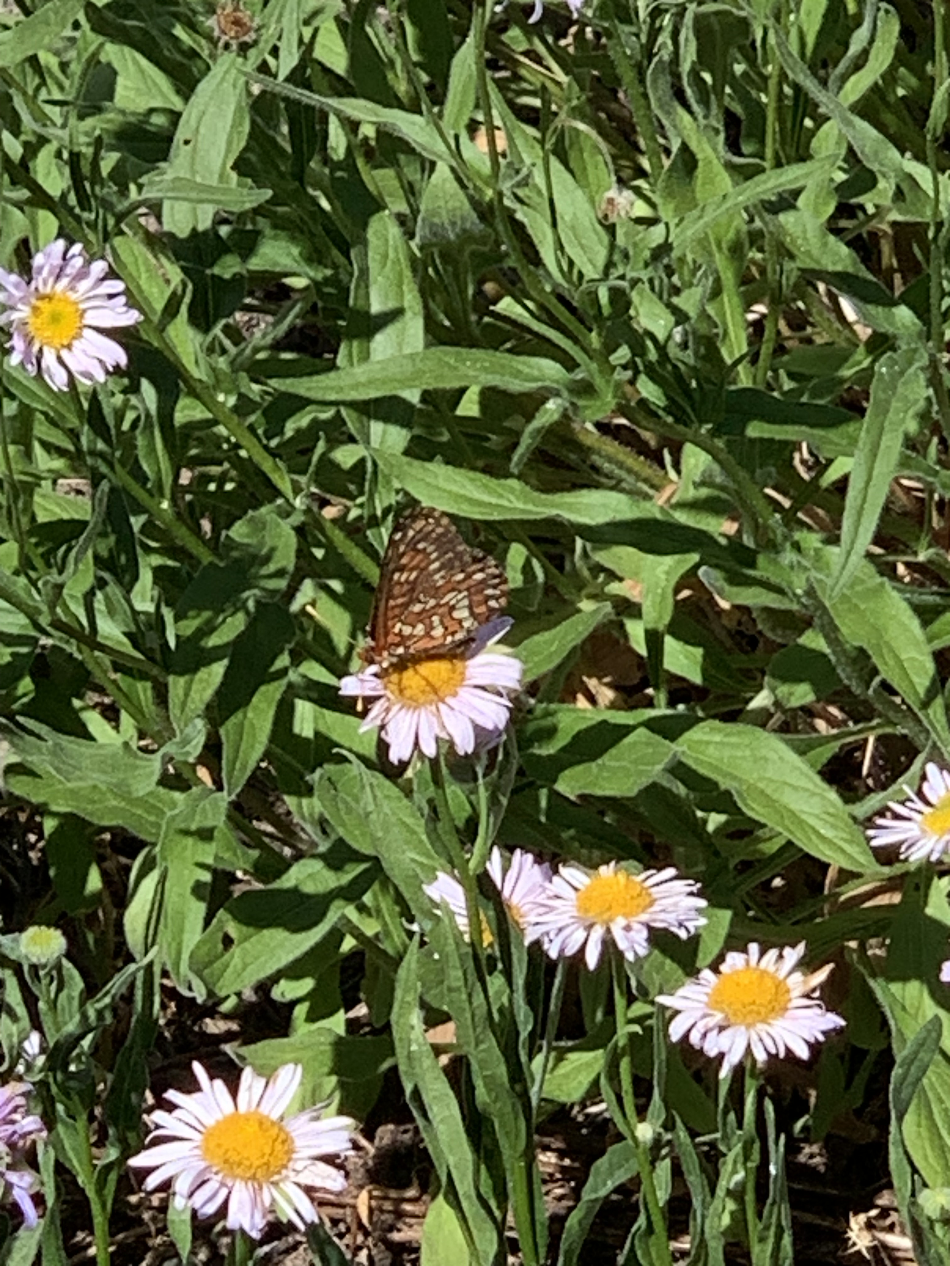
A movement caught my eye, and a patterned black butterfly, a Variable Checkerspot, had landed on my thumb. It didn’t seem to mind what I was, just a landing or a resting place. It stayed there for the better part of a minute before flying to an Oxeye Daisy. I watched it flit from flower to flower. It didn’t appear to be in a hurry, either, like me. I can watch little things in nature—and some big ones, too—for an extended time. I once spent 15 minutes observing an ant carry a pine needle. That was in wilderness, and there wasn’t anybody else there that day, either. On a lazy summer’s day in the Boundary Waters, I have watched many an eagle soar out of sight among the clouds.
My animal sightings are often minor in the current age of seeking uniqueness. What isn’t minor about many of these sightings are the memories have stayed with me for years: watching a porcupine’s feeding by Jackson Lake one night in 1971; crows by a stream feeding their large, demanding young at Glacier Bay in 1988; watching a butterfly exit from a chrysalis seventy years ago in Crow Lake, Ontario; my first meteor sighting one night from one of the Finger Lakes; a beaver I snuck up to see while in a canoe on Kekakabic Lake. I then backed away and left it alone. During a “working” canoe trip to rate all 47 campsites on Lake Insula on categories from landing to latrines, my wife and I had a hermit thrush visit us in the middle of our campsite one afternoon. We stayed quiet until it left. Hermit thrushes are worth remembering, especially their song. I remember deep down on the Tonto Platform of the South Rim of the Canyon hearing a raven’s call echo off the curve of the Redwall Limestone known as The Abyss.
I’m analytical. I know that the deepest blue sky is about 95 degrees upward from a low sun. I enjoy seeking out that deepest blue, If I know where to look, I can spot Venus in daylight, a small golden dot. I follow the Moon through its phases and relative height above the horizon, as well as the angle the crescent makes with the horizon. They all change and are predictable. As for wind, in familiar country, I try to identify the tree by the sound the wind makes blowing through it. I also note wind direction, especially when it is strong from the south or southwest, harbinger of a storm.
The rest of the crew was starting to show up; the Variable Checkerspot had long since left. Time to leave this area of curious butterflies and a reminder of other special places.
We pulled up to an empty campsite on Knife Lake, just east of the Eddy Lake portage, and I hopped out of the canoe to check it. Seasonal ranger Mark Ringlever and I were doing an eight-day circle of the Kawishiwi District, checking permits and campsites, talking to people, picking up litter, digging new latrines, and covering old ones, but basically a long canoe trip into deep wilderness with Mark’s being paid to do it. Knife Lake is a large, beautiful border lake with many arms, clear water, and is featured often in northland wilderness writer Sig Olson’s books. Earlier that day, we came upon a group of seven young women with an older man leading the trip. Mark said to the man, “Wow, I want your job.” The man’s reply was, “Wow, I want yours.”
At the Knife Lake site, I saw something I vividly remember three decades later: a fire’s burning in the woodpile just outside the fire grate, flames four feet high, fed by the wind, about to reach a grassy area and trees nearby. Fire inside a fire grate is almost friendly; fire outside the grate, burning uncontrolled, is scary.
We each used our shovel and Pulaski, threw some burning wood into the lake, and used some of our pots to put water on it until the fire was finally out. Had the summer been drier, this fire could have been off to the races. There would be no Knife Lake Fire this year—we continued our trip uneventfully. Later that summer, I did a trip on the Kawishiwi River and fully a third of the sites we visited had outright active fires or warm ashes.
I learned years ago that a campfire will burn itself out overnight. We left camps that way. We know now that fire can spread through duff underground and reappear on the surface. I put my fires dead out which I define as when deep ashes are cold to my bare fingers.
Five years after the Knife Lake incident, I was a volunteer helping Mike Manlove, another ranger. We paddled into Good Lake, and at the first of two campsites on the lake there was a tent up, nobody there, and a fire burning. The leader of the trip, a guide, returned while we were there. As Mike wrote him a $100 ticket for an unattended fire, the man was upset, embarrassed, and apologized, saying he had spent over four hundred nights in the Boundary Waters and nothing like this had ever happened. I wonder how many fires he had left unattended during that time.
Mike told me a story about a Forest Service employee’s arrival by power boat at a recently used campsite on Basswood Lake where the fire was still burning. (The Wilderness Act allowed up to 25 hp motors on part of Basswood as a compromise.) He saw the culprits’ canoes out on the lake and chased them down, ordering them to return to the site to put the fire out. The campers worked in law enforcement in south Florida. As the employee wrote the ticket, one of the Floridians asked whether there would be professional courtesy, you know, one cop to another.
The Forest Service employee responded, “What would you do if you caught me running coke down in Dade?” “We’d bust your —. We deal with drug running real seriously down there. It’s costly.” “Well, we deal with unattended fire real seriously up here. It’s costly.”
The 2007 Ham Lake fire in the Boundary Waters began when a man burned garbage, convenient but illegal (air pollution), and did not put the fire fully out. Seventy thousand acres and over 150 buildings were burned, valued at $10 million, another $11 million spent to control it. Cary Griffith wrote in Gunflint Burning of the effort to control the fire and the tragedy that followed. It is a powerful story.
Build fires on rock or hard dirt, not duff. Don’t just kick dirt over where the fire was. You must touch the deep ashes and the nearby ground and ensure both are cold.
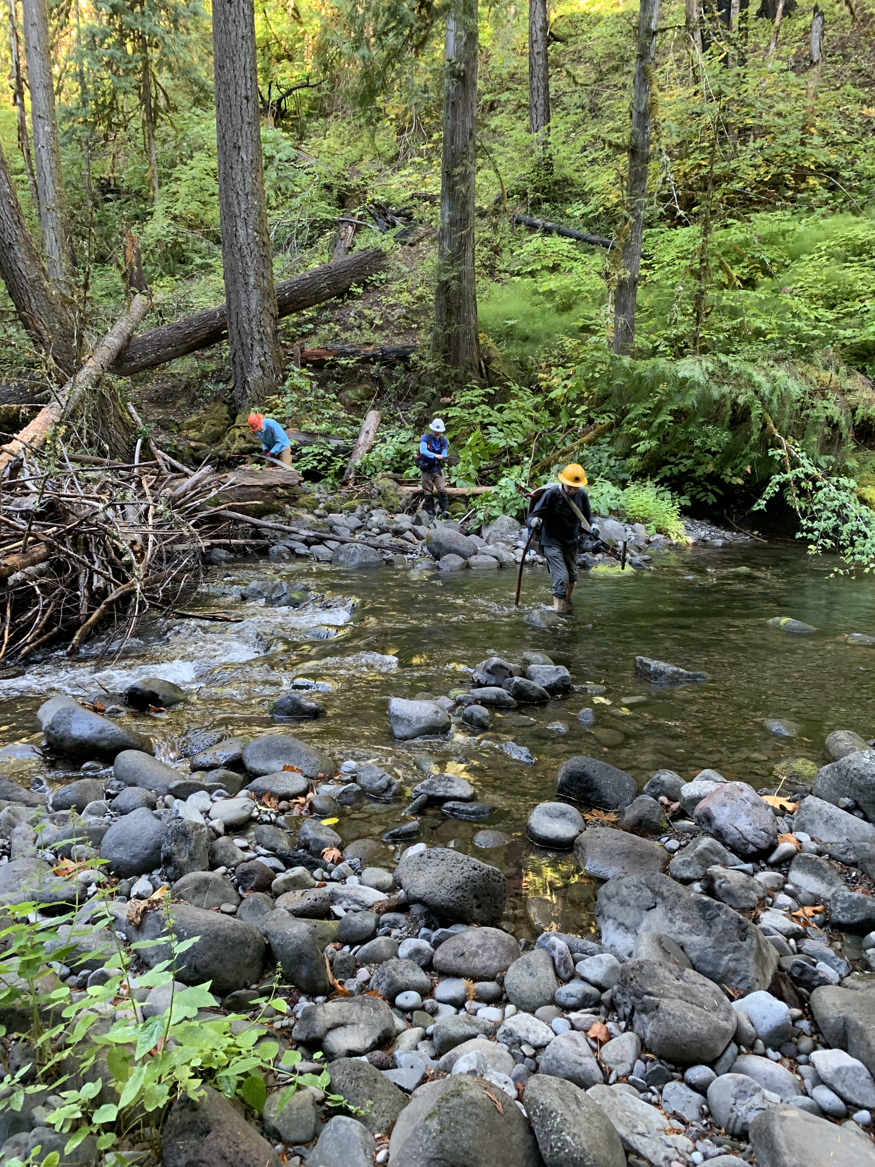
The brief but intense sting on my left palm from the force of my axe striking dense heartwood was another reminder the day wasn’t going well. Nine of us were logging out Horse Creek trail in the Three Sisters Wilderness, entering by a log bridge over Horse Creek itself that one needs to carefully cross, 1500 feet of climbing over 3 miles with gear to get to our spot, the second time this year I had been to this point. The trail climbs further and we needed to clear it to a trail junction 5 miles in.
The 17 inch diameter log angled over the trail with the end some 60 feet up the hill, giving it significant end bind, meaning the saw blade was grabbed due to force coming from above down the log. Plastic wedges only keep the cut or kerf open if the saw is deep enough to drive one into the kerf or cut, and we were nowhere near that. It took several of us more than two hours to dispose of this blocking log, and there were 16 more of various sizes and difficulty in the next half mile to Roney Creek.
Bridge entering Three Sisters Wilderness
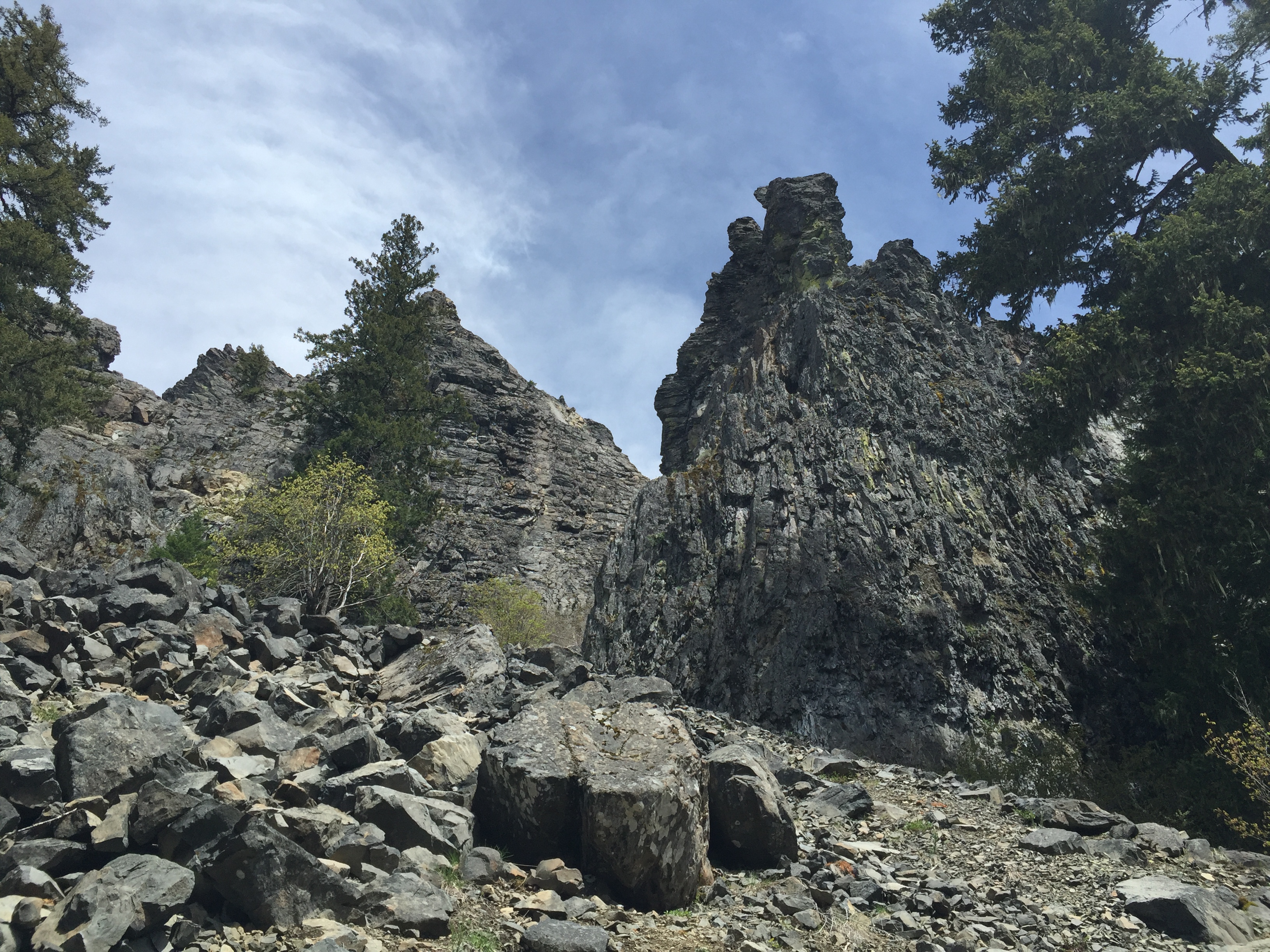
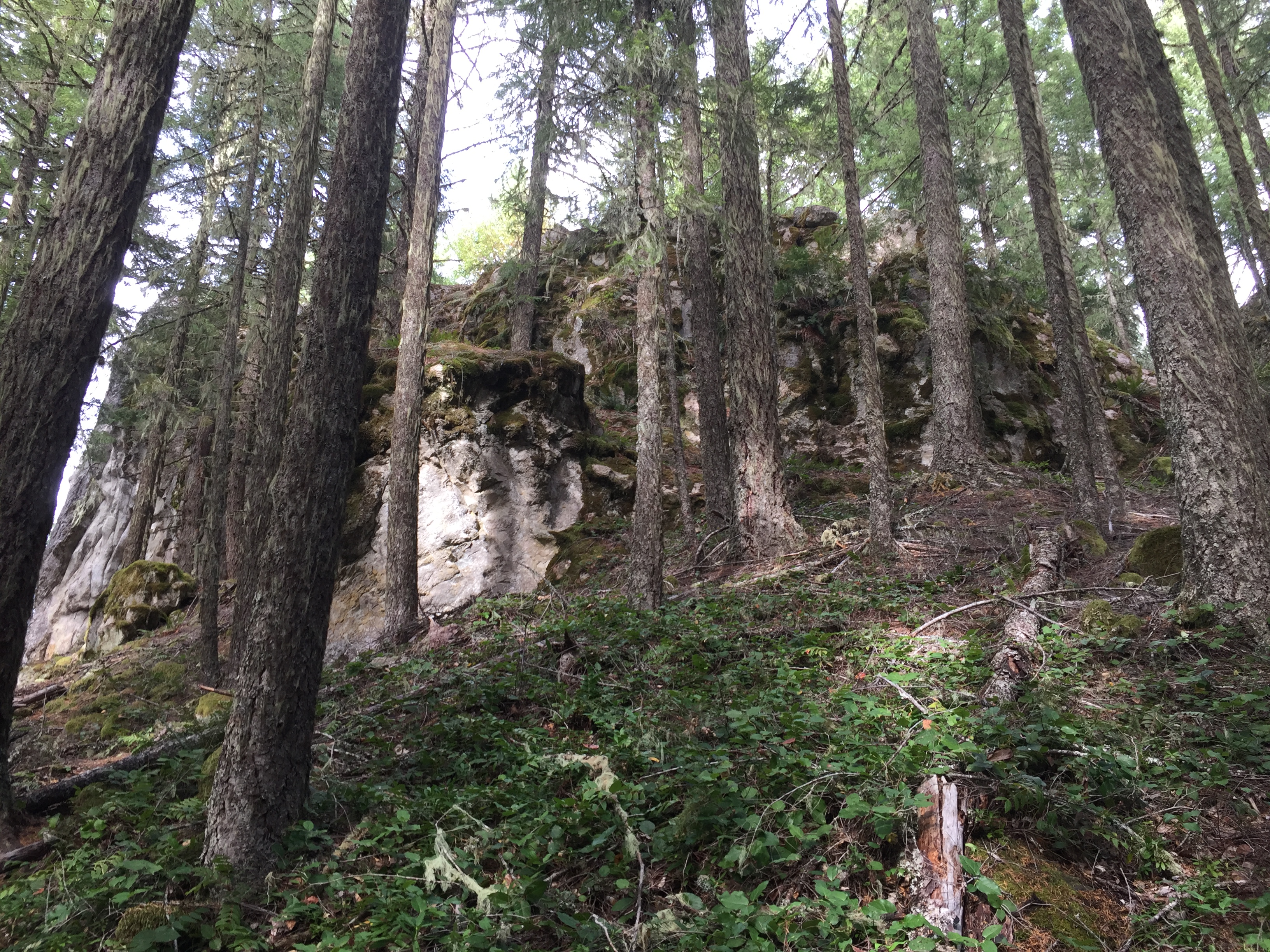
We had been on Horse Creek a month earlier, on a cold, rainy day, reaching this point with two logs, both with end bind, right together. We worked on one, then left it for another time, since the upper trail still had snow and it was getting late in the day with a long hike out. Today was the next time. I thought my sawing the previous outing was decent, considering my arms were not in saw shape, but on this day it seemed like every log had an unusual problem, either in the cutting or the disposal. I was on my hands and knees clearing debris from the trail, most of it still holding water from the deep snow that had only recently melted. There was another log angled about 40 degrees up a cliff, requiring my partner and me to climb part way up the cliff to pry it loose, where it eventually became a side rail along the trail.
Small cliff where log was present.
I was too hard on myself, I realized later, after we reached Roney Creek and could turn around to hike back out, arriving back at the trailhead after 5 pm with a long drive home. I was the crew leader for the day, the 21st time I have been one, only the third time, however, on a logout. The crew leader doesn’t need to be the most experienced person, and I am not. I have been on over a hundred days of logouts, but I seldom make the decision how to cut a big log. I like to think about it a little, but there are plenty who know right away what they want to do, others who think they do and discuss their thoughts aloud, throwing words like branches into the air. Lot of egos in the woods, like the rest of society.
My role as crew leader was to make the arrangements online, file a comms or a communication problem with the Forest Service, and be at the meeting spot in Springfield early when we met in town to make sure everybody was there. As it happened, one we were going to meet in the mountains showed up in town, and we didn’t have room in the vehicles. I made the quick decision to drive myself so we didn’t have to cram everything and everybody into two full vehicles.
Usually on logouts, we leapfrog each other, skipping a few so each crew works on several logs in a defined area then moves on past the other. I made the decision before the day started to send 3 of the 9 of the group, the strongest, up the trail 3 miles to start logging from there. They would cut their way to the end, informing me by radio of their progress. The rest of us had to deal with left over logs that were not used for sawyer certification plus the remainder to Roney Creek. There were 4 B/ C certified sawyers among us, including me; I elected not to lead a saw crew but to float, so one of the other B certs would have a crew. He was stronger and more adept at reading logs than I.
I knew the people, the trail, I the conditions, that several logs we had left for certification uses were probably still there, and that further up at least one log, maybe more, would take an unusual amount of time. I hoped that the three I sent beyond could clear the trail from the creek to the end, a possibility since unlike us, they would not work in a burn area, where we would be, and could expect fewer blowdowns.
I have a good sense of time on the trail, and when I called in to the Forest Service from the trailhead, said we would plan checking out at 1700, or 5 pm. It would be a long day.
We removed logs that had been left, along with nearby brush on the trail. I then heard from the lead group that he had seen what was ahead of us and would start clearing from the creek,, ,so we wouldn’t have to go past it. After we finished the original certification logs, we hiked up to work the problem logs. By lunch, we were ready to make the final push to the creek; the upper group was about 1.3 miles from the end.
I bring other skills to the group, neither easily seen nor commented upon. I removed several smaller logs by myself on the way up. It’s part of the job. I knew how far we were from the creek, thought we had a decent chance of making it there by 3, which would get us back at the trailhead about 5. I also knew four of the people came together in one vehicle and when we finished, they could go down the trail and leave. I doubt others had those thoughts, but I did.
We reached Roney Creek after we cut out the last two logs. I got a call from the lead group telling me they were near the junction. I gave the go ahead to start hiking out, and when I was a half mile from the trailhead ninety minutes later heard from the now trailing group that they were at the creek. We got the trail cleared and were at the trailhead not long after 5. No way we could have done this by leapfrogging each other.
I radioed the Forest Service that we were done, drove home, and that night wrote the report and credited the crew with their hours. Horse Creek had been cleared for another year.
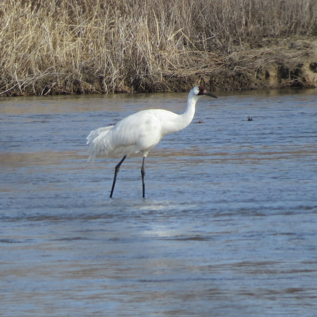
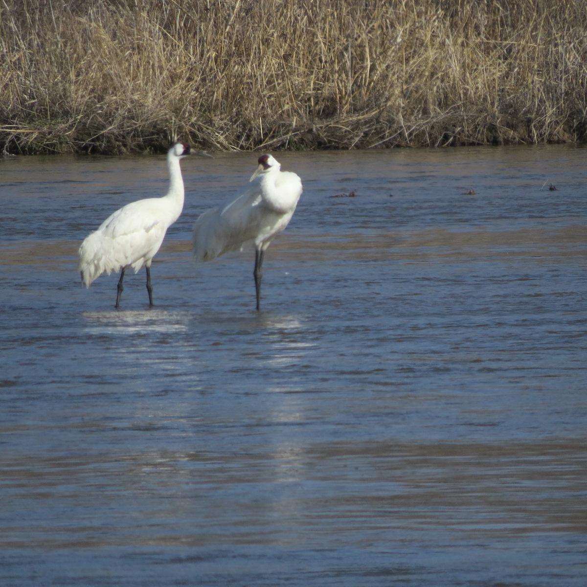
The final year I guided at Rowe Sanctuary, I seemed to be the only one who hadn’t seen a Whooping Crane. Many had seen them on the river; others who came into the Visitor’s Center saw Whoopers in the nearby fields as they drove in.
One night, I operated the Crane Cam and was able to put the camera on three Whoopers in the river at dusk. That was nice, but it was virtual seeing; anybody in the world could have seen it, at least the 1973 who had logged on.
I was a little jealous, but I try to be realistic; rare sightings in nature are just that: rare. If one shows up often enough in the right place, success is more likely. I had never seen Whoopers closeup, and while I hoped I might, I wasn’t expecting to. Low expectations coupled with willingness to try are good approaches to viewing wildlife.
As I arrived at the Visitor’s Center one morning, another volunteer flagged me down in the parking lot. She was an expert birder, one who frequently had seen Whoopers, in part because she was often in the right place at the right time. Experts find a way to do that. She came to the driver’s window and whispered somewhat conspiratorially to me:
“Mike, a half mile east of the Lowell Bridge, on the river.” I didn’t have to ask what.
I did what one must do in those instances. Go. I drove forward, did a U turn, all the while computing where exactly I was going. Within five minutes, I had passed Lowell bridge and was on a dirt road heading east. I spotted two parked cars, a sign in Crane Country in spring that Whoopers are nearby. Four large white birds were in the middle of the river. The rules for viewing a crane from the road are simple: stay quiet, stay in the car, and don’t do anything stupid.
After years seeing tens of thousands of Lesser Sandhill cranes, I was struck by the far greater size of the Whoopers, with their striking white body, black legs and crown. I took some pictures, stayed quiet, stayed in the car, and did nothing stupid. I told myself this might never happen again, rolled up the window and quietly drove away.
I was at the right place at the right time by knowing the right person and having a bit of luck. Two minutes on either side, I might never had the experience.
The second to last day, I still looked for Whoopers from the viewing blinds. I didn’t expect to see any more, but I enjoyed observing the thousands of Sandhills, they and I waiting to see what the day and the river offered. I was viewing in perfect light; sunlight’s reflection off the cranes turned them into flying copper and the browns of the prairie grasses became pure gold. I watched the birds dancing on the river in front of me, upstream and downstream, bowing to and hopping over each other, circling, running towards and away from each other, individuals, pairs and groups dancing, when I suddenly saw, both out from the corner of my eyes and in front of me, the entire river rising and falling as one huge living wave of birds. The wave was remarkable, beautiful, unexpected, and brief, and then vanished. Two seconds.
It would be hours before I sorted out what happened. Frankly, the spiritual explanation of a “Gaia” river—a living river— seemed better at the time. The river rose and fell. I saw it happen, even if nobody else in the blind commented on it. Maybe I saw it because I am an expert in viewing cranes, and I was at the right place at the right time when the river rose and fell.
The late Paul Johnsgard, famous crane researcher and writer, wrote eloquently of a magical time when season (spring), river (Platte) and bird (Lesser Sandhill crane) came into conjunction. He was so right. I saw so many cranes dancing in so many places, in so many ways that at some point all the dancing became—if only for two seconds—a perfect wave. Experts are ready for the unexpected.
Two days later, I left the Platte, closing my tenth season, thrilled to have seen several Whooping cranes close up. It was a “finally” moment, which I never have again. But I had it once.
I expected the sighting east of Lowell Bridge would be the most vivid memory of my trip. But by being ready for the unexpected, my most memorable moment was two seconds the following morning when the living Platte danced before my eyes.
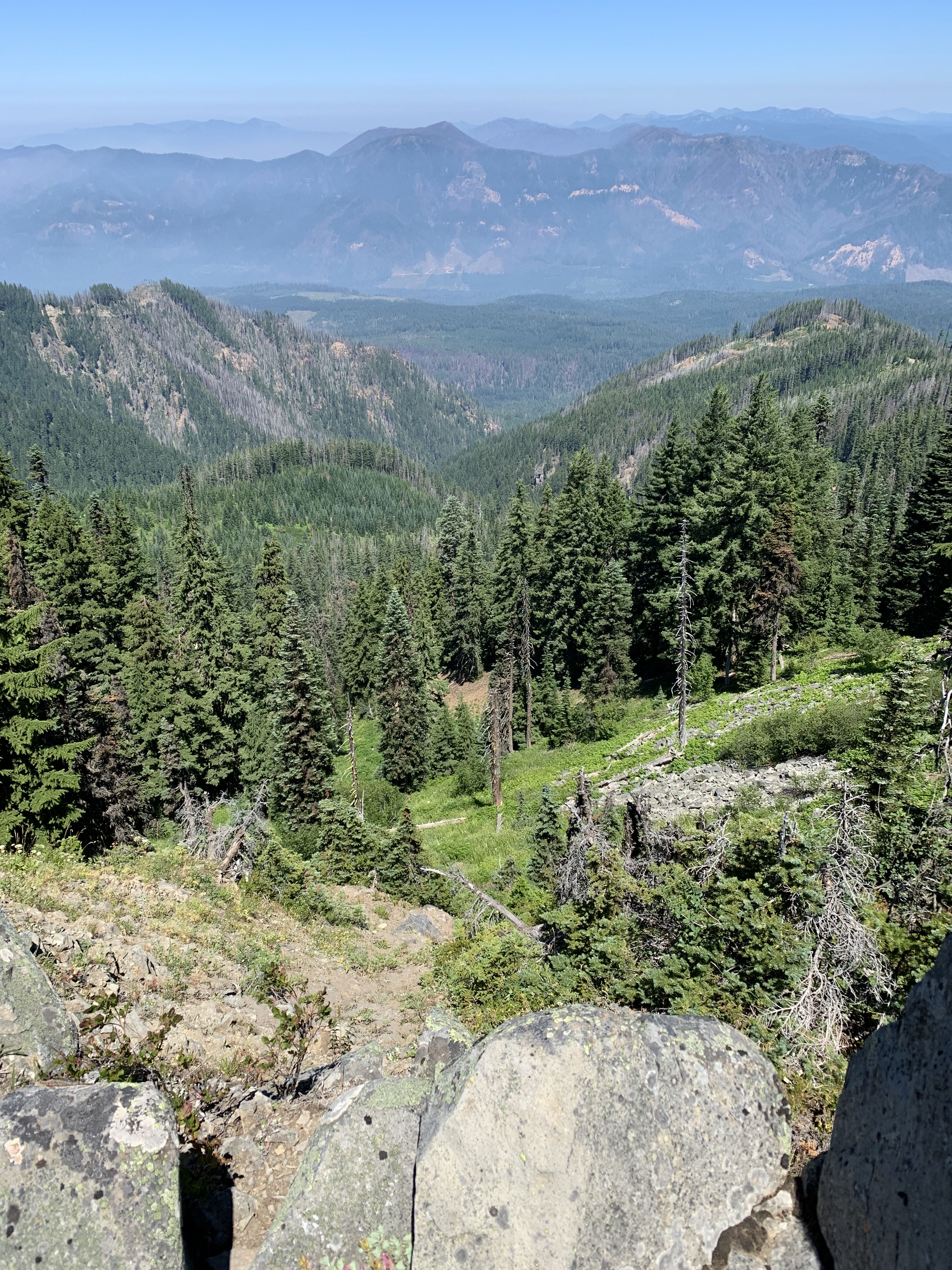
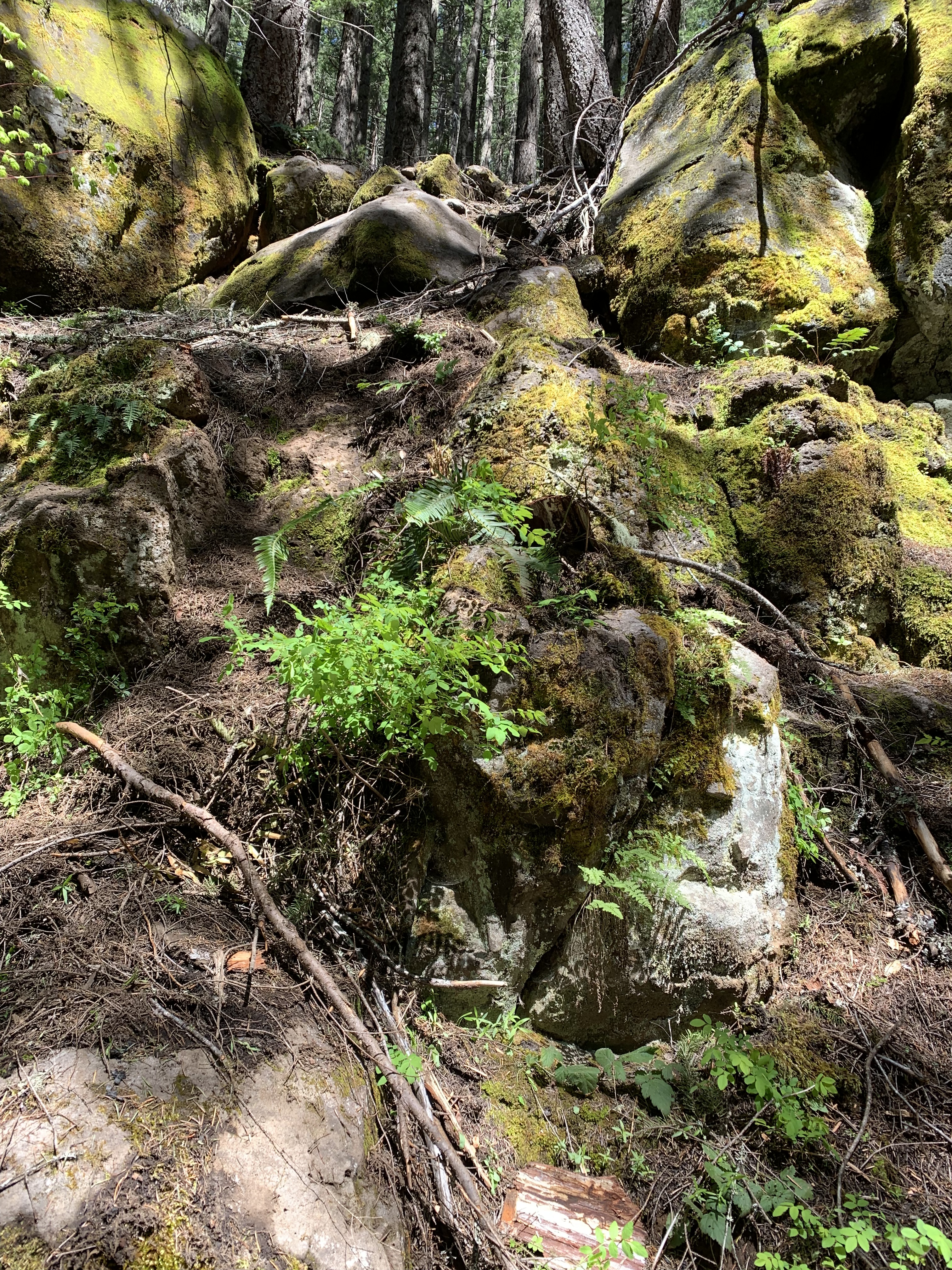
I reached Young’s Rock after an hour’s hike with a half-mile elevation gain from Camper’s Flat, 25 miles south of Oakridge, and promptly ran into snow on the north side. While the snow wasn’t deep, I had the first inkling that I might not be able to reach Moon Point. I continued a quarter mile further until three large logs, covered in snow, blocked my way.
The first I could cross, the second was more than three feet in diameter, too big to climb over, nowhere to go under, the downhill bypass involving a steep drop I didn’t want any part of. Going uphill offered wet snow, was slippery, steep, and impassable.
I turned around. I didn’t spend much time thinking about it, I just reversed course. Even if I could have gotten through, the trail was going to have more snow, and I had to do the log crossings on the return, doubling the probability of having a problem. Moon Point was not going anywhere; I would try again. Six weeks later, I made it, and I led the hike three months after that, but from road FS 2129, a full thousand feet above Camper’s Flat, making the trek more reasonable.
It wasn’t the first time I had turned around because of obstructions. Years earlier, snow stopped me just short of the summit of Mt. Wrightston in the wilderness of the same name in southern Arizona. This was one of my favorite hikes, rising four thousand feet from the valley, but because there was no safe way to cross one stretch without my being at significant risk for sliding 50 or more feet. I failed to reach the summit, with its splendid views. I still had a morning off work, got to hike in deep snow in southern Arizona, and returned safely to work later that day, wet feet and all. It was great.
Sometimes it isn’t what is on the ground but what is coming down that changes plans. I led a late season hike to Crescent Mountain in November 2015. I thought we would miss the rain, but I was wrong, and the steep trail had small waterfalls all the way to the beginning of the meadow, about 1300 feet vertical above Maude Creek. There we encountered wind, snow, and fog. We were still warm, if wet, but it didn’t seem like a great idea to go to the summit for nonexistent views. We turned around, and back at the parking lot tried unsuccessfully to dissuade two young women from starting out, especially with their wearing running shoes with their feet in plastic bags.
This year, I cut short both a snowshoe and a ski attempt to deal with my adopted winter trails, the 9.5 mile trek on the PCT from Willamette Pass to Maiden Peak Saddle and Tait’s Trail. I was too exhausted both times to finish, and it took me fewer than ten seconds to make the decision to turn around early. I had no regrets, other than not having the stamina. Winter trips are dependent upon snow conditions, and either the wrong equipment or the wrong snow (or both) will make for an arduous, perhaps unsuccessful outing. I finally completed the loop, checking and replacing the blue diamonds as needed, but it was April and excellent snow conditions before I succeeded.
In late spring 2009, I turned around at Bridalveil Creek in Yosemite, because I wasn’t sure I could get across the springtime flow safely. I looked and looked, finally said no, not worth the risk, and reversed course with no regrets.
See you on the trail. If a trail is unknown, especially in early season, consider that snow, downed logs, streams, weather, or physical ability may stop you. Turning around is not failure; stuff happens. Listen to your gut. If you are uncomfortable, turn around. You know the way back. Hiking should be enjoyable.
Young’s Rock; Blowdowns, April 2016
Bottom of Tait’s Tie Trail. Now just 2.5 miles to snowshoe out. March 2024.
Six of us started up the Larison Rock trail outside of Oakridge. There were supposed to be seven, but one person who thought he knew where the trailhead was, did not. There are two of them, one at 1200 feet (350 m)elevation, across the river from Oakridge; the other was a longer drive around the mountain and at about 2800 feet (850 m). We hoped he would find the right place and catch up.
I was last and figured I would catch the others fairly soon. Two looked like they were in their fifties, one maybe forties, and the other 67. The trail goes uphill 1500’ (450 m) in the first two miles (1.3 km0, steep, but steady and good tread. It doesn’t waste one’s time gaining altitude—my kind of climb.
I started to catch up to the first person as he adjusted his poles, thinking that I hoped he would be faster. His poles adjusted, he moved on ahead, and for the next mile, I was still in the back, not gaining any ground on him at all. That’s unusual. I’ve had some knee and Achilles tendon issues, for which I walk carefully on steep grades, but I wasn’t hurting, and I was climbing well. At least I thought I was.
I passed two of the group who had removed layers, and about a quarter mile later, I did the same, making a quick change and moving on ahead. The three in front of me were out of sight and stayed that way to the rest stop where I wanted to regroup. The two behind me arrived not long after I did. I had a drink and something to eat, and the first four were off going up the trail to the upper road, where we would stop again. I was going to go last, but the guy who adjusted his poles at the bottom was still working on his pack, so I decided I would go on ahead.
After maybe a half mile (800 m), a little more, I encountered a pair of mountain bikers coming the other way, went around them, and then heard footsteps behind me. I realized the last person was right behind me, so I pulled over to let him go by. He moved ahead about a hundred yards before I lost visual contact. I finally caught up with him and others at the upper trailhead. These guys were fast.
The year prior, when we went the last part to the top, which switchbacks steadily, I had someone behind me, and I just kept my pace the same to the top. I climb at nearly my flat ground cruising pace. This day was different. The group took off, and while I climbed at a decent pace, I was the last one to Larison Rock itself, where we had lunch. I wasn’t breathless, I wasn’t sore, I was fine. I was also dead last.
I had not “led” the hike at all; in 8 years of leading this hike, that had never happened before.
While we ate lunch, the missing person showed up. He had driven to the upper trailhead, turned around when he realized there was another trailhead down below, and had come up the same trail as we, quickly. He was more than a half hour behind me at the start, and I had only been on top twenty minutes.
I’m not as fast as I once was. Doing trail work, I am used to carrying more and hiking less. But there is no need to make excuses. Things are what they are. I am observing a generational change, this time from the other end. I’m fine with that. I don’t need to train with longer hikes—like doing Hardesty weekly—to see if I could improve. I can enjoy what I still do, and do well, sparing myself Hardesty’s 3300 foot (1000 m) vertical climb. That sounds a lot better.
I began to hear a gentle tapping on the tent fly. Then it stopped for a bit, began again, and increased. It was raining, and judging by how the clouds had looked all day and earlier this evening, the rain was likely to continue for some time.
Fine by me. Great, even. I was in my tent on Basswood Lake in the Boundary Waters, warm, had a book, a light, no place to go, and nobody nearby. Dinner had been eaten, the dishes cleaned, everything put away, food secured, canoe tipped over, tied to a tree, some dry firewood underneath. I hadn’t heard or seen a soul for two days. The tent wasn’t going to leak, water wasn’t going to soak the floor, my clothes were dry; I was at total peace with the world.
I’m not sure what such peace is worth, but in the woods, where pudding cups or chocolate of any type is currency, tundra swans on the wing are news, loon calls are music, autumn reds and yellows are art, entertainment is turning my full attention to a single leaf with interesting drops of water on it, or watching an eagle catch a thermal and soar out of sight, a rainy night after a day’s work makes me woods wealthy. I had paddled around a nearby bay that morning when I noted a beaver’s swimming off the starboard bow of the canoe. I could not reach my camera, so I contented myself by paddling without removing the paddle from the water, quietly pulling of the paddle followed by turning it perpendicular and feathering it through the water, staying the same distance behind the beaver for about a minute. Eventually, the beaver dived, but with no tail slap. That’s ideal, to be so close to an animal without obvious disturbance.
It was a gift, I concluded, after a great day such a pleasant night in the wilderness. I turned off the light and lay in the dark, listening to the tapping, occasionally increasing when a light wind blew water off the white spruce above me. I would later drop off to sleep, awakening some time after midnight to no sound. When I went outside, there was a dense mist just this side of rain, but not so dense as to hear it on the tent. It was cloudy, not because I could see clouds, but because I couldn’t see any sign of the Moon that I knew was above the horizon. I can’t remember if I awakened later that night to the sound of heavy rain. Maybe I just dreamt it. Morning would come with gray skies, but I had no place I needed to be, other than by a warm, crackling fire having my breakfast, looking out over the lake wondering what awaited today for a woods wealthy person.
Chosen as part of the Winter’s Writing Series by McKenzie River Trust. Read at Tsunami Books in Eugene Sunday 3 March 2024. https://mckenzieriver.org/woods-wealthy/