Archive for the ‘UNPUBLISHED OUTDOOR WRITING’ Category

KOBUK VALLEY, NP, ALASKA

July 17, 2013

I really wanted to see this Park, the most remote one of the 57 Parks in the 50 states. It is about 100 air miles east of Kotzebue and about 150 west of Bettles. Many people haven’t heard of either of these places.  Had I thought about it after the Noatak River trip in 2010, I would have been able to have gotten a trip from Bettles.  I had a Gates of the Arctic backpack in 2012 that I decided to add a Kobuk Valley trip on.  The good news was that we had an early pick up at Summit Lake, on the Continental Divide, because the pick up pilot knew we were there and that the weather was going to deteriorate.  We got out before the storm hit.

Unfortunately, the fact that the storm was coming from the west meant that the next day’s trip was not likely to be easy.  A group of 5 of us, a family of “park collectors”, like me, and me got into a float plane (Beaver) and got over Ambler, a town near Kobuk Valley, on the Kobuk River.  Twenty miles from the Dunes, we turned around because of low visibility.  We were over the Park, and I thought that might be sufficient, but it wasn’t.  It never is sufficient not to see something the way you want to see it.

Let me digress on that last statement.  I wanted to see Kobuk Dunes.  I didn’t want to camp there for a week, hike the whole park, or canoe the river through the Park.  Those are all worthwhile activities for some people.  For me, seeing the Park was seeing the Dunes.  Pure and simple.

In 2013, I decided I was going to see all the rest of the Alaska National Parks (there are 8, and I had been in 4).  I decided to set up a week trip do see the southern 3: Katmai, Lake Clark,and Wrangell-St. Elias.  I started thinking, and I realized I could fly to Kotzebue and try Kobuk from there.  Kotzebue is on the Chukchi Sea, and that in itself would be worth seeing.  I booked the trip.  I flew from Phoenix to Anchorage, stayed a day in Anchorage, flying that evening to Kotzebue.  With no obvious taxi, I schlepped everything to the Nullavig Hotel and stayed the night.  I was told by Jim Kincaid of Northwestern Aviation that we would be flying the next day, probably in the afternoon.  The following morning, he confirmed that for me.

I took a walk right after an early breakfast, and I headed over to Northwestern Aviation’s office.  I don’t know why I did, but in Alaska, one does things like this.  Right after they opened, I walked in, and Jim met me, saying, “I’m really glad you’re here.  Can you go in 30 minutes?  I have some people I can’t pick up this morning, but I need to go this afternoon.”

I said that if he could take me back to the hotel, I could get my luggage and be back in 30 minutes.

It took 13.  I had everything pretty much packed before I had left the hotel the first time, so when I went in, I stopped at the desk and asked them to get my bill ready, while I went up to my room.  When I came down, the bill was ready, I paid and left.

We had to push the airplane into position, we got in, and we were on our way out over Kobuk Lake, brackish, and then to the north side of the river, passing Kiana.  We then crossed the river and went through a couple of small squalls until we reached the Dunes.  I didn’t even see the runway on the sand until we were 100 yards away.  We landed, got out, and I had a half hour.  Only a half hour?  Not less than a half hour!!  I sprinted up the ridge to a large dune, where I could look out over trees and a stream.  It was quiet, the sand was damp and firm, the size of the dunes huge, with a copse of trees and a stream nearby.  I immediately thought of it as a place to camp.

Time passed quickly, I got my pictures, we got into the plane, and we headed back to Kotzebue.  It was a wonderful trip, and I got into my 45th park on the second try.

We brought in the sign and put it in the sand. Kobuk has no trails, roads, NPS office (except in Kotzebue).

The copse of trees was by a small stream. To camp there would be lovely.

Plants can grow almost anywhere.

The size of the dunes is remarkable.

I suddenly realized that my footprints were a nice addition to nature.

More of the same.

Just such a lovely spot.

On the return trip. The Kobuk River has six channels, and this was only one of them.

Runway two seven at Kotzebue. It is too short for full size 737s, which have a special dispensation to land here. I thought when we came in, there was a bit more thrust reversal than usual.

IMG_3172

WILDLAND FIRE IS INHERENTLY DANGEROUS; NO MORE PURPLE RIBBONS

July 6, 2013

Ten Standard Fire Orders 

  1. Fight fire aggressively, but provide for safety first.
  2. Initiate all actions based on current and expected fire behavior.
  3. Recognize current weather conditions and obtain forecasts.
  4. Ensure instructions are given and understood.
  5. Obtain current information on fire status.
  6. Remain in communication with crew members, your supervisor, and adjoining forces.
  7. Determine safety zones and escape routes.
  8. Establish lookouts in potentially hazardous situations.
  9. Retain control at all times.
  10. Stay alert, keep calm, think clearly, act decisively. 

Eighteen watch-out situations 

  1. Fire not scouted and sized up.
  2. In country not seen in daylight.
  3. Safety zones and escape routes not identified.
  4. Unfamiliar with weather and local factors influencing fire behavior.
  5. Uninformed on strategy, tactics, and hazards.
  6. Instructions and assignments not clear.
  7. No communications link with crewmembers/supervisors.
  8. Constructing line without safe anchor point.
  9. Building fireline downhill with fire below.
  10. Attempting frontal assault on fire.
  11. Unburned fuel between you and the fire.
  12. Cannot see main fire, not in contact with anyone who can.
  13. On a hillside where rolling material can ignite fuel below.
  14. Weather is getting hotter and drier.
  15. Wind increases or is changing direction.
  16. Getting frequent spot fires across the line.
  17. Terrain and fuels make escape to safety zone difficult.
  18. Taking a nap near the fireline.

I’m going to be a Monday morning quarterback, but on the other hand, accidents and their investigation interest me, for we must learn from them. Commercial aviation has done so to a remarkable extent; medicine has not.

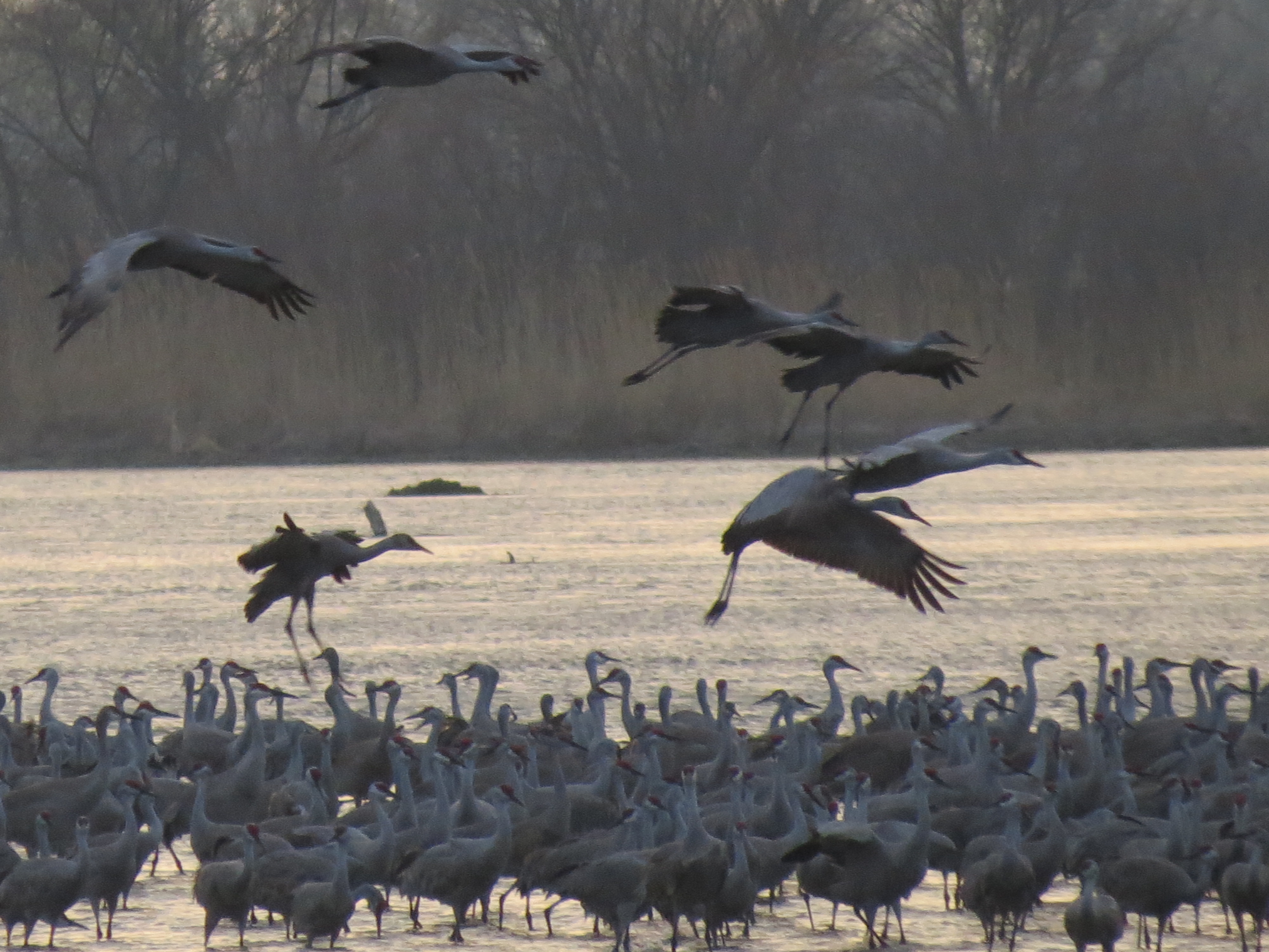
1949: Mann Gulch fire.  Thirteen died when the fire blew up due to strong winds.  From the time trouble was recognized until the men were dead was 11 minutes.  Those who died did so running uphill.  They died from asphyxiation or burns.  The fire was not affecting houses or civilian lives.  We had a culture from the 1910 fire, where 87 died, that all fires were to be put out before 10 a.m. the next day.  Ironically, this has created many problems we face today.

1994: South Canyon fire, near Glenwood Springs, Colorado.  In early July, a lightning strike started it.  Because some residents complained about smoke, a decision was made to fight the fire, which was not endangering any structures or lives, and was 5 acres when a decision was made to attack it, despite its being one of the lowest priority fires in Colorado at the time, where there were at least 35 fires burning, and resources were stretched.  When the fire was initially scouted, the difficulty and the risk were noted, and recommendations were made not to fight it in that particular area.  Catastrophes occur when there are major errors, but they also occur when there is a concatenation of smaller errors.  This fire was an example of the latter.  It was attacked because a person complained of the smoke–an inadequate reason.  Had the fire grown, it might well have been clearly inaccessible to attack in the place where the people who attacked it subsequently died.  It might have been fought differently.  I do wonder whether those who complained about the smoke ever wondered whether they were culpable.

Fourteen people died, including most of the Prineville, Oregon hotshot crew, when they descended a hill, in this worrisome area, in thick growth to build fire lines. Several members thought this maneuver was dangerous, because they had unburned fuel, extremely volatile fuel,  between them and a fire they couldn’t see (Watch out #9). Nobody spoke up, except some smokejumpers elsewhere on the fire, who did not think what they were asked to do was a good idea.  Eight of the ten major rules for fire fighters, 12 of 18 Watch Out guidelines were eventually compromised or violated.

A dry cold front came through that afternoon, predicted, but the information wasn’t relayed to the firefighters.  At 1520 hours, concerns were raised, and some left the area.  At 1600 hours, all left, but sawyers were still carrying their saws, and many were walking.  Twenty minutes later, they were dead, shelters not deployed.  Not only can fire move faster than we can run (this one moved 14 mph), superheated gases and radiant heat can kill people at a great distance, and winds can knock them over.  On Mann Gulch, winds lifted a survivor up and down three times.  The idea that fire suddenly erupts and people die with no warning is not true.  Fire does suddenly erupt, but usually there are hints.  There were such hints at South Canyon.  There were draws, and there was wind, an ideal situation for fire spread, and one that had been previously noted.  Many firefighters didn’t appreciate the severity of the situation until it was too late, for the safety zones were too far away and uphill.

The recommendations after South Canyon were hoped to make fire fighting safer.  They didn’t.

Thirty Mile Fire, Washington State, 2001.  Four fire fighters died after deploying their shelters in a rock field when a small fire earlier in the day suddenly exploded, overwhelming the crew. The problem was many small errors–virtually no sleep the night before (impairs judgment equivalent to being legally drunk), going suddenly to a fire that they hadn’t planned on, faulty equipment, slow start, and pulling in the lookout.  At the lunch spot, not a safety zone, two spot fires were noted up a dead end road (which had not been previously appreciated when the group arrived at the fire), and tankers were sent to the spots.  At this point, the hauntingly sad video given by survivors stops, and the listener is told to put himself in the position of the fireboss, rather than knowing what happened later.  The fireboss sent more help to the spot fires, had no lookout to look at what the main fire was doing, and ultimately, the whole group was cut off from escaping from the lunch site the other way.  Instead, they went up the dead end road (which also had civilians present) to what appeared to be a safe area, with a stream to the east, a rock slide with no growth (but fuel between the rocks), and the road.

Thirty minutes before the fire overwhelmed the crew, many were taking pictures of themselves, not looking for safe spots or beginning shelter deployment, not knowing this would be the last picture of them alive.

Shelter deployment means that people were in an area they should not have been in.  They were too far from the safety zone.  That happens.  Shelters are a last ditch effort to save oneself.  Had everybody deployed on the road, they would have all survived.  But some deployed on the rocks.  They died of asphyxiation.  Many at the time were not adequately trained to deal with shelters, which one must be able to get in either standing or lying.  Several wore fusees and backpacks into the shelter; fusees burn at 375 degrees and can ignite if in contact with the shelter itself.  Some lost gloves, which were in retrospect available and nearby, and others left backpacks too close to the shelter, where they burned, adding fire near the shelter.  I don’t know what I would do if I were in that situation.  I haven’t been trained; all of these people were.  Many deploying shelters do so when there is a great deal of wind from the fire, sometimes ripping the shelter from a person’s hand. When I saw this haunting video, I said to myself, “When the tanker on the downwind spot fire radioed that they needed additional help, that is when I would have pulled out.  Everything is going wrong on this day, and we need to regroup.”

We get back to the basic part of fire fighting.  It is dangerous, and everybody who fights fire knows that.  My experience is nearly nil, only having driven a water tanker on a controlled burn in 1995.  The culture had been not to question orders, and there is a degree of pride in being able to handle adversity.  Nobody likes to lose a fire, nobody wants to say that they couldn’t attack it.  Nobody wants to see houses destroyed.

What I don’t remember about 1994, although I could be wrong, was that we didn’t refer to the fallen firefighters as heroes.  They were professionals, and they were sadly victims. The fire should have been allowed to burn, nobody should have been deployed in any area that was unsafe, regardless of the risk to property and especially not because somebody complained about the smoke.  And that brings me to 19 years later, a lot closer to home.

2013:  Arizona.  Nineteen firefighters die fighting the Yarnell Hill fire.  We don’t know many details yet.  A lookout was posted, and he radioed that the winds had shifted and he was leaving.  We’ve heard he did all the right things, but I know nothing yet of whether his messages were received, or what else was said or not said.  Shelters were deployed, unlike Storm King, so there was more time for the firefighters to realize they were in trouble.  There wasn’t much time, but the early reports saying “nothing could have been done, the fire was on them in seconds” may not be accurate.  I don’t yet know.  More than one report is comparing the Yarnell Hill fire with the South Canyon fire.  Both were initially small, both were in difficult terrain with extreme drought, and both were handled by hotshots.  Both had a major, predictable wind event, both had unburned fuel between the firefighters and the main fire, and both led to disasters.

I suspect by the end of August, most of the investigation will be completed.  Lack of a meteorologist will be one issue, I suspect, or at least under appreciation of what the winds would be.  Working in dense fuels with fire nearby, not seen, will likely be another.  An adequate escape route will be another.  Beyond that, I would not speculate further except to unequivocally state, this was NOT an Act of God.  That statement to me is a copout, an excuse for not trying to understand circumstances that people should understand, and a way to sweep the matter under a rug.  Unfortunately, the mistakes made will be publicized, likely inflaming many communities as much as the fire did.  But mistakes were made.  Thunderstorm downdrafts, erratic winds, Venturi effects, plentiful dry fuel, and a burning fire are all understandable.  Whether we can predict what they will do is another matter, and evidence is beginning to mount that our modeling of fire behavior is inadequate due to increased size of fires because of suppression, climate change allowing bark beetles to survive winters, and more houses in the wildland-urban interface.  Ability to recognize danger and to speak up is part of firefighter training.  If we cannot adequately predict the worst case scenario, and plan for it, then we have no business sending people into harm’s way, except to save lives, not property.  Worst case scenario planning is why firefighters are required to have safety zones and exits to them, both hopefully plural.

Just as Challenger repeated 17 years later with Columbia, almost to the day, with many of the same cultural problems still persisting in NASA, so did South Canyon repeat 19 years later with Yarnell Hill, almost to the day.  I suspect, like NASA, there are still cultural problems in the firefighting community.  Hopefully, the investigation will uncover these issues, and the wildland firefighting community will address exactly how we will approach fires, what we will do, and what simply will not be tolerated.  Whether one wishes to call the men heroes dying doing what they loved is a matter of choice.  I call the men tragic victims who died, not one of whom expected to that day in Yavapai County.  I don’t call dying doing what I loved great.  If I love doing something, dying is not the outcome I want. But that is a my opinion.  We didn’t learn from Mann Gulch in 1949; 45 and 52  years later we had South Canyon and 30 Mile fires respectively.  We didn’t learn enough from them, and 12 years after 30 Mile we had Yarnell Hill.

To the Watch Out situations, I would add:

19. Size of fire does not matter.  Small fires can kill you.

20. Always be aware that you may have only 10 minutes to live, should things turn sour. Act accordingly.

My prediction:  another catastrophe will recur.  My hope:  It won’t.

“THIS CAN’T BE HAPPENING TO ME”

June 8, 2013

Last week, an elderly couple, experienced canoeists, capsized in Upper Basswood Falls, which straddle the Canadian border, and the 78 year-old man drowned.  His 75 year-old wife made it to the Canadian side.  She heard him say, “I can’t move,” but was unable to help.  I can imagine that.  Ice out was 3 weeks ago, and she probably was hypothermic.

I don’t like Upper Basswood Falls.  Never have.  A couple once left their young daughter at the end of a portage, while they returned to get the remainder of their gear.  She fell in the river, and that was the last time they saw her alive.  I was there on September 12, 2001, and that’s where I first heard the news that the world had changed forever.  In 1991, I did one of the most stupid things I have ever done in the woods.  Solo, I was coming upstream, on the Canadian side, and moved forward in the canoe to deal with the current.  I later learned that there are three things that a solo canoeist cannot manage:  wind, muck, and current.  I was  thrown out of the canoe, without its capsizing.  I found myself suddenly underwater thinking “This can’t be happening,”  usually the first thought people have in these circumstances.  It isn’t a good one. Quetico maps often don’t show portages, and when I went ashore, there was a short carry.  Fortunately, the water was warm, and all that was hurt was my pride.  I could have drowned, because back then I didn’t wear a PFD (Personal Flotation Device), either.  I know that, because I was underwater, which wouldn’t happen with a PFD.  I made two bad decisions and got away with them.  In 40 years of canoeing, it is the only time I dumped.  I’ve worn a zipped up PFD since, for it cannot come off.  The victim was found without one.

Upper Basswood Falls is not a waterfall but a series of falls, and there is a long portage around them.  The Horse Portage, as it is called, is 340 rods (1700 m).   It is longer, should one choose to set in downstream a little further, which I have also done.  The trail is not good, and the put in spot isn’t, either.  But in high water, it is safer.

The couple had reportedly discovered they could paddle Upper Basswood Falls and avoid the Horse Portage. The thought of bypassing the Horse Portage has never crossed my mind, and I’ve paddled 5 miles (8 km) of Class III rapids in the Far North on the Nahanni, a week’s travel from civilization and no way out other than on the river. This information shocked me.  A solid rule in the Boundary Waters-Quetico is never to paddle rapids if a portage exists.  In known high water, with 3 feet of snow on the lakes a month earlier, probable water temperatures of 45-55 F., Upper Basswood is a killer.  The widow isn’t sure whether he scouted the rapids; that means that both of them did not decide together whether to continue.  In any case, he took a different channel from usual, and that was that.

A few people die annually in the Boundary Waters-Quetico from falls or drowning; lightning is another cause.  Rapids must be avoided; further downstream I once tried to dissuade a pair not to run Wheelbarrow Falls.  They asked me to take pictures.  I have some good ones, which first show the pair with no helmets and bare feet.  Not wise.  Then the pictures show the canoe tipping, going broadside, and two guys in the water being taken downstream.  They survived, unscathed.  The canoe was perpendicular to the rapids, full of water.  They said they could handle it, although a canoe full of water weighs about 600 kg.  I later learned they did get the canoe out, before the keel bent and the Grumman became scrap metal.

I told my wife last night I would never stay on shore if I heard her say in the middle of the river, “I can’t move.”

“I’d get you out, or we’d both go together.”  I really meant that.  She reminded me that we have animals.  I reminded her that we have each other.  I wouldn’t live with myself if I did anything less.  But, I said, “I wouldn’t put us in that situation.”  I won’t, and I haven’t.  I hope to be 78 and still canoeing, although I would be exceptionally careful in rivers, high winds, rain, and thunderstorms.   I insist she speak up any time something doesn’t seem right.  That took a while to get her to do, and for me to listen, but we’re better off for it. The man’s widow didn’t know if he had a life jacket on.  If I forgot to put mine on, my wife would tell me.  These are little things, perhaps, but in the woods, as in so many other places, it is the concatenation of little things that produces the disaster.  Was the reason the victim couldn’t move was that he was pinned down?  Would a PFD had prevented it?  We will never know.

Bad things happen.  Some are simply not preventable.  Lightning strikes kill, although if one pitches a tent where there are no tree roots and uses a pad, there is a good chance of avoiding ground currents.  Trees fall;  high winds are frightening, because healthy trees can be suddenly splintered like matchsticks.  I’ve seen it.   I will sleep during a thunderstorm; during high winds, I stay awake listening for the first loud “CRACK,” for once I hear it, we are out of the tent, until the wind dies down.  The BW had a derecho in 1999, wiping out 30 million trees.  Incredibly, nobody was killed.

Fire is another concern, and even small “distant” fires can blow up into monsters, which almost killed a pair in 2011, when the Pagami Creek fire ran 12 miles in a day, and the couple had to turn their canoe over in a river, stay underneath it, breathing the air that was there.  Getting caught in a fire that day was nothing anybody could have foreseen.  The couple survived a freak occurrence by doing the right thing.

I am not afraid to solo.  I did that in April in snow into Angleworm Lake.  Or almost.  The snow got too deep, the trail difficult to find, and the map showed more distance left than I had hoped for.  I didn’t spend time analyzing; I automatically turned around to return to a known dry spot on the trail that I had noted on the way in.  I was fine.  What I told my wife after the trip was simple:  “I think this was the smartest I’ve ever behaved in the woods.”  But being smart just makes the stupid things less likely to occur; freak occurrences and unexpected illnesses are wild cards.

I’m sure some might say that dying in the woods is not the worst way to go.  Maybe.  The problem with dying “doing what you loved,” is that people who love you are left behind, and others often have to put their lives at risk to recover your body.  It is clear if I am ever in the position where death is a real possibility, there is a good chance I did something wrong.  I’d like to think if I got on a river that was unusually high, a lake with huge waves, or a thunderstorm that looked really bad, I would tell my wife we were going to stop to think about our options.  Nature isn’t out to kill us.  Nature just is.  We decide whether we run rapids, deal with waves, lightning, bears, and falling trees.

It’s a real shame what happened.  I never dreamed an elderly couple would shoot the beginning of Upper Basswood in spring.  I’m just filled with sadness, hoping some learning will come from this.

If there is one, only one rule I would tell people in the woods, it is this:  if you aren’t certain what to do, stop immediately and think of your options, remembering the best one likely is to turn back or change what you are doing.  It may be inconvenient and annoying, but you will survive to have those emotions.

If you allowed me a second rule, it would be this:  “Nobody ever drowned on a portage.”

MAMMOTH CAVE, 2013, MIDWEST ROAD TRIP TO GET MY HEAD BACK ON STRAIGHT

May 7, 2013

It was time; indeed, it was past time, to get back into the woods again, even for a day or two.  A good hike in the mountains around Tucson would help, but I really wanted to get deeper into the woods.  The Vermilion Community College Scholarship Banquet is held the last Thursday of April, and twice I have canoe tripped into the Boundary Waters before the banquet.  I decided I would do the same this year.

I also decided I could probably see Mammoth Cave National Park on the way, if I went to Minneapolis by way of St. Louis, and drove from St. Louis to Mammoth Cave.  The distance is about 330 miles, but it is good road the whole way, and on a Friday I did just that.  Illinois, in exceptional drought the year before, was now in flood.  I could have canoed in the forests along the road, or in the open fields that would not be ready for planting for some time to come.  I was just behind the latest storm, and as I reached Mammoth Cave in late twilight, the temperature was in the low 50s, down 30 degrees from the day before.

The next morning, I awoke to fog over the Green River Valley, which cuts through the center of the park.

Morning Fog, over Green River Valley

One of many springs

Mammoth Cave is truly mammoth.  It is the largest cave in the world, nearly three times the length, in passages, of the next largest.  With more than 400 miles (650 km) of passages, the Cave offers several tours.  With my time limited, I took two tours, one in the original entrance, the other in the new entrance, that was blown up to make way for an entry point, back before the cave became a national park and entrepreneurs took people down into the cave, people wearing top hats, long skirts and high heeled shoes.

Saltpeter for gunpowder used in the War of 1812 was made here;

Saltpeter for gunpowder used in the War of 1812 was made here;

Bat on wall

In between the tours, I walked the 12 miles (20 km) of trails near the visitor’s center, then took a wildlife flower hike to relearn what I once knew about wildflowers, such as jack-in-the-pulpit and trillium.  The trees were just beginning to leaf out, and the temperature was mild.

Phlox

Jack-in-the-Pulpit

IMG_3046 IMG_3047

The Second Tour took us in a different entrance, one that was blown open when some cold air was exiting the cave and a small hole discovered.  This one descended about 270 steps and went through a wider variety of terrain.  There are longer tours that will show more of the passages, and there are caving tours, for those who want to see what exploring is like.

Gate to keep people from touching stalactites and stalagmites, since one touch will destroy any future growth. Past generations of visitors did this.

IMG_3064 IMG_3083 IMG_3084 150 meters below ground.

On Sunday, I drove back to St. Louis, first looking at the Green River Ferry:

Green River Ferry

….and doing one more trip around an area over one sinkhole and looking down on an underground river, above ground further south in the park, and here emptying in to the Green River.  This part of Kentucky is full of sinkholes.

Underground river emptying into the Green River.

Underground river emptying into the Green River.

UNCOUNTABLE COSTS: HOW MUCH IS THE BOUNDARY WATERS WORTH?

April 30, 2013

There is serious possibility of opening a sulfide mine in the Boundary Waters watershed, with politicians on both sides supporting it, because it will create jobs.  I haven’t heard much about the costs of such an mine.  Costs are different from money.  For example, we have spent more than a trillion dollars in Iraq and Afghanistan.  That’s money.  The cost, in dead, maimed, displaced, and ruined families is uncountable, but I would submit it is enormous. Because we can’t place a value on a human life, we don’t, so the money we were told we would spend–a laughable $1.7 billion–was at least four if not five orders of magnitude too low.  Before going to war, costs should be understood, but few in Congress understand costs.

Without doubt, the mine near Ely would provide jobs, although mining is more than pick and shovel work these days.  Mining requires engineering skills, knowledge of geology, and more important, knowledge how to do it safely, which means disposing of the waste in such a way that the environment is not polluted.

There are a few of us who think this mine is a bad idea.  A really bad idea.  One company that may be involved is not American; while that doesn’t make it necessarily bad, they don’t have the deep connection to the Boundary Waters that some of us have.  Worse, these types of mines have in every instance been shown to have left toxic metals on the surface that leach into the water and pollute it.

The name of the most beautiful wilderness in the Lower 49 is the Boundary Waters.   Connect the dots.  This region has some of the cleanest water on the continent.  I have drunk from the lakes on every one of my 62 trips up there. How many places can we still drink water out of a lake?

Fish live in water, too.  The second Saturday in May is a special day in Minnesota, for it is fishing opener.  I wonder how people will feel about the possibility of far fewer fish, should the mine pollute the watershed.

But the mine won’t be a problem, I have been told.  I will hear the good-looking young men and women, who sound so sincere, say that there is nothing to worry about.  The executives, who have so much money to gain from the mine, will say technology will make this mine safe, and there won’t be a problem.  The jobs that will be created will be so important to the Iron Range communities, where many are short on money and long on clean water and forests.  Everything will be just fine.  Listen to the reassuring voices.  Look at the handsome young people.  Watch the pictures of cute deer drinking out of a lake near the mine site.  Everything will be fine.

Until it isn’t.  Let me repeat that in a different way.  Everything is safe until it isn’t.  That goes for Challenger, Columbia, Tenerife, the Comet, Electra, and DC-10, shipping oil out Prince William Sound, pipelines through Arkansas, Deep Water Horizon, Chernobyl, Fukushima, and I suspect Keystone XL.

When the you know what hits the fan, suddenly people will be sorry.  “It’s an Act of God,” “we couldn’t have possibly foreseen this,” “we will do everything we can to make you whole.”  And the company will file for bankruptcy.  I wasn’t born yesterday. I could name dozens of other catastrophes.

But then it will be too late.  It will NOT be an Act of God, any more than rheumatic fever or tuberculosis was, death from infected hangnails, or acute lymphoblastic leukemia. Complex systems will fail.  It is a matter of statistics and probability, and there are not many who understand these concepts.

The questions I ask are quite simple:

1.  How much is the Boundary Waters Canoe Area Wilderness worth?

2.  What is the probability that the mine will pollute, and how are you computing that probability?

The first  question has no answer, and the second is difficult to compute.  We could do an Expected Value analysis on  the Boundary Waters.  We could add up the tourism dollars, the cost of the timber, the fresh water, the campsites, and multiply it by 1, since it already exists with probability 1.  We could have the money the mine puts into the hands of the people of northern Minnesota (not how much ore is there, but how much money goes to the locals, which is a much smaller number) and multiply it by the probability it will cause no problem, which from past experience, is fairly close to zero, and get another expected value.  We then compare the two.  But the first expected value is too low, because no price can be placed on the Boundary Waters. We can’t place a cost on certain things, like people’s lives, unless we want to use human trafficking as a means.  Is this what we’ve come to?

Because these mines have ALWAYS had problems, it is incumbent upon those supporters to show why THIS mine will be different.  But let’s get back to what we can’t measure–the  value of wilderness that is nowhere else this accessible, this pristine, and this transformative of people.  No, we can’t say what that is worth, but it sure is worth something.  It falls into the category of “It ain’t for sale at any price,” and that is what some of us are saying.

There are a few other things that ought to be pointed out as well.

First, Ely, one of the towns that would be impacted by this mine, was once populated by miners, whose kids went to work in the mines.  There is a community college in Ely–Vermilion Community College–where the last Thursday in April is a scholarship banquet, where $42,000 is donated to students.  I am responsible for 3 of those scholarships. 

In 2007, I gave a scholarship to a young woman, whose parents came to the banquet.  Her father worked in the mines on the Iron Range west of Ely, where the mine tailings are, for lack of a better word–ugly.  He was so proud of his daughter, whose education would have her not go into the mines, the way he did.

Now we are offering jobs back in the mines.  We seem to be going backward.

Second, many call the Boundary Waters “God’s country,” a term used for unspoiled wilderness, Up North, in Boreal Country.  I wonder how many believers up there think that mining in a sensitive watershed is in keeping with Creation.  Just a thought.  BOUNDARY WATERS_2007114

The third issue I have is one that we don’t discuss in this country, because the major religions don’t believe in it, and many people don’t either.  We need to have fewer children.  If we had fewer children, we wouldn’t need to find so many jobs for them.  The notion that somebody can finish high school, go into the mines for good money (so long as the mine keeps working), buy a truck, a snowmobile, a boat, have 5 or 6 kids, lots of debt, and expects the kids will be able to do the same thing–and their kids, too–just doesn’t apply any more in this country.

I’ve got skin in this game, although I have no kids.  I think we leave some areas off limits to mining, just as we limited the dams in the Boundary Waters, even though it was a matter of cheap power.  Really?  Cheap?  What would the cost have been had we destroyed Curtain Falls and flooded Crooked Lake and Lower Basswood Falls?  It almost happened.

Crooked Lake at top; Iron Lake at bottom.

Curtain Falls today:  Crooked Lake at top; Iron Lake at bottom.

DSCF0026

The Friends of the Boundary Waters, of which I am a member, is going to fight this mine tooth and nail.  So is Steve Piragis in Ely, for whom preservation of the water resource is his livelihood.  I will support them.  The Friends wants to expand its scholarships too, so that more young men and women are trained to do jobs that wilderness management requires.  That is where the money ought to go.

It’s a harder slog to fight this mine as it was recently for me to get into Angleworm Lake in 3 feet of snow. IMG_3096 I’m not young, handsome, or have a reassuring voice.  I am in the minority who dares say we have too many people and that polluted wilderness will not return.  I’m looking at 10-100 years, not next week’s pay check.  I’m thinking of those like me, who need wild country to find themselves and to think thoughts that can only be answered in God’s country. I may not win.

But I am going to the mat on this one.

LOOKER-UPPERS

April 1, 2013

Several years ago, out in the Sonoita Grasslands, southeast of Tucson, I saw a thunderstorm develop over in Rain Valley.  Several of the thunderheads were producing a lot of rain, but the southernmost one wasn’t.  Instead, it kept discharging cloud-cloud lightning, as if it had a choice to either rain or light up periodically, and chose the latter.  In any case, it looked like a giant lightbulb.  I thought that interesting, so I stayed out to watch it.  I often just sit somewhere and look up.  It isn’t wasted time.

I am a looker-upper.

As I continued to gaze, I noted Jupiter high to the right of “Lightbulb,” shining with a steady light, as planets do.  I knew the object was Jupiter, because of its brightness and location.  Now I had a gas giant in view, with its own clouds and storms, as I observed from a rocky planet with its own storms, all right before my eyes.

And “Lightbulb” kept discharging.

I was fascinated with the show, but I knew that storms don’t last too long in the high desert, and I began to think of going inside, grateful, as I always am, for any show that nature provides.  For some reason, however, I stayed out a little longer.  I’ve long known that a an extra minute spent just looking may occasionally be worthwhile.  Besides, I was absolutely fascinated with “Lightbulb”.

Suddenly, a meteor shot through the sky between Jupiter and “Lightbulb.”  There aren’t many times my jaw drops suddenly, but it sure did here.  I had a simultaneous show in three levels of the sky:  the troposphere, high above the stratosphere, and in outer space.  I said another thank you to the heavens, watched for a while longer, and then finally went inside.

There is one other place I have seen three parts of the sky come into splendid conjunction.  If one travels to the Platte River in March, near the Great Southern Bend of the river, one may see the Sandhill Crane migration.  I really should use three different verbs here: to see, to experience, and to transform.  Many people see the migration, some experience it, and a few–like me–are transformed by it.  Transformation of a person by a sight means that the person is never again quite the same.  Not many sights transform me: a total solar eclipse did, and so did a sighting of a wolf in the wild 12 feet away, with nobody within 10 trail miles.  That’s heady stuff, being transformed.

To see these spectacular birds, with their haunting call, darken the sky during a splendid Nebraska sunset and a full Moon rising in the eastern sky may transform a person.  I volunteer in Nebraska every spring, paying my way up there and working at Rowe Sanctuary, so I can go to the viewing blinds morning and evening.  It’s really selfish, but I do some work, too.  I work with other volunteers and Rowe Staff, all of whom are looker-uppers.

SUNSET CRANES

SUNSET CRANES

Sure, this conjunction may be explained by biology, astronomy and physics, but I doubt  many observers in Stevie’s Blind at Rowe Sanctuary on a March evening feel that way when twenty-five thousand cranes in the sky land right in front of them.  I doubt Stevie Staples, for whom the blind was named, looked at the cranes that way, either, and she was a teacher.

PART OF A FLOCK OF 20,000

Once one becomes a looker-upper, the person may become a bit of an astronomer, meteorologist, and birder, too.  Oh, I don’t mean the person can spot Andromeda Galaxy without optical aid, knows the difference between a Pied-billed and a Western Grebe, or can tell whether the sky is convectively active, but the person is learning.  I find myself looking up at the day sky, noticing where the deepest blue occurs.  There is a mathematical point in the sky where the sky is bluest, depending upon where the Sun is, but I don’t bother with the math.  I’m more interested in finding the deepest blue, and my 1x eyes are perfect for the task.

From blue sky, I started noticing clouds and weather, too.  Soon, I became as interested in the weather as I was in the night sky.  It’s easy to do, and as a guy who goes into the woods a lot, it helps to know how to predict the weather.  Oh, of course, I wasn’t a professional meteorologist, but I knew enough to keep myself more comfortable than I otherwise would have been.

I continued to look up and became a birder.  I won’t say I am a great birder, but I’ve seen many species, many of which I actually figured out on my own.  It’s often good to bird alone.  It makes a person a better observer, requiring spotting the subtleties that allow identification.  Other times, it is good to go with an experienced birder who can spot a particular bird and explain why and what it is. Birding is fun, but it is not a passion.

Looker-uppers aren’t necessarily experts; they just know where beauty lies.  And a lot of beauty lies above us, free for those who look.

SLEEPING PAIR OF CRANES

CRANE MOON

As I became a birder looker-upper after first being a star looker-upper, some birders come to my star parties after first being a bird looker-upper. They wonder how I know the night sky so well.  I wonder how they know the birds so well.  We all laugh.  We are all learning from each other, fellow looker-uppers, trying to get answers to questions we have about what is out there, what it is, why it is, who and why we are.

What I have learned about my fellow looker-uppers is that each of us finds our own faith in the sky.  Each of us has called the sky “the heavens” at some time.  None of us really knows what lies beyond, but we are all curious.  I don’t think there is a one of us who looks at the Sandhill Crane migration, Orion, Saturn, the rising of the full Moon, a Vermilion Flycatcher or a yellow-headed Blackbird

YELLOW-HEADED BLACKBIRD

YELLOW-HEADED BLACKBIRD

, a towering cumulonimbus, or a 2000 year-old Sequoia

STANDING BY A SEQUOIA, MARIPOSA GROVE, YOSEMITE NP.

STANDING BY A SEQUOIA, MARIPOSA GROVE, YOSEMITE NP.

without being filled with a sense of wonder.  I’m a deeply spiritual person, and a fellow looker-upper helped me discover that fact.

That same person, a wise man, a good friend, a fellow looker-upper, and a devout Christian, recently told me, “There are no atheists in foxholes and no atheists who watch cranes.”

CRANES LANDING AT SUNSET, 2012

CRANES LANDING AT SUNSET, 2012

Judging by how often I hear “Oh my God, they are beautiful,” when I take people to the viewing blinds, I think he is right.


CRANES LANDING AT SUNSET, FROM STEVIE’S BLIND

CRANES OVER FULL MOON, ROWE, 2013

CRANES OVER FULL MOON, ROWE, 2013IMG_2918

MR. POTTER

February 24, 2013

In the coming months I will visit two places which I will call Potterville, Nebraska and Potterville, Minnesota.  You won’t find these towns in a road atlas; they are first defined as if they actually exist, which they would today had Mr. Potter had his way, which so far he hasn’t.  For those who aren’t aware of Potterville, see the movie “It’s a Wonderful Life” next holiday season.

Potterville, Nebraska is a place where Platte River water is used for solely for recreation, irrigation of crops, and drinking.  Cottonwoods and invasives have turned the river into a treelined thin strip of water, often dry.  There are no longer any Lesser Sandhill Cranes there in March.  I’m not sure where they went.  Maybe they went the way of the now extinct Passenger Pigeon, which like the Sandhill Cranes, once darkened the sky.  But I’m talking birds, and to many, birds don’t matter, not if one believes man owns the Earth and all the resources that can be extracted right now, because now matters, and the future….well, that is Potterville, where the special places like the Platte disappeared, as does its water every summer.

Potterville, Minnesota has many resorts on nearby Basswood Lake, providing guiding and other low paying jobs to those in Ely, Minnesota, where good jobs are scarce.  Crooked Lake is huge, with drowned trees still visible well out from the current shore, the hydroelectric power from Curtain FallsCurtain Falls; Canada on Left, US on right. providing cheap electricity to the mines on the Iron Range.  Two beautiful islands, out in the middle, on the border, are deeply submerged.  I never saw them with the late Mike Manlove.  Nor is there an island near the border, where I would have heard wolves on 25 September 1992, had the island been there.  I never saw Basswood Falls, for it was flooded.   Nor did I see the pictographs that once made Crooked Lake famous, for they were also flooded.  Mr. Potter said 80 years ago we needed jobs at all costs, to support our ever growing population; having smaller families and preserving wilderness just wasn’t–well, an American solution.

Overhead in Potterville, Minnesota are many aircraft, the noise rivaling that of the Grand Canyon.  No executive order was given by Harry S Truman forbidding flights below 4000 feet over the wilderness, for it had never been done before, and new ways viewing the world and of doing things are not part of Potterville.  In winter, the sound of snowmobiles is heard all through the region.  The last wolf sighting was about 90 years ago.  A sulfide mine has created a lot of jobs, but the water has become extremely polluted, and the mine will close soon.  Unfortunately, the company has gone bankrupt and will not pay for the cost for cleaning up the pollution.  Many said that a mine would pollute and the cost to the environment would not be paid; they were shouted down at town meetings.  Funny how you can’t find anybody in Potterville now who said they were for the mine.    Curtain Falls

But there is no Potterville, Minnesota, thanks in large part to Sigurd F. Olson, one of America’s first wilderness writers, Bill Magie, and many others who fought Potterville tooth and nail, recognizing that the world had changed, and Americans needed wilderness, not to conquer, but to visit, to test themselves, to see sights they couldn’t see anywhere else, and to recover their senses.  Sig Olson knew that we aren’t all that removed from the land, and there are many for whom wilderness is not just an escape, but a requirement for their sanity.  I am one of those.  There aren’t many like me, and most don’t understand us, but we exist.

Sig was once burned in effigy in Ely, Minnesota.  Nevertheless, he persevered until his death in 1982, while snowshoeing near his home, which today is called “Listening Point.”

Because of Sig and others, Curtain Falls is a wilderness cataract, straddling the international border.  Mike Manlove and I saw the lovely two islands, and I heard wolves that September morning out on Crooked Lake.  Basswood River is untouched, and Lower Basswood and Wheelbarrow Falls are beautiful.

Because of a few who fought Mr. Potter in Nebraska, in March there will be a half million Lesser Sandhill Cranes–90% of the world’s population– along a short stretch of the Platte River.  There will be water for the birds, for 4 miles of shoreline are protected by Rowe Sanctuary.  Many thousand people will visit Rowe’s viewing blinds during the 5 week season.  These people will spend several million dollars in Kearney, Nebraska, providing a big boost to the local economy.

Cranes Landing at sunset, 2012

I will guide about 10% of those people, telling them about the cranes, what they mean to me, and how this is one of two great North American migrations.  I will go to Nebraska, paying my own way, sleep on the floor in the gift shop, so I can hear the cranes at night, and work 17 hour days.  I will come home exhausted but thrilled.  There is not a time in the 70 trips I have taken into the blinds where I have not learned something new or seen an absolutely mind boggling sight.

Cranes at sunset, Rowe Sanctuary, 2011

Cranes Landing in Platte, sunset, 2012

Experiences such as mine have no price tag; Mr. Potter thinks everything without a price tag has no value.  He is wrong.  I’m not a hunter, but I think every guy and gal who has sat in a duck blind, gone out in camo on a chilly autumn morning to get a buck thinks that the country they traverse is worth something.  They just can’t put a price tag on it, Mr. Potter.  I can’t put a price tag on seeing 50,000 cranes in the sky at once, watching a crane dancing 100 meters away, hearing the calls at night, watching them kettle, catching the south wind north on their way to perhaps Siberia.  No, I can’t put a price tag on seeing them in Bettles, Alaska, last August, north of the Arctic Circle.

No, Mr. Potter, I can’t put a price tag on making 20 miles in a headwind, hearing wolves at night, sitting by a campfire, not thinking of anything, seeing the Harvest Moon coming up over Lake Insula, hearing the call of a loon at 2 a.m., looking at the darkest skies in the US and being in the largest roadless area in the Lower 49.

Lake Insula sunset

Common Loon

Big Water...vast sweep of Agnes Lake.

Or seeing Curtain Falls, in its natural state.  These things are priceless, Mr. Potter.

In April, I will spend a morning with the Executive Director of the Friends of the Boundary Waters, before going up north to Ely to spend two days on Basswood, not expecting to see anybody, sitting by a campfire, thinking of nothing, and maybe hearing a wolf.  I will be able to drink right out of the lake. I will be by myself, alone in a vast wilderness, which I require visiting periodically to be the person I am.  It’s a birthright of Americans that these places still exist.  But preserving these places must be fought against the Mr. Potters.

The Friends have worked to protect the Boundary Waters, just as Rowe Sanctuary has worked to protect the Platte River.  Both of these organizations, together employing about 8 people, will get about half of whatever estate I leave behind.  After I come out of the woods, I will attend the Vermilion Community College Scholarship Banquet, where I will give 3 scholarships I have created or helped fund.  Supporting VCC means a great deal to me.  It is a special night for many students.  Jobs are scarce, and the father of a young woman who was the second recipient of our scholarships wanted his daughter not to follow him into the mines.  He is not alone.  Money goes a long way in northern Minnesota and rural Nebraska.

It can cause or prevent Pottervilles. I’m trying to prevent them, but the battle can not be lost.

Not even once.

ULURU

November 19, 2012

From 20 km, I finally saw the monolith, Uluru (Ayers Rock), that for years had been at the top of “The List,” of things I have wanted to see or do ever since I saw a wolf on Isle Royale, six and a half years previously.


The day after we flew in, we took a sunrise tour, where we saw the low rays of the Sun, in a few days to be briefly eclipsed by the Moon, strike the sandstone.  Then we approached it.


Uluru has been around for 350 million years.  What we see is the tip of a large uplifting, with rock extending about 2 km below the surface.  I didn’t know that, and that was only the beginning of discovering what I did not know.


For example, we visited numerous caves and inlets to the rock.  Uluru is not simply a rock with vertical faces; there are many places where water can collect, places where people can–and have–hidden, lived, and practiced their faith.  The aborigines, who were once shot on sight by the first white men on the continent, have been present in this area for 60,000 years.  That is roughly thirty times the existence of any other major religion on the Earth.  To them, Uluru is sacred.  There are places along the trail where one is not allowed to photograph, just as it is considered insulting and wrong to photograph an aborigine without their permission.  The visitor’s center is off limits to photography as well.

As one leaves the visitor’s center, there is a request–not a requirement, since there are no requirements at Uluru, only requests–not to climb what is considered sacred to the aborigine people, who never climb the rock.  There is a chain that allows people to climb the monolith, but the day I was there, the rock was closed because of high winds.  It didn’t matter to me, since I had not planned to climb it anyway, knowing it was sacred and ought not to be climbed.


Thirty-six people have died on Uluru from climbing, and for each the natives have required a ceremony to help those who died into the afterlife.  There are several memorial plaques that were placed on Uluru as well, although there are no new ones, because that affects the monolith, too.


Frankly, I found it good to go to a place where there were no extreme sports allowed.  There were no races up Uluru, no helicopter rides or hot air balloon rides to the top.  Indeed, the airspace over Uluru is also off limits.  There were no people BASE jumping, or using other conveniences to fly off the mountain.  Other than the chain fence, and the worn path into the Sandstone, there were no marks on Uluru other than a few paintings in the lower caves.

I can only imagine what Uluru would be if left to the white people.  There would be multiple routes to the top, the sandstone would be pockmarked with pitons, there would be ropes hanging off it, old campfires, tents, mountain biking, tours to the top, marathons ending at the top, races around the monolith, human waste and other litter.


I don’t have a problem with any of the above races, so long as they take place where it is appropriate, not one sacred to people who have existed in an incredibly harsh environment for sixty thousand years and have not destroyed it.

Theodore Roosevelt once said about the Grand Canyon, “You cannot improve on it.  Leave it as it is.”  We have not done that.  South Rim Village is large, although it is a relatively small area on the Rim.  There are trails, although they are limited as well, and they require a great deal of effort to walk.  We have, however, filled the airspace with fixed and rotary wing aircraft, creating a great deal of unnecessary noise.  By Uluru, one hears the wind, the birds, and very little else.

That evening, we took a sunset tour, again watching the change of colors that were a function of the Sun, the sandstone, the caves, and the black stripes where water drained off the monolith with each rain.  It was spectacular.  A group of Austrian tourists were nearby, and I practiced my German with them.  I lent them my binoculars so they could see parts of the monolith that I now knew something about.  It was the first time I had taught about nature while speaking only German.  I explained the pools along the rock that collected water and then overflowed to pools below.  I found words that I knew as I needed them.  It wasn’t great, but they understood what I was saying.  In two roles that I was comfortable in, teaching and nature, I was able to relax and speak.  It made the view even more magical.  How many different languages had been spoken at this site during the past six hundred centuries, I cannot imagine.  But one man spoke two that night, and for him, and that was special.


It’s nice for once to see something truly unique, virtually unspoiled, and will stay that way, except for the path to the top, which may some day be closed.  I hope it will be.


I went to Uluru to see the largest monolith in the world.  I came away thinking how nice it was that Australians, most specifically the most maligned ones–the aborigines–have not allowed the large numbers of people who have to show they are the best at whatever sport they decide they must do.  World class is to me an overused term, but at Uluru, the term is deeply appropriate.

What a blessing.


SPAMMED ON JACKFISH BAY

September 27, 2012

My wife and I got spammed on Jackfish Bay on our last canoe trip.  No, I didn’t have a computer; I saw a plastic bag in the forest behind the campsite, and it had three full cans of SPAM, the real deal.  Minnesota is the Spam capital of the world; for those who don’t know the etymology, it is shoulder of pork and ham.  When I first canoed, 50 years ago, Spam tasted pretty good.  Then again, in the woods, most things taste good, even pine needles.

On the same campsite were two empty beer cans and a burned out can in the fire area.  We carried all of this garbage out, along with our trash. The white pine in the center of the campsite had dozens of scars from people who had to chop at it.  Despite that, the tree was tall and had no signs of blister rust, unusual for a tree this age.  White pines are the most beautiful tree in the woods; the wood from them is prized.  Why anybody would deliberately chop at a tree that was likely a sapling when the Voyageurs came through 225 years ago is beyond me.

White pine (Pinus strobus), scarred by prior campers.

But, give a guy (usually a guy) an axe, and everything in the woods becomes fair game.

On the way out of the woods, we passed a campsite where somebody had cut a few dozen balsam pine boughs for a mattress.  There was a time, half a century ago, when we cut balsams down for tent stringers, used their boughs for mattresses, put cans in the campsite can pit (or in the lake), and threw axes at trees.  These days I thought were gone.  Having cleaned some 500 campsites in the Boundary Waters, those days are not gone.  Note to campers:  aluminum foil does not burn completely in campfires.  No, it does not.

The Wilderness Act of 1964 establishing the Boundary Waters (BW), made most of it, except for a few lakes, including Basswood, non-motorized.  Cans were not allowed, green trees were not allowed to be cut (they don’t burn, and there is no reason to do so), permits were required (and were free for more than three decades), and the number of people who could congregate at one spot was limited to 9.  The BW was and is the largest roadless area in the contiguous states.  This did not sit well with some, and Sig Olson, one of the first great wilderness writers, was burned in effigy in his hometown of Ely.

Sig knew, far before many, that wilderness was no longer something to be conquered or to be lived off but something to be protected.  It was a massive shift in thinking that many still have not embraced.

We now have lightweight and safer gear: air mattresses, chairs, small saws, rain suits, good tents, barbless hooks, food packaged in plastic, but not metal, that it ought to be easy to travel in the wilderness without harming it.

I write this to those who do not know the rules but wish to abide by them; I hope maybe a few of the others might think about what they are doing as well.  The BW is not pristine America post-glacial era.  Most has been logged, about a century ago, and it has been burned by natural and human-caused fires.  I’ve seen a third of the campsites with hot ashes or frankly burning fires and no inhabitants.  I’ve seen many other fires built outside the fire area.  Given the dryness of the soil–dig a latrine, as I have and you realize this fact–fires can spread underground.  Fire is a natural phenomenon, lightning sparked fires, such as the Pagami Creek Fire last year, clear the forest for new growth.

The debate should be about whether we let naturally caused fires to burn.  There should be no debate whether somebody should be allowed to leave an unattended campfire.

The BW is open to fishing and hunting.  Fishing has to change too, from a half century ago.  Catching large stringers of fish–or one huge fish, a breeder–has to stop, and catch and release, except for a meal, with barbless hooks should be done.  Is this inconvenient?  Sure.  But what about the upcoming generations?  BW lakes are not sterile, but the northerly climate makes them far less productive of fish than many lakes at lower latitudes in the US.

The world changes.  We are no longer voyageurs with canoes in an unmapped wilderness.  We are a quarter million annual visitors in the wilderness the size of Rhode Island.  While there is much room, large numbers of people put pressure on the wilderness with human waste, human trash, and other impacts.  Humans belong in the BW, but as our numbers increase, our impacts must lessen.  Even the best camper may break rules when caught out in severely inclement weather.  I’ve seen hundreds of pounds of abandoned gear.  The late Mike Manlove referred to this as “being out of one’s comfort zone.”

Wilderness is not only subject to attacks from within but from without.  Fish have mercury, lakes become acid.  Water quality may deteriorate from sources far from the wilderness.  Careless boaters can transfer invasive species from one infected lake to a previously normal one.   Heavily log or burn much of the forest, and streams and lakes will become muddy.  This affects fishing.  Eventually, such damage may clear.

Mining, on the other hand, is forever.  A sulfide mine, planned near the wilderness, is a huge concern.  Communities need jobs, but sulfide mines are particularly toxic to watersheds, and the BW is a watershed if ever there was one.  Another pillar of the local economy is tourism.  Destroy the watershed, and tourism will disappear.  I am told the mine will be safe; things tend to be “safe” until they are suddenly not safe.  Then, everybody is sorry, the money made, the rich folks gone.

One hundred fifty years ago, the virgin pine stands of northern Minnesota were thought to be inexhaustible.  Forty years later, the state was importing lumber.  Log enough, and the jobs eventually end, along with the forest.  Mine enough, the jobs eventually end, along with the surrounding area.  If we have an unemployment problem, one good solution would be for many families to have a lot fewer children.  The US population has more than doubled in my lifetime; we have one of the highest birth rates in the industrialized world.

This is the 21st century, and we need natural resources, wise use of land, and a lot fewer people than we are producing.  If we continue to act the way we did in the 18th century, nearly exterminating the beaver, the 19th century (the buffalo and the forest), and the 20th (treating wilderness like a playground), there will be a large emptiness in the 21st.

Nature can recover, but within limits, and often with very different outcomes than even the best biologists can predict.  Enjoy the wilderness, carry out what you brought in, and maybe a little stuff that others brought in, too.

SEASONS OF THE CANOE COUNTRY….AND LIFE

September 25, 2012

“Come on in,” called Dorothy Molter, as I had paddled up to shore on her island home on Knife Lake and knocked at the door.  Dorothy was a legend on Knife Lake.  She left nursing and Chicago around 1930 and lived on an island in Knife Lake, which straddles the border between Minnesota and Ontario.  Called “The loneliest woman in America,” Dorothy had hundreds of visitors every year.  She was grandfathered (or mothered) and allowed to live the rest of her life on Knife Lake after the Wilderness Act of 1964 required resorts to be taken down, power boats removed, limits on numbers of people who could go in, and even how low planes could fly overhead.

Dorothy was a legend.  She gave me some of her famous root beer, and as we talked, I commented that it was a little more difficult to canoe trip when I was 32 then it had been when I was 18, guiding canoe trips in Algonquin Park, wearing the coveted red neckerchief that only guides wore.

“Yes,” Dorothy replied, completely straight-faced, “I don’t paddle and carry as well as I once did, either.”  Dorothy had forty years on me and she would live for 5 more, her statement a lovely put down to my complaint about age.  I never forgot that.

In the ensuing 31 years and twice as many trips I have taken into the Quetico-Superior, not exactly easy from Arizona, I can count lots of things–wildlife sightings, fish caught, bear charges (1), aurorae seen.  What has fascinated me the most, however, has not been the three seasons in which I have paddled, but the changing seasons of my life with the canoe country.

I first put a canoe on my head 50 years ago, in the spring of my life.  I was an apprentice guide, and I carried wooden Old Towns, slept in canvas tents or under a canoe.  Nobody practiced Leave No Trace camping.  We had can pits, cut live balsam for tent stringers every night, and washed dishes in the lake.  I carried up to 140 pounds, dragged reluctant canoes down rivers, and fought waves so large they hurt, when the bow crashed down on the other side.

In my 30s and 40s, in the summer of my life, I discovered and then explored the Quetico-Superior, covering as much distance as I could.  I had a map on the wall in my office, and after each trip there was new ink on the blue and green splotches.  Miles mattered, new routes mattered, single carrying portages mattered.  I was up early, paddled hard all day, and slept well at night?  Rain?  I got wet.  Headwinds?  I worked.  Portages?  They were a chance for me to show what I had.

When I was 43, I volunteered in Ely for the Forest Service, spending six months away from my medical practice and 100 days in the woods between mid-May and mid-October.  I was a third again older than the guy who visited Dorothy Molter, in far better shape, but I now learned about the trees and the plant life that I had walked by, cut, and burned.  I learned that giving back to the wilderness was more important than having my own personal proving ground.

As I approached 50, I brought my wife along, a previous non-camper, and taught her how to travel.  She in turn taught me how to enjoy the woods–together.  I stopped single carrying portages in 2001, when I was 52.  I had nothing to prove and a lot I could hurt.  I enjoyed walking back in the woods for a second trip.

When I was 56, I soloed into Kawnipi Lake one more time.  Many of us who ply the canoe routes of Hunter’s Island feel Kawnipi is the most beautiful lake on either side of the border.  I may go back again, but it doesn’t matter now whether I do.  I have been there six times, love the place, and am thankful for what I’ve seen there.

“Bowling alley.” Kawnipi Lake.

The northern sweep of Agnes Lake, on the way to Kawnipi.

The year after, my wife and I sponsored a scholarship at Vermilion Community College (VCC).  We have no formal tie to the school, but Ely has given both of us a great deal, and we get great pleasure from helping the next generation of wilderness enthusiasts, many of whom not only live at the edge of wilderness but at the edge of poverty.  These young–and older–men and women are doing great work, and each year at the spring banquet, I meet them and hear their stories.

After 2003, my wife and I started base camping in Lake Insula.  I never thought I would base camp, but I enjoy the day trips where we explore side bays, sometimes finding trails that lead to interesting views.  It is nice not to have to set up camp every night and break it down every morning.  Do I miss the long days and the multi-lake trips?  No, I look back on them with fondness.  My pictures have faded; neither the diaries nor my memories have.

We’re now well into our 60s, the autumn of our lives, and every autumn we come up and base camp somewhere else.  We find a nice place, explore, relax, and forget about the “road, steel and towns” that Sig Olson wrote about.  We are in his “back of beyond.”  We enjoy canoeing and we work well together.  The lakes are old friends; the campsites second or third homes.  Every year we can come up is a gift–one more chance, one more trip, a few carries, the automaticity with which I put a canoe on my head, or deal with a 2 foot chop.  I have watched with great joy my wife become an excellent canoe tripper who also loves the woods, and helps me make a comfortable camp, in all sorts of weather.

Fall colors on Jackfish Bay.

We established a second scholarship at VCC and contribute to a third.  VCC has become family.  I come up for the banquet in April and take a solo trip for a day or two.  I don’t go far, I just want to be out there, alone, thankful for those who saved this wilderness from damming, clear cutting, and roads.  In the autumn of my life, I get to see others in the spring of their lives and canoe in spring, too.

We don’t know how long we will be able to canoe.  The autumn is a brilliant time in Ely, and it is a brilliant time in our lives.  This past trip, I saw Lesser Sandhill Cranes fly high over me on Pipestone Bay.  Next March, I will be in Nebraska, at Rowe Sanctuary, showing people these same birds during their spring stopover along the Platte, one of the two great North American migrations.

We will camp as often as we can in the Boundary Waters.  We know there are no guarantees reagarding ability or longevity.  We hope to canoe into our 70s.  I dream of going out in the winter of my life when I am 80; I took my father into the Quetico when he was 78.  We hope there will be enough of those with sense to guarantee the future of this region to those whose lives are not only drawing to a close, but those whose lives have yet to begin.

Eventually, we will die, like every living organism we have seen in the wilderness.  Our ashes will be spread in the area, finally being part of the wilderness we have travelled, loved and supported.